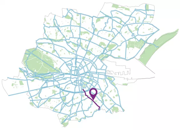
Maps and Reports

Permanent Scheme Reports
Interim Scheme
Drawing 01 – Harcourt Street to The Clayton Hotel on Charlemont Street
The scheme extents to the north of the scheme start at Harcourt Street (R811), where Charlemont Street intersects it at the Baxter and Greene Café. The area is majority office buildings and cafes with few residential properties. Companies such as EY, the National Transport Authority and WeWork occupy some of the large offices in the surrounding area.
Starting from Harcourt Street moving south down Charlemont Street, the two existing signalised pedestrian crossings and pedestrian landing area will remain as existing. The existing cycle lanes on both sides of Charlemont Street will be upgraded. The cycle lane will be widened to 2m with additional hatching between the carriageway and the cycle lane on the western side of Charlemont Street. There will also be the implementation of bollards spaced at two metre intervals, providing protection to cyclists from the carriageway. The left turn traffic lane from Charlemont Street onto Harcourt Street will be removed. This allows for space to be given to cyclists and to the hatching. Additionally the existing bus lane that runs along the east side of Charlemont Street will be removed to allow room for the proposed one-way protected cycle lane. This also allows room for one loading bay and one standard car parking space on the eastern side of Charlemont Street, approximately 20 metres south of the pedestrian crossing. Continuing further south along the scheme, the existing bus stops on both sides of the carriageway will remain as they are currently. Approximately 30 metres south of the bus stops, a signalised pedestrian crossing exists outside Giraffe Childcare and Structure tone office buildings, which will remain as it currently is. South of the pedestrian crossing, Albert Place West (running in a northeast to southwest direction) intersects with Charlemont Street on the eastern side and Charlemont Row (running in a southwest to northeast direction) intersects with Charlemont Street from the western side.
On the eastern side of Charlemont Street, at the junction with Albert Place West, the existing loading bay will remain as it currently is. The protected cycle lane will run behind this loading bay, providing greater protection from the carriageway from parked cars and bollards. Approximately 16 metres south of the loading bay, there will be more parking protected cycle lanes where parallel parking bays and a proposed disabled bay will provide additional segregation to cyclists between themselves and the carriageway. There is also additional hatching and bollards between the cycle lane and the parking bays. On the western side of Charlemont Street at this location, the 2m cycle lane continues with bollard protection before reaching the Grand Canal Bridge at the Barge Gastro Bar. Along this whole section of the design there will be approximately 15 parking spaces removed. Outside the Clayton hotel the existing drop off location will remain.
Drawing 02 – Clayton Hotel on Charlemont Street to Northbrook Road
On the eastern side of Charlemont Street, prior to the Grand Canal Bridge, the parking protected cycle lane continues with hatching and bollards between the parking spaces and cycle lane for further protection. After the parking spaces on Charlemont Street, the cycle lane returns to bollard and hatching protection. The traffic lane travelling southbound reduces from two traffic lanes to one, providing one lane for traffic going straight ahead and traffic turning left onto Grand Parade. On the western side of Grand Canal Bridge, the one traffic lane travelling northbound remains however the existing cycle lane is widened with bollard protection to provide a right turn pocket for cyclists to join the two-way cycle track on Charlemont Place, travelling in an east – west direction. On the southern side of Grand Canal Bridge, the signalised pedestrian crossings on all arms of the junctions remain but traffic lanes on Ranelagh Road (R117) have been reduced down to one lane in both directions. There are 2m wide cycle lanes on both sides of the carriageway, with bollards providing protection between cyclists and the carriageway. Canal Road intersects on the western side of Ranelagh Road, just south of Grand Canal Bridge. On Canal Road, on approach to Grand Canal Bridge, the existing left turn lane to cross the bridge has been removed and the lanes have been reduced to one traffic lane for vehicles wishing to travel straight onto Grand Parade and vehicles turning left onto Grand Canal Bridge. This has allowed for room to widen the existing cycle lane and to provide greater protection through additional hatching between the cycle lane and traffic lane. Cyclists are able to continue travelling straight ahead onto Grand Parade or turn left onto the bridge.
Continuing south from Grand Canal Bridge along Ranelagh Road, the existing two lanes of traffic has been reduced to one to allow for hatching and bollard protection for cyclists. The northbound lane remains as existing, serving traffic travelling straight onto Grand Canal Bridge and left onto Canal Road. Approximately 38m south of the Grand Canal Bridge Athlumney Villas connects to the southwestern side of Ranelagh Road. At this location the cycle lane continues across the side road entrance however bollards are removed to provide access for vehicles.
A similar arrangement to Athlumney Villas side road is in place 130m south of Grand Canal Bridge at its junctions with Dartmouth Road and Mountpleasant Terrace. Dartmouth Road connects onto the north eastern side of Ranelagh Road whilst Mountpleasant Terrace connects onto the southwestern side of Ranelagh Road. The existing bus lane on the west side of Ranelagh Road that ends where Ranelagh Road meets Mountpleasant Terrace will be removed. Travelling further south on Ranelagh Road, the existing bus stops on both sides of the carriageway will remain as they are. On the western side of the carriageway, the cycle lane is protected from the carriageway by hatching and temporary islands at the existing pedestrian crossing as well as bollards. Approximately 15 car parking spaces will be removed on the west side of Ranelagh Road along this section. On the eastern side of the carriageway, approximately 13 metres after the pedestrian crossing, Northbrook Road connects onto the north eastern side of Ranelagh Road and the junction radii will be tightened using hatching and bollards, reducing the distance from footpath to footpath for crossing pedestrians.
Drawing 03 – Northbrook Road, Ranelagh to Ranelagh Village
The scheme continues along Ranelagh Road heading southeast passed Northbrook Road on the east side of the road. The existing right turn traffic lane on Ranelagh Road for vehicles turning onto Northbrook Road from the southeast is proposed to be removed, resulting in one traffic lane northbound and one traffic lane southbound on Ranelagh Road. On the east side of the road the existing bollard protected cycle lane will remain and on the west the cycle lane will be protected by hatching and bollards. Approximately 35m south of Northbrook Road, Orchard Lane and Mountpleasant Square (North) both connect with Ranelagh Road. Orchard Lane connects with south eastern side of Ranelagh Road and Mountpleasant Square (North) connects with the north western side of Ranelagh Road. Just south of this junction, the carriageway will be 7.1m wide, the proposed protected cycle lane on the eastern side of the carriageway will be 2m wide and proposed protected cycle lane on the western side will be 2m wide segregated from traffic by hatching and bollards. Approximately 7 car parking spaces on the west side will be removed to facilitate the cycle lane. The existing bus stop at Mountpleasant Square will remain as it is on the eastern side of Ranelagh Road. At this location, Ranelagh Road begins to bend, running in a north western to south eastern direction.
On the bend on Ranelagh Road at Mountpleasant Square, there is a traffic lane for southbound traffic wishing to continue straight on Ranelagh Road and a right turn pocket for vehicles wishing to turn right off Ranelagh Road onto Mountpleasant Square or Mountpleasant Place. There is one traffic lane for vehicles travelling northbound on Ranelagh Road, which is a reduction from the existing arrangement where there is an existing bus lane and traffic lane. Travelling further south on Ranelagh Road, the existing cycle lanes and bollards will remain and the traffic lanes will also remain as they are. Approximately 100m south of the Ranelagh Road / Mountpleasant junction, just prior to the Luas bridge over Ranelagh Road, Mander’s Terrace connects to the south side of Ranelagh Road. Approximately 40m south past Mander’s Terrace, the Luas bridge crosses Ranelagh Road overhead. Underneath this bridge, on Ranelagh Road, the existing cycle lanes and bollards will remain. The existing bollards will continue until the pedestrian crossing on Ranelagh Road outside the Blink Bar on the eastern side of the carriageway and Ranelagh Luas stop entrance on the western side of the carriageway. The existing cycle parking opposite the Ranelagh Luas stop entrance will remain. After the pedestrian crossing at the Ranelagh Luas stop entrance, the existing bus stop on the eastern side of the carriageway will remain. On the western side of Ranelagh Road in Ranelagh Village, two standard parking spaces are proposed outside Avril Gallagher & Co Solicitors and Project Black coffee shop. The cycle lane at this location will be 1.7m and protected by the two parking spaces and hatching with bollards.
Drawing 04 –Ranelagh Village to Cinnamon, Ranelagh
The scheme continues through Ranelagh village. After the existing bus stop on Ranelagh Road opposite the Luas station the existing bollard protected cycle lane will remain as it currently is. On the west side there will be two disabled parking spaces, located outside of Locksmiths Cycles and Sound Hire. The proposed cycle lane here will be protected by these parking spaces and bollards. Beyond the disabled parking bays, there is a proposed temporary island build out at the existing bus stop. The cycle lane will run behind this temporary island build out, between the island and the footpath. There will be a crossing point and footway level for pedestrians across the cycle lane where pedestrians will have priorty over cyclists. The raised crossing and the slightly narrowing of the cycle lane (1.65m here) will help control speeds of cyclists. Along Ranelagh Village there is approximately 5 parking spaces being removed, however this is subject to further consultation. There is an existing loading bay after the bus stop outside Spar which will be maintained. There will be bollards and hatching segregating the cycle lane and loading bay.
At the end of Ranelagh Village, the existing bollard protected cycle lane on the east side of Ranelagh Village will continue across Ranelagh Avenue (which runs northeast to southwest) onto Ranelagh. There will be two traffic lanes heading southeast, as existing with one for those heading straight and one right turn lane for vehciles turning into Cullenswood Road (which runs northeast to southwest). The existing pedestrian crossings from outside OHO and PaddyPower, just after Ranelagh Avenue to a traffic island on Cullenswood Road is maintained. There is a junction here where Ranelagh Village meets Cullenswood Road and Ranelagh (which runs northwest to southeast). On Cullenswood Road the existing left slip lane turning into Ranelagh Village and a right turn lane turning on to Ranelagh will be maintained. These lanes are split by an island. There is also a traffic lane heading southwest along Cullenswood Road. The taxi parking will be maintained on both sides of Cullenswood Road. To the west of Cullenswood Road there is a public realm area outside a row of shops including: Urban Health, HSSCU AND Gray& Co.
Cyclists turning right from Cullenswood Road onto Ranelagh can join the protected cycle lane on Ranelagh. After the Cullenswood Road junction on Ranelagh there are protected cycle lanes on both sides of the road. On the east side of Ranelagh there is a wide hatch with existing bollards next to the traffic lane segregating the cyclists from motor traffic for approximately 15m until Ranelagh meets Westmorland Park (which runs northeast to southwest). The existing protected cycle lane will then continue segregated by bollards. On the west side of Ranelagh the proposed protected cycle lane will be segregated by bollards. There will be advisory cycle lanes at junctions. In this section to allow for the proposed protected cycle lane facility, the northern lane which heads towards the city centre will be removed and there will be one lane for those travelling left onto Cullenswood Road or straight onto Ranelagh Village.
50m southeast of the Cullenswood Road, Ranelagh junction there is a pedestrian crossing on Ranelagh which will be maintained just in advance of where Ranelagh meets Chelmsford Road (which runs northeast to southwest) on the east of Ranelagh and Beechwood Avenue Lower on the west of Ranelagh (which runs northeast to southwest). This crossing serves many local businesses including Dillinger’s on the west side of Ranelagh and Zaytoon on the east. In advance of the junction with Chelmsford there are two traffic lanes heading southeast and one traffic lane heading northwest. The total width of the 3 traffic lanes is 8.8m. Heading southeast to northwest the right turn lane will be removed. Along Ranelagh between Chelmsford Road and Beechwood Avenue Lower the protected cycle lanes will be 1.8-2m wide and will be segregated by hatching and bollards. In this section there will be one traffic lane in both directions with a total width of 6.9m.
The bus stop on the east side of Ranelagh 10m in advance of Chelmsford Lane and the bus stop 15m south of Ashfield Road on the west side will be maintained. The existing protected cycle lanes continue on both sides of Ranelagh in this section of the design.
The existing pedestrian crossing on Ranelagh is maintained between Chelmsford Lane (runs northeast to southwest) and Sallymount Avenue (runs northeast to southwest). This is next to I-service on the east side of Ranelagh and Humphreys Pub on the west, approximately 10m northwest of Sallymount Avenue.
The existing bollard protected cycle lanes continue along the eastern side of Ranelagh Road and protected cycle lanes with bollards are proposed on the west.
Drawing 05 – Ranelagh Road, Sallymount Avenue to Sandford Road (just before Marlborough Road junction)
There are proposed protected cycle lanes on both sides of Ranelagh Road after Sallymount Avenue (runs northeast to southwest) meets Ranelagh Road. There will be proposed removal of approximately 14 parking bays on the West side of the road to allow for the continual provision of the protected cycle lanes from here until Anna Villa (which runs northeast to southwest). Outside Tesco on the west side of Ranelagh Road, 55m north of where Ranelagh Road meets Anna Villa, an on-road loading cage is proposed. This is subject to further consultation.
Along this section there will be two traffic lanes with a total width of 6m and the proposed protected cycle lanes vary in width along the section with a small area of cycle lane at 1.3-1.4m wide between Sallymount Avenue and Tesco on Ranleagh Road and the rest of the cycle lane will be approximately 1.6m wide. The footway will remain as existing.
The scheme continues onto Sandford Road (which runs northeast to southwest) just after Ranelagh Road meets Anna Villa. Here the existing pedestrian crossing will be maintained outside R.McSorley.
The proposed protected cycle lanes continue along Sandford Road, widening to 1.6m after Woodstock Gardens (which meets the east side of Sandford Road and runs northeast to southwest). The existing bus stops on both sides of the road between Woodstock Gardens and Merton Drive (which meets the west side of Sandford Road and runs northeast to southwest) will be maintained.
Drawing 06 – Sandford Road, (just before Marlborough Road junction) to Sandford Road, Cherryfield Avenue Lower
There will be a protected cycle lane, segregated from traffic by bollards on both sides of the road in advance of the junction where Sandford Road meets Merton Drive (which meets the western side of Sandford Road and runs northeast to southwest), Marlborough Road (which meets the east side of Sandford Road and runs east to west) and Sandford Close (which meets the west side of Sandford Road just after Sandford Parish Church and runs northeast to southwest). At this junction there is an existing pedestrian crossing across Sandford Road approximately 5m southeast of Merton Drive, outside Sandford Parish Church which will be maintained.
On approach to this junction from the northwest there is one traffic lane proposed in both directions. From the southwest to this junction there are two traffic lanes heading northwest one for those going straight and left and one right turn lane for those going to Marlborough Road. The traffic lanes here are 9.3m wide and the cycle lane is pinched at some points to 1.4m and 1.5m for most of the section. Across junctions and side streets there will be a red advisory cycle lane.
The existing bus stop on the east of Sandford Road 11m north of where Larch Grove (which runs east to west) meets Sandford Road will be maintained.
After Larch Grove there will be protected cycle lanes on both sides of the road segregated from vehicles by hatching of varying width and then bollards. There will be an existing bus stop maintained on the west side of Sandford Road approximately 45m northwest of where Sandford Road meets Hollybank Ave Lower (which runs northeast to southwest). After this bus stop the proposed protected cycle lanes on both sides of the road will be segregated by bollards. Along this section the protected cycle lanes will be 1.42- 1.5m wide and there will be one traffic lane in each direction approximately 3m wide.
Drawing 07 – Sandford Road, Cherryfield Avenue Lower to Clonskeagh Road, Eglington Road Junction
Proposed protected cycle lanes of 1.7m-2m width continue along this section of Sandford Road, segregated by bollards. Approximately 45m southeast of where Sandford Road meets Cherryfield Avenue (which runs northeast to southwest) the existing bus stop will be maintained on the west side of the road.
The protected cycle Lanes continue until a junction where the east side of Sandford Road meets Belmont Avenue (which runs northeast to southwest and is currently one way in this direction) and the west side meets the entrance to Beckett College. Just before the Sandford Road, Belmont Avenue Junction there is Circle K Belmont Ranelagh and Parcel Motel Collection Point on the east side of Sandford Road. The existing pedestrian crossing across Sandford Road at this junction to Beckett College will be maintained. After this crossing there is an existing protected contra flow cycle lane for cyclists turning left from Sandford Road onto Belmont Avenue which is protected by a temporary island build out at the junction on Belmont Avenue and then hatching and bollards further along Belmont Avenue. For cyclists coming from the southeast the cycle lane is protected by hatching and bollards in advance of the junction with Belmont Avenue. There is one traffic lane in both directions proposed. The existing right turn lane on Sandford Road onto Belmont Avenue will be removed.
Heading in the direction of Clonskeagh, 25m after this junction on the east of Sandford Road the existing bus stop will be maintained. Along this section there will be protected cycle lanes segregated by proposed bollards on both sides of the road. There are two traffic lanes heading south and one heading north with a total width of 9.1m. The scheme passes Circle K Belmont Ranelagh on the eastern side on Sandford Road. Here the existing protected cycle lane on the west side of Sandford Road will be maintained and the same proposed on the east side.
Sandford Road ends and meets Clonskeagh Road (which runs northwest to southeast) at a junction with Milltown Road (which lies to the west of Sandford Road and runs northeast to southwest) and then Eglinton Road (which lies to the east of Sandford Road and runs east to west) approximately 15m further southeast than Milltown Road. There will be advisory cycle lanes across the junction which will be red in colour. On Milltown Road the existing two traffic lanes in advance of the junction will be maintained and approximately 10m before Milltown Road meets Sandford Road the existing left turn slip will be shortened to allow for a proposed protected cycle lane along the north side of Milltown Road. This proposed cycle lane is protected by bollards and stops at the existing pedestrian crossing across Milltown Road where it meets Sandford Road. This crossing will be upgraded and the junction radii narrowed on the south east side of Milltown Road to slow down vehicles and provide a shorter crossing distance for pedestrians across Milltown Road.
Additionally there are pedestrian crossings across the slip road from the footway on Milltown Road to an island between the traffic lanes which will be maintained. There is another pedestrian crossing from this island across Sandford Road and another from the island across Milltown Road. All of these will be maintained.
On Eglington Road where it meets Sandford Road there is a proposed hatch build out protected by bollards which will protect cyclists turning left onto Eglington Road from Sandford Road. There is protected cycle lanes proposed on both sides of the road protected by bollards until approximately 45m from the junction. After this, the existing advisory cycle lanes continue. There are two traffic lanes on Eglington Road which are maintained and a left turn slip road for those turning left onto Clonskeagh Road. The advisory cycle lane will be maintained on this slip road. The Handmaids of the Scared Heart of Jesus lies on the north side of Eglington Road 30m from the junction with Sandford Road.
There is an existing pedestrian crossing which will be maintained at the start of Clonskeagh Road, across Clonskeagh Road onto the island on Eglington Road between the left turn slip road and the two traffic lanes.
The scheme continues along Clonskeagh Road where there will be protected cycle lanes on both sides of the road, segregated from traffic by bollards. For this small section the cycle lanes will be 1.2-1.3m wide due to existing width constraints. There will be two traffic lanes, one in each direction with a total width of 6m.
Drawing 08 – Clonskeagh Road, just after the Eglington Road Junction to Vergemount
The protected cycle lanes continue along Clonskeagh Road. The existing bus stops on Clonskeagh Road will be maintained. There will be advisory cycle lanes at side roads and in front of a row of shops on the east side of Clonskeagh Road between Tramway Lane (which runs northeast to southwest) and Vergemount Ct (which runs northeast to southwest). The businesses here include: OROKO Travel, Independent Theatre Workshop, ITW Dance Studios and SureSkills Training. The protected cycle lanes outside at this section are 1.5m-1.7m wide, the traffic lanes are 6m and the footways are 1.8m-1.6m wide.
On the west side of Clonskeagh Road, opposite Vergemount Park the existing bus stop will be maintained. 5m after Vergemount park on Clonskeagh Road there is a pedestrian crossing which will be maintained which serves Clonskeagh Hospital. On the east side of Clonskeagh Road approximately 10m after the pedestrian crossing there is a bus stop which will be maintained. The bollard protected cycle lane widens on this side of the road after this bus stop to 2.2m. On the west side of the road the proposed cycle lane will be 2m wide. There is a break for 20m in the bollards on the east side of Clonskeagh Road to allow for the entrance to Vergemount. On the west side of the road the protected cycle lane is 1.8m wide. There are two traffic lanes with a total width of 6.6m. At this point Clonskeagh Road bends to run north to south.
Drawing 09 - Clonskeagh Road, Vergemount to Clonskeagh Bridge (end of scheme extents)
At this point in the scheme Clonskeagh Road runs north to south. One-way protected cycle lanes, segregated from motor traffic by bollards are proposed along this section. The protected cycle lanes will be 1.6m-2m wide and there will be two traffic lanes with a total width of 6.3-7.5m in total. The east side of the road meets Vergemount. After Vergemount on the east side of the road 20m of existing parking bays will be maintained. Then there will be a parking protected cycle lane for 100m (approximately 24 parking bays) where the layout has the existing footway, then the 1.6m wide cycle lane. There is then a 0.8m buffer between the cyclist and the parking bays. The parking bays are 2.1m wide. There are two traffic lanes along this section with a width of 6.5m-7m in total. On the west side of the road opposite the junction with Vergemount the protected cycle lane changes to an advisory lane with intermittent bollards out with the existing pay and display parking bays until approximately 20m from Clonskeagh Bridge which will be retained. The parking bays and advisory cycle lane will continue for approximately 130m until an existing bus stop which will be maintained.
There is an existing 10m wide loading bay outside 105 café, Chaar&co, and Harry’s Nike followed by an existing bus stop opposite Farmer Brown’s which will be maintained. After the bus stop there is pay and display and permit only parking bays outside Mr Fahrenheit. Along this seciton there will be a 1.5-1.6m advisory cycle lane on the east side of the road. There will be a 2m protected cycle lane on the west side of the road protected by hatching and bollards until the end of the scheme extents. The footway heading downhill to farmer Browns will stay as is and there is no footway along the rest of this section at road level after Farmer Browns until Clonskeagh Bridge.
There is a break in the protected cycle lane to allow for movements in and out of the side road leading down to the Farmer Brown’s car park next to the River Dodder.
This scheme ends on Clonskeagh Bridge and ties into existing and future walking and cycling schemes at the River Dodder.
End of Scheme Extents.
Permanent Scheme
Drawing 01 – Harcourt Street to The Clayton Hotel on Charlemont Street
The scheme extents to the north of the scheme start at Harcourt Road (R811), where the R114 intersects it at the Spar. The area is majority office buildings and cafes with few residential properties. Companies such as EY, the National Transport Authority and WeWork occupy some of the large offices in the surrounding area.
Starting from Harcourt Street at the Spar, moving east towards Charlemont Street, it is proposed to provide a one-way cycle track on the southern side of Harcourt Road, with an aim to tie in with future BusConnects plans for the R114. The segregation of the cycle track will be by 60mm build up from the road carriageway to the cycle track and a further 60mm build up to the footpath. At the Harcourt Road / Charlemont Street junction, the proposed scheme removes the existing pedestrian landing area on Charlemont Street between the northbound and southbound traffic lanes and proposes a reduction of traffic lanes from 3 (2 northbound and 1 southbound) to 2 (1 northbound and 1 southbound) traffic lanes. This includes the removal of the existing bus lane heading Northwest. There will be signalised pedestrian crossings on all 3 of the junction arms. On the Charlemont Street arm of the junction, a continuous cycle lane adjacent to the pedestrian crossing is proposed to accommodate cyclists travelling westbound on Harcourt Road. Where possible this cycle lane is segregating cyclists from traffic on Harcourt Street by build outs.
On Charlemont Street, a 2m wide one way raised cycle track on both sides of the road is proposed with a 3m footpath on both sides of the road. The segregation between the footway, cycle track and the carriageway will be the same as described above. At the start of the cycle tracks after the pedestrian crossing on Charlemount Street there is proposed low level planting between the cycle track and footway for approximately 2m on both sides of the road. The carriageway width will be 6.5m. The reduction in traffic lanes allows room for one loading bay and one standard car parking space on the western side of Charlemont Street, approximately 20m south of the Harcourt Road / Charlemont Street junction. Continuing further south along the scheme, there is a bus stop island proposed on the eastern side of the carriageway. At the island bus stops the layout will be: the footway followed by the cycle track, then the bus stop island with bus shelter on it and then the carriageway. There will be a crossing across the cycle track from the footway to the island for pedestrians to access the bus stop and this will differ in colour from the cycle track.
There will be a signalised pedestrian crossing present 40m further south on Charlemont Street, outside Giraffe Childcare and Structuretone office buildings. The existing pedestrian crossing here will be upgraded to be raised. Between Harcourt Street and this crossing there are 4 trees proposed on the footway on the west side of the road and one on the east side. South of this crossing, Albert Place West (running in a northeast to southwest direction) intersects with Charlemont Street on the eastern side and Charlemont Row (running in a southwest to northeast direction) intersects with Charlemont Street from the western side. On the eastern side of Charlemont Street, at the junction with Albert Place West, it is proposed to provide a loading bay, parallel parking spaces and one disabled bay. There are 3 proposed trees on the footway behind this and another 3 proposed on the footway closer to Grand canal. The one-way raised cycle track will run behind these parking spaces, between vehicles and the pedestrian footpath.
The existing bus stop on the western side of Charlemont Street will be relocated to 40m south of the proposed pedestrian crossing / Albert Place West junction. This will also have a bus stop island arrangement, as described above. There are 2 trees proposed at either side of the bus island between the cycle track and footway.
The eastern side of Charlemont Street has a proposed parking bay and a loading bay outside the Clayton hotel. The raised cycle track will run behind it. There will be a proposed tree and planting in advance of the parking bay between the carriageway and cycle track and again between the loading bay and parking bay.
All the entrances to the side roads off Charlemont Street apart Harcourt Road along this section will be upgraded to have pedestrian and cyclist priority access. The detail of the pedestrian and cyclist priority access includes a 60mm build up from the road carriageway to the cycle track, a further 60mm build up to the footpath and a gradual (1:15) slope back down towards the side road.
Associated tactile paving and audible signals will be used throughout the scheme at proposed bus stops, crossings and change of cycling/ pedestrian facilities.
The scheme will aim to reduce street clutter by means of reducing the over use of items such as traffic sign poles on the footpath where possible. Details of street signage and street furniture are yet to be developed.
Street lighting will be upgraded where required along the scheme. Details of street lighting is yet to be developed.
Drawing 02 – Clayton Hotel on Charlemont Street to Northbrook Road
On the eastern side of Charlemont Street after the proposed loading bay there is proposed low level planting between the end of the loading bay and the cycle track before the cycle track stops in advance of the grand canal junctions. At this location the cycle tracks will be 2m wide on both sides of the carriageway, the carriageway will be 6.5m and the footway will be widened to 3m-4.7m. The traffic lanes travelling southbound reduce from two traffic lanes to one, providing one lane for traffic continuing straight ahead and for traffic turning left onto Charlemont Place.
On approach to Grand Canal Bridge, it is proposed to provide an additional signalised pedestrian crossing prior to reaching Charlemont Place and Charlemont Mall. There are cycle lanes proposed through the Charlemont Street / Charlemont Place / Charlemont Mall junction in order to provide a connection to the existing two-way cycle track, running in an east – west direction parallel to the canal.
On Grand Canal Bridge, the one traffic lane travelling northbound remains however the existing cycle track is widened with a build out to provide a right turn pocket for cyclists to join the two-way cycle track on Charlemont Place, travelling in an east – west direction. On the southern side of Grand Canal Bridge, the signalised pedestrian crossings on all arms of the junctions will be upgraded and the traffic lanes on Ranelagh Road (R117) will be reduced to one lane in both directions. There will be 2m wide raised cycle tracks on both sides of the carriageway. There are existing footways on both sides of Grand Canal Bridge. On the west side the footway will be widened towards the southern side of the bridge. On the west Canal Road intersects on the western side of Ranelagh Road, just south of Grand Canal Bridge. On Canal Road, on approach to Grand Canal Bridge, the existing left turn lane to cross the bridge has been removed and the lanes have been reduced to one traffic lane for vehicles wishing to travel straight, onto Grand Parade and vehicles turning left onto Grand Canal Bridge. Cyclists are able to continue travelling straight ahead onto Grand Parade, or turn left onto the bridge.
Continuing south from Grand Canal Bridge along Ranelagh Road, the existing two lanes of traffic have been reduced to one traffic lane in order to allow for a 3m wide footpath and 2m wide cycle track on both sides of the carriageway. The segregation of the cycle track will be by 60mm build up from the road carriageway to the cycle track and a further 60mm build up to the footpath. The northbound traffic lane remains as existing, serving traffic travelling straight onto Grand Canal Bridge and left onto Canal Road.
Approximately 38m south of the Grand Canal Bridge Athlumney Villas connects to the southwestern side of Ranelagh Road. At this location it is proposed to provide a continuous raised cycle track across the side road entrance. The detail of this includes a 60mm build up from the road carriageway to the cycle track, a further 60mm build up to the footpath and a gradual (1:15) slope back down towards the side road (this will be done at side roads and entrances throughout the scheme). The carriageway on Ranelagh Road is proposed to be 6.5m, with one traffic lane going in each direction (north and south) to allow for a 2m wide one-way raised cycle track on both sides of the road. The existing bus lane on the west side of Ranelagh Road will be removed.
Dartmouth Road connects onto the northeastern side of Ranelagh Road whilst Mountpleasant Terrace connects onto the southwestern side of Ranelagh Road. Travelling further south on Ranelagh Road, the existing bus stop on the western side of Ranelagh Road will be removed and the existing bus stop on the eastern side of the road is proposed to be an island bus stop arrangement. The Island bus stop arrangement will be: the footway followed by the cycle track, then the bus stop island with bus shelter on it and then the carriageway. There will be a crossing across the cycle track from the footway to the island for pedestrians to access the bus stop and this will differ in colour from the cycle track.
The existing pedestrian crossing across Ranelagh Road, just south of the proposed island bus stop, is to be upgraded to a raised signalised pedestrian crossing.
On the eastern side of the carriageway, there are 4 trees proposed on the footway next to the cycletrack between Mountpleasant Terrace and Northbrook Road. Approximately 13m after the pedestrian crossing, Northbrook Road connects onto the northeastern side of Ranelagh Road, and it is proposed to have the same arrangement as previous side roads where the footpath and cycle track will run continuously across the entrance. On the western side of the carriageway, a right turn pocket for cyclists is proposed through the use of a build out to allow for cyclists wishing to turn right off Ranelagh Road onto Northbrook Road to clear the main cycle track heading northbound.
All the entrances to the side roads off Ranelagh Road along this section will be upgraded to have pedestrian and cyclist priority access apart from Northbrook Road which will have a proposed raised table at the entrance. The detail of the pedestrian and cyclist priority access includes a 60mm build up from the road carriageway to the cycle track, a further 60mm build up to the footpath and a gradual (1:15) slope back down towards the side road.
Associated tactile paving and audible signals will be used throughout the scheme at proposed bus stops, crossings and change of cycling/ pedestrian facilities.
The scheme will aim to reduce street clutter by means of reducing the over use of items such as traffic sign poles on the footpath where possible. Details of street signage and street furniture are yet to be developed.
Street lighting will be upgraded where required along the scheme. Details of street lighting is yet to be developed.
Drawing 03 – Northbrook Road, Ranelagh to Ranelagh Village
The scheme continues along Ranelagh Road heading southeast passed Northbrook Road on the east side of the road. There are one-way raised cycle tracks proposed along this section on both sides of the road. The segregation of the cycle track will be by 60mm build up from the road carriageway to the cycle track and a further 60mm build up to the footpath.
The existing right turn traffic lane on Ranelagh Road for vehicles turning onto Northbrook Road is proposed to be removed, resulting in one traffic lane northbound and one traffic lane southbound on Ranelagh Road. Approximately 35m south of Northbrook Road, Orchard Lane and Mountpleasant Square (North) both connect with Ranelagh Road. Orchard Lane connects with the south eastern side of Ranelagh Road and Mountpleasant Square (North) connects with the north western side of Ranelagh Road.
The existing bus stop at Mountpleasant Square on the eastern side of Ranelagh Road is proposed to become an island bus stop. At the island bus stops the layout will be: the footway followed by the cycle track, then the bus stop island with bus shelter on it and then the carriageway. There will be a crossing across the cycle track from the footway to the island for pedestrians to access the bus stop and this will differ in colour from the cycle track. At this location, Ranelagh Road begins to bend, running in a northwestern to southeastern direction.
On the bend on Ranelagh Road at Mountpleasant Square, there is a traffic lane for southbound traffic wishing to continue straight on Ranelagh Road and a right turn pocket for vehicles wishing to turn right off Ranelagh Road onto Mountpleasant Square or Mountpleasant Place. There is one traffic lane for vehicles travelling northbound on Ranelagh Road, which is a reduction from the existing arrangement where there is currently an existing bus lane and traffic lane. It is proposed to have a similar arrangement for cyclists and therefore a right turn pocket has been provided on the southbound cycle track, to allow for cyclists to cross parallel to pedestrians at the new pedestrian crossing located on the southern arm of the junction. This scheme proposes a signalised pedestrian crossing on Ranelagh Road (N), Mountpleasant Square and Mountpleasant Place and on Ranelagh Road (S). Additionally, on Mountpleasant Square and Mountpleasant Place, the existing island build outs between the traffic lanes on each road have been removed. This is currently used as an uncontrolled crossing. The existing island build out between the two roads has been widened to allow for pedestrian landing areas for the signalised crossings. There is one tree proposed on the north side of Mountpleasant Square approximately 20m back from the junction with Ranelagh Road and another tree proposed on the south side of Mountpleasant Place approximately 10m back from the junction.
Travelling further south on Ranelagh Road, the 2m one way raised cycle tracks will continue on both sides of the road segregated from the footway and carriageway in the same layout as explained above. Approximately 100m south of the Ranelagh Road / Mountpleasant Place junction, just prior to the Luas bridge over Ranelagh Road, Mander’s Terrace connects to the south side of Ranelagh Road. On the west side of Ranelagh Road between Manders Terrance and the Luas Bridge there will be 2 proposed trees and a planter between the footway and cycle track. Approximately 40m south passed Mander’s Terrace, the Luas bridge crossing Ranelagh Road is overhead. Underneath this bridge, on Ranelagh Road, the 2m wide one-way raised cycle track continues before reaching the raised pedestrian crossing on Ranelagh Road outside the Blink Bar on the eastern side of the carriageway and Ranelagh Luas stop entrance on the western side of the carriageway.
After the pedestrian crossing at the Ranelagh Luas stop entrance, the existing bus stop on the eastern side of the carriageway is proposed to be upgraded to an island bus stop and there will be the removal of one tree at this location. The layout of the island bus stop will be as described previously. On the western side of Ranelagh Road in Ranelagh Village, two standard parking spaces are proposed outside Avril Gallagher & Co Solicitors and Project Black coffee shop. The cycle track at this location will be 1.5m and protected by the two standard parking spaces.
All the entrances to the side roads off Ranelagh Road along this section will be upgraded to have pedestrian and cyclist priority access apart from Northbrook Road which will have a raised table and Mountpleasant Square and Mount Pleasant Place which will have signalised crossings. The detail of the pedestrian and cyclist priority access includes a 60mm build up from the road carriageway to the cycle track, a further 60mm build up to the footpath and a gradual (1:15) slope back down towards the side road.
Associated tactile paving and audible signals will be used throughout the scheme at proposed bus stops, crossings and change of cycling/ pedestrian facilities.
The scheme will aim to reduce street clutter by means of reducing the over use of items such as traffic sign poles on the footpath where possible. Details of street signage and street furniture are yet to be developed.
Street lighting will be upgraded where required along the scheme. Details of street lighting is yet to be developed.
Drawing 04 – Ranelagh Village to Cinnamon, Ranelagh
The scheme continues through Ranelagh Village proposing raised cycle tracks on both sides of the road. On the west side of Ranelagh Village behind the proposed parking spaces there are two proposed disabled parking spaces, located outside of Locksmiths Cycles and Sound Hire. Similarly, the cycle track here will be protected by these parking spaces. There will be a build out between the parking bays and the cycle track and tactile paving will be introduced to indicate where to cross the cycle track from the parking bays. Beyond the disabled parking bays, there is a proposed island bus stop. The island bus stops layout will be: the footway followed by the cycle track, then the bus stop island with bus shelter on it and then the carriageway. There will be a crossing across the cycle track from the footway to the island for pedestrians to access the bus stop and this will differ in colour from the cycle track.
The 1.5-1.8m one-way raised cycle tracks continue along Ranelagh Village. There are two traffic lanes with a width of 6m. The footways at this section are 2.7m wide on the west of the carriageway and 3.1m wide on the east. There is a proposed loading bay on the on the west of the carriageway outside Spar. There is a kerb segregating the cycle track from the footway and a kerb buffer between the cycle track and loading bay for access to vehicles. Tactile paving is proposed to indicate a crossing point from the loading bay to the footway on both sides of the cycle track approximately 20m from where Ranelagh meets Cullenswood Road (which runs northeast to southwest). After the tactiles the raised cycle track is segregate from vehciles by a kerb. On the east side of Ranelagh village the raised cycle track continues across Ranelagh Avenue (which runs northeast to southwest) onto Ranelagh. Where the cycle track crosses side roads there will be a dropped kerb for access and pedestrian and cyclist priority access.
Ranelagh Village ends at a junction where it meets Ranelagh (which runs northwest to southeast) and Cullenswood Road. There will be one traffic lane in each direction on Ranelagh Village on approach to this junction. The existing right turn lane for vehciles turning into Cullenswood Road has been removed and a right turn ban will be in place.
On Cullenswood Road there is one traffic lane for turning left onto Ranelagh Village, one traffic lane for turning right onto Ranelagh and one traffic lane heading southwest along Cullenswood Road. The existing left slip lane from Cullenswood Road onto Ranelagh Village will be removed and the existing public realm area where Ranelagh Village meets Cullenswood Road will be widened to facilitate a pedestrian crossing across Cullenswood Road. There will be additional cycle parking provided on this public realm area located between the existing taxi parking and the junction with Ranelagh Road. There will be an advisory cycle lane on the lead up to the junction on Cullenswood Road. On both sides of Cullenswood Road the taxi parking will be maintained.
There are 3 proposed pedestrian crossings at the junction of Ranelagh Village, Cullenswood Road and Ranelagh. One crossing Ranelagh Village from outside OHO and PaddyPower, just after Ranelagh Avenue to Cullenswood Road, one across Cullenswood Road and another across Ranelagh. The footways on the west side of Ranelagh Village, on the north and south side of Cullenswood Park have been widened and the island on Cullenswood Road has been widened.
Cyclists turning right from Cullenswood Road onto Ranelagh can join the raised cycle track on the east side of Ranelagh. Cyclists turning left from Cullenswood Road onto Ranelagh can turn onto the raised cycle track after the junction. Cyclists travelling along Ranelagh Village, turning right into Cullenswood Road can use the proposed right turning pocket for cyclists after the pedestrian crossing across Ranelagh. In this section to allow for the proposed raised cycle track on Ranelagh, the northern lane which headed towards town will be removed and there will be one lane for those travelling left onto Cullenswood Road or straight onto Ranelagh Village.
After the Cullenswood Road, Ranelagh junction the scheme continues along Ranelagh. There will be raised cycle track on both sides of the carriageway. On the east side of Ranelagh there is a build out next to the traffic lane segregating the cyclists from motor traffic for approximately 15m until Ranelagh meets Westmorland Park (which runs northeast to southwest). There is a proposed raised table across Westmorland Park where there will be a dropped kerb along the cycle track for access. On the west side of Ranelagh the raised cycle track is segregated from traffic by a delineation kerb. The scheme passes Elmwood Avenue Lower (which runs northeast to southwest). There is a prosed pedestrian and cyclist priorty access across this side road. On the north side of Elmwood Avenue Lower there is a loading bay proposed 15m from where it meets Ranelagh, near Rita’s Pizza.
The one-way raised cycle tracks continue along Ranelagh. Between Westmoreland Park and Chelmsford Road (which sits on the east side of Ranelagh and runs northeast to southwest) there will be two traffic lanes heading southeast and one heading northwest. 50m southeast of the Cullenswood Road, Ranelagh junction where Ranelagh meets Chelmsford Road there are 4 proposed pedestrian crossings. One across Chelmsford Road, one across Elmpark Avenue (which runs northeast to southwest), and two on Ranelagh on either side of the junction. The detail of the design on Chelmsford Road is subject to further consultation. These crossing will serves many local businesses including Dillinger’s on the west side of Ranelagh and Zaytoon on the east.
In advance of the junction with Chelmsford there are two traffic lanes heading southeast and one traffic lane heading northwest. The total width of the 3 traffic lanes is 8.8m. Heading towards town from southeast to northwest the existing right turn lane from Ranelagh to Chelmsford Road is proposed to be removed and there will be one traffic lane in each direction proposed with a width of 6.5m. On the east side of Ranelagh after Chelmsford Road the footway will be widened to approximately 3.8m. The one way raised cycle track continues along this section on both sides of the road and are 2-2.2m wide. On the east, the cycle track is segregated from traffic by a kerb and on the west it is segregated by a build out of 1.1m wide.
There is a proposed island bus stop on the east side of Ranelagh 10m in advance of Chelmsford Lane (which runs northeast to southwest) and another island bus stop is proposed 15m south of Ashfield Road. The layout of the island bus stop will be the same as described previously.
The existing pedestrian crossings on Ranelagh will be removed between Chelmsford Lane (runs northeast to southwest) and Sallymount Avenue (northeast to southwest).
All the entrances to the side roads off Ranelagh Road excluding Cullenswood Road, Chelmsford Road and Elmspark Avenue will have proposed pedestrian and cyclist priorty access. The detail of this includes a 60mm build up from the road carriageway to the cycle track, a further 60mm build up to the footpath and a gradual (1:15) slope back down towards the side road. There will be raised tables at the entrances to both Chelmsford Road and Elmpark Avenue and the corner radii is reduced.
Associated tactile paving and audible signals will be used throughout the scheme at proposed bus stops, crossings and change of cycling/ pedestrian facilities.
The scheme will aim to reduce street clutter by means of reducing the over use of items such as traffic sign poles on the footpath where possible. Details of street signage and street furniture are yet to be developed.
Street lighting will be upgraded where required along the scheme. Details of street lighting is yet to be developed.
Drawing 05 - Ranelagh Road, Sallymount Avenue to Sandford Road (just before Marlborough Road junction)
The scheme continues with two proposed raised cycle tracks along Ranelagh Road. There will be two pedestrian crossings proposed across Ranelagh Road on both sides of Sallymount Avenue (which runs northeast to southwest). On the west side of Ranelagh Road at this junction there will be turning pockets on the cycle lane for cyclists travelling northwest down Ranelagh turning into Sallymount Avenue and for those coming from Sallymount Avenue onto Ranelagh. There is a proposed crossing across Sallymount Avenue where it meets Ranelagh Road.
After this junction the one-way cycle track segregation changes on both sides of the road. The cycle track will be raised to the same height as the footway and will be segregated from the footway by a delineation kerb. There will be a kerb segregating the cycle track from the carriageway. The cycle track will be 1.5m wide, the carriageway will be 6m wide and the footways will be 1.8m wide.
Along this stretch until Anna Villa (which runs northeast to southwest) on the west of Ranelagh Road there will be proposed removal of parking to allow for the continual provision of the cycle tracks. Outside Tesco on the west side of Ranelagh Road, 55m north of where Ranelagh Road meets Anna Villa, an on-road loading bay is proposed (this is subject to further consultation).
The one-way raised cycle tracks with delineation kerb will continue along Ranelagh Road onto Sandford Road (which runs northwest to southeast). At the start of Sandford Road just after Ranelagh Road meets Anna Villa the existing pedestrian crossing will be upgraded to be a raised controlled crossing outside R.McSorley.
This section on Sandford Road will have two traffic lanes with a total width of 6m and the proposed raised cycle tracks will be 1.5-1.6m wide.
The existing bus stops on both sides of the road between Woodstock Gardens (which meets the east side of Sandford Road and runs northeast to southwest) and Merton Drive (which meets the west side of Sandford Road and runs northeast to southwest) will be removed.
All the entrances to the side roads off Ranelagh Road in this section apart from Cullenswood Road, Marlborough Road, Sallymount Avenue, Chelmsford Road and Elmpark Avenue along this section will be upgraded to have pedestrian and cyclist priority access. The detail of this includes a 60mm build up from the road carriageway to the cycle track, a further 60mm build up to the footpath and a gradual (1:15) slope back down towards the side road.
Associated tactile paving and audible signals will be used throughout the scheme at proposed bus stops, crossings and change of cycling/ pedestrian facilities.
The scheme will aim to reduce street clutter by means of reducing the over use of items such as traffic sign poles on the footpath where possible. Details of street signage and street furniture are yet to be developed.
Street lighting will be upgraded where required along the scheme. Details of street lighting is yet to be developed.
Drawing 06 – Sandford Road, (just before Marlborough Road junction) to Sandford Road, Cherryfield Avenue Lower
This section of Sandford Road runs in a northwest to south easterly direction. The raised cycle tracks with delineation kerb between the cycle track and footway will continue until Sandford Road meets Marlborough Road (which meets the east side of Sandford Road and runs east to west). The cycle tracks will be 1.8m wide and segregated from the carriageway vertically by a kerb. Along this section the footways at 2.1m, the carriageway is 6m.
On the west side of Sandford Road just before it meets Merton Drive (which runs northeast to southwest) the cycle track segregation changes and the cycle track returns to being raised and at a different level from the footway and carriageway. Just after Merton Drive on Sandford Road there is a junction with Merton Drive, Marlborough Road and Sandford Close (which meets the west side of Sandford Road just after Sandford Parish Church and runs northeast to southwest). This junction will be upgraded to have 4 signal-controlled pedestrian crossings: one across Marlborough Road, one across Sandford Close, one across Sandford Road just southeast of Merton Drive and one on Sandford Road, 5m southeast of Sandford close outside Sandford Parish Church.
On Sandford Road in advance of this pedestrian crossing there is one traffic lane proposed in both directions. Vehicles heading southeast will be held approximately 15m in advance of the pedestrian crossing when the lights are red. Just southeast of where Sandford Close meets Sandford Road the scheme proposes one traffic lane heading northwest and one traffic lane heading southwest. There will be the removal of a right turn lane from Sandford Road for those turning into Marlborough Road.
This junction will have on road cycle lanes and where possible there are traffic islands to protect cyclists on the west side of Sandford Road who are turning right onto Marlborough Road.
After this junction the traffic lanes widen to a total of 6.5m and therefore there will be raised cycle tracks again on both sides of the road segregated from the footway by a change in level and kerb and segregated from the carriageway by a kerb. The proposed cycle tracks have a width of 2m. The footway on the east side of Sandford Road will be increased to 4.1m and the footway to the west will be 3.5m. There are 2 trees proposed on the east side of Sandford Road after the proposed pedestrian crossing. An island bus stop is proposed on the east of Sandford Road approximately 11m north of where Larch Grove (which runs east to west) meets Sandford Road. The island bus stops layout will be: the footway followed by the cycle track, then the bus stop island with bus shelter on it and then the carriageway. There will be a crossing across the cycle track from the footway to the island for pedestrians to access the bus stop and shelter and this will differ in colour from the cycle track.
On the west side of Sandford Road there will be an island bus stop proposed approximately 45m northwest of where Sandford Road meets Hollybank Ave Lower (which runs northeast to southwest). There are 3 proposed trees on the footway near the cycle track between Sandford Close and just after the floating bus stop.
The cycle segregation changes just in advance of Hollybank Ave Lower (which runs northeast to southwest from the west side of Sandford Road) to be at the same level as the footway with a delineation kerb. The cycle track will differ in colour or texture to the footway and there will be a kerb to segregate the cycle track from the road. This continues for approximately 120m.
On the east side of the road between Hollybank Avenue and Cherryfield Avenue Lower 2 trees will be removed.
All the entrances to the side roads off Ranelagh Road and Sandford Road apart from Marlborough Road and Sandford Close along this section will be upgraded to have pedestrian and cyclist priority access. The detail of this includes a 60mm build up from the road carriageway to the cycle track, a further 60mm build up to the footpath and a gradual (1:15) slope back down towards the side road.
Associated tactile paving and audible signals will be used throughout the scheme at proposed bus stops, crossings and change of cycling/ pedestrian facilities.
The scheme will aim to reduce street clutter by means of reducing the over use of items such as traffic sign poles on the footpath where possible. Details of street signage and street furniture are yet to be developed.
Street lighting will be upgraded where required along the scheme. Details of street lighting is yet to be developed.
Drawing 7 - Sandford Road, Cherryfield Avenue Lower to Clonskeagh Road, Eglington Road Junction
Along this section, Sandford Road runs in a north westerly to south easterly direction. The cycle track segregation will return here to be a raised cycle track where there will be a 60mm build up from the road carriageway to the cycle track and a further 60mm build up to the footpath.
On Sandford Road approximately 55m northwest of where Northwood Park meets Sandford Road there is a proposed access to bus lay-by. For the length of the bus stop the cycle track stops and is raised to footway level. After the bus stop the raised cycle track will start again. The scheme passes the Circle K Belmont Ranelagh and Parcel Motel Collection Point on the east side of Sandford Road.
There is a junction after this where the east side of Sandford Road meets Belmont Avenue (which runs northeast to southwest and is currently one way in this direction) and the west side meets the entrance to Beckett College. The existing pedestrian crossing across Sandford Road to Beckett College will be upgraded. There are 3 other proposed pedestrian crossings at this junction- one across the entrance to Beckett College, another across Sandford Road and another across Belmont Avenue. There will be advisory cycle lanes cross this junction. On the west side of Sandford Road the cycle lane is protected by traffic islands.
There is one traffic lane in both directions on Sandford Road on both sides of the junction. The existing right turn lane on Sandford Road onto Belmont Avenue will be removed.
After the junction, the 2m wide cycle tracks continue on both sides of the road. The footway will be 2.2 m on the east side of Sandford Road and 1.8m on the west. Heading in the direction of Clonskeagh, 25m after the junction on the east of Sandford Road there is a proposed access to bus lay-by where the cycle track is raised up to the footpath and drops back down after. After the bus lay-by there are two traffic lanes proposed heading southeast (one for vehicles turning left or straight on and a right turn lane) and one traffic lane heading northwest with a total width of 8.8m.
Sandford Road ends at a junction with Milltown Road (which lies to the west of Sandford Road and runs northeast to southwest) and then Eglinton Road (which lies to the east of Sandford Road and runs east to west) approximately 15m further southeast than Milltown Road. There will cycle lanes across the junction which will be red in colour. And are protected at the corner of the junctions by small traffic islands and turning pockets.
On Milltown Road the existing left turn slip lane is removed and the footway has been widened here. There will be two traffic lanes proposed (one in each direction). There is also a proposed raised cycle track on the north side of Milltown Road proposed up to the junction with Sandford Road. The existing pedestrian crossing will be upgraded across Milltown Road.
There is a pedestrian crossing proposed across Sandford Road from the south side of Milltown Road to the North side of Eglington Road. And another proposed pedestrian crossing across Eglington Road where it meets Clonskeagh Road.
On Eglington Road where it meets Sandford Road/ Clonskeagh Road the corner radii will be narrowed. There will be cycle lanes proposed on both sides of the road protected at the junction by small build outs. A tree is proposed on the east side of Eglington Road between the cycle lane and the footway. After this, the existing advisory cycle lanes continue. There are two traffic lanes on Eglington Road. The existing left turn slip road for those turning left onto Clonskeagh Road has been removed. The Handmaids of The Scared Heart of Jesus lies on the north side of Eglington Road 30m from the junction with Sandford Road.
There is an existing pedestrian crossing across Clonskeagh Road (which runs northwest to southeast) onto the island on Eglington Road which will be removed.
After this junction the scheme continues along Clonskeagh Road. Along this section there will be cycle tracks which are at the same level as the footway segregated by a delineation kerb and segregated from the carriageway by a kerb on both sides of the road. The cycle tracks will be 1.6m wide here and the footway will be 2m wide. The carriageway is 6m wide here.
All the entrances to the side roads off Sandford Road along this section apart from Belmont Avenue, the entrance to Beckett College, Milltown Road and Eglington Road will be upgraded to have pedestrian and cyclist priority access. The detail of this includes a 60mm build up from the road carriageway to the cycle track, a further 60mm build up to the footpath and a gradual (1:15) slope back down towards the side road.
Associated tactile paving and audible signals will be used throughout the scheme at proposed bus stops, crossings and change of cycling/ pedestrian facilities.
The scheme will aim to reduce street clutter by means of reducing the over use of items such as traffic sign poles on the footpath where possible. Details of street signage and street furniture are yet to be developed.
Street lighting will be upgraded where required along the scheme. Details of street lighting is yet to be developed.
Drawing 08 – Clonskeagh Road, just after the Eglington Road Junction to Clonskeagh Road, Vergemount
The scheme continues along Clonskeagh Road. Along this section there will be cycle tracks which are at the same level as the footway segregated by a delineation kerb and segregated from the carriageway by a kerb on both sides of the road. The cycle tracks will be 1.6m wide here and the footway will be 2m wide. The carriageway will be 6m wide here. The existing bus stop on the east side of Clonskeagh Road 90m southeast of the Eglinton Road junction will be removed.
The one-way cycle tracks continue along Clonskeagh Road with dropped kerbs in front of a row of shops on the east side of Clonskeagh Road between Tramway Lane (which runs northeast to southwest) and Vergemount Court (which runs northeast to southwest). The businesses here include: OROKO Travel, Independent Theatre Workshop, ITW Dance Studios and SureSkills Training. The one-way cycle track segregation changes 5m before the east side of Clonskeagh Road meets Vergemount Court to a raised cycle track with a 60mm build up from the road carriageway to the cycle track and a further 60mm build up to the footpath. This type of cycle track continues for the rest of the scheme extents.
On the east side of Clonskeagh Road where it meets Vergemount Park (which runs northeast to southwest) one tree will be removed. On the west side of Clonskeagh Road opposite Vergemount Park, an island bus stop is proposed. The island bus stops layout will be: the footway followed by the cycle track, then the bus stop island with bus shelter on it and then the carriageway. There will be a crossing across the cycle track from the footway to the island for pedestrians to access the bus stop and shelter and this will differ in colour from the cycle track. One tree is proposed on the footway next to the cycle track just after the crossing to the island bus stop.
On Clonskeagh Road, 5m after Vergemount park a raised pedestrian crossing is proposed. This crossing will serve Clonskeagh Hospital. One tree is proposed on the footway, bordering the cycle track just beyond the entrance to Clonskeagh hospital On the east side of Clonskeagh Road approximately 10m after the pedestrian crossing an island bus stop is proposed. The layout of this will be the same as described previously. At this section the footway will be approximately 2m wide and the cycle track will be 1.8-2m wide. There are two traffic lanes with a total width of 7m. Between the pedestrian crossing and the island bus stop one tree will be removed to provide space for the cycling facility.
On the east side of Clonskeagh Road at the entrance to Vergemount (a crescent off the east side of Clonskeagh Road) a dropped kerb is proposed on the cycle track to allow for vehicle movements. There is a proposed new footway on the east side of Clonskeagh Road after the entrance to Vergemount between the cycle track and the existing greenspace. At this point Clonskeagh Road bends to run north to south.
All the entrances to the side roads off Clonskeagh Road along this section will be upgraded to have pedestrian and cyclist priority access. The detail of this includes a 60mm build up from the road carriageway to the cycle track, a further 60mm build up to the footpath and a gradual (1:15) slope back down towards the side road.
Associated tactile paving and audible signals will be used throughout the scheme at proposed bus stops, crossings and change of cycling/ pedestrian facilities.
The scheme will aim to reduce street clutter by means of reducing the over use of items such as traffic sign poles on the footpath where possible. Details of street signage and street furniture are yet to be developed.
Street lighting will be upgraded where required along the scheme. Details of street lighting is yet to be developed.
Drawing 09 - Clonskeagh Road, Vergemount to Clonskeagh Bridge (end of scheme extents)
At this point in the scheme Clonskeagh Road runs north to south. One-way raised cycle tracks are proposed along the rest of the scheme extents. The raised cycle track segregation will be a 60mm build up from the road carriageway to the cycle track and a further 60mm build up to the footpath. The cycle tracks will have a width of 2m, the proposed footway to the east will be 1.8m and the footway to the west will be 2m. The carriageway has two traffic lanes and has a width of 7m at the start of this section and is 6.5m towards Clonskeagh Bridge.
Where the east side of the road meets Vergemount there is a dropped kerb on the cycle path and footway to allow for vehcile movements. There is a proposed raised pedestrian crossing just after Vergemount. After this on the east side of the road there will be proposed parking bays for approximately 115m split in a few locations by proposed trees. The one-way raised cycle track will go between the footway and the parking bays and there will be a 0.8m buffer between the parking bay and the cycle track. The footway will be 2- 3.3m wide. The proposed parking bays are 2.3m wide.
On the west side of the road 5 trees will be removed between the bend in the road from Vergemount to the raised pedestrian crossing. After he pedestrian crossing there will be the removal of parking bays and 3 trees to facilitate the cycle track. 115m after Vergemount on the west side of Clonskeagh Road there is a proposed bus lay-by. The cycle track will raise up to the level of footway at this lay-by to facilitate crossing to the bus. There are 2 proposed trees just after he bus stop layby between the cycle track and the footway.
The next section of Clonskeagh Road has a row of shops on the east side including the 105 café, Chaar&co, and Harry’s Nike. There is a proposed loading bay outside these businesses which the cycle track will run behind. Next to this is a proposed island bus stop outside Mr Fahrenheit. The island bus stops layout will be: the footway followed by the cycle track, then the bus stop island with bus shelter on it and then the carriageway. There will be a crossing across the cycle track from the footway to the island for pedestrians to access the bus stop and shelter and this will differ in colour from the cycle track.
On the west side of the road before Farmer Browns the existing footway heading downhill to Farmer Browns is being improved with a ramp from the cycle track. A new footway for pedestrians travelling north-south on Clonskeagh Road is proposed on the west of the cycle track after this and will run alongside the cycle track on Clonskeagh road at a different level until the end of the scheme. The cycle track along this section is 2m wide and the proposed footway will be approximately 2m wide.
Just before Clonskeagh Bridge on the west side of the road there is a side road leading down to the Farmer Brown’s car park next to the River Dodder. There will be a dropped kerb on the cycle track that crosses this side road.
On the east side of the road the existing pay and display and permit holders parking bays will be removed in front of the Applegreen petrol station, approximately 20m from Clonskeagh Bridge to allow for the one-way raised cycle track.
Associated tactile paving and audible signals will be used throughout the scheme at proposed bus stops, crossings and change of cycling/ pedestrian facilities.
The scheme will aim to reduce street clutter by means of reducing the over use of items such as traffic sign poles on the footpath where possible. Details of street signage and street furniture are yet to be developed.
Street lighting will be upgraded where required along the scheme. Details of street lighting is yet to be developed.
The scheme proposes footways on either side of the Clonskeagh bridge, one-way raised cycle tracks and one traffic lane in each direction. The scheme extents end here and tie into existing and future walking and cycling schemes at the River Dodder.