2.1.4 Medieval Dublin to 18th Century Dublin
2.1.4 Medieval Dublin to 18th Century Dublin
The arrival of the Anglo-Normans (1171) saw the establishment of a town council and craftsmen’s guilds, creating structured development in the city, along with fortifying the city walls with stone. The River Poddle (augmented by the Dodder) supplied water to the city.
The city spread outside the walls forming four distinct areas. The old Dubh Linn district, a common pasture area stretching from St Stephens Green to St Patrick’s Cathedral; Oxmantown, from St Mary’s Abbey to Oxmantown Green, the western area from Thomas Street, and the eastern area encompassing Hoggen Green (now Trinity College). These areas developed around monastic abbeys, which provided services such as hospitals. The religious orders were also landlords in the area, thus ensuring a stable suburb was established; with income used for charitable purposes. Following the Reformation in 1541 many churches were converted to industrial use.
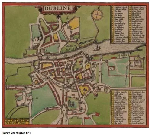
Speed’s map of Dublin of 1610 depicts the extent of development on both sides of the Liffey where land was reclaimed and the quays were developed. Christ Church Cathedral was also central to the urban area of that era. By the end of the 1600s the population of Dublin was at 60,000. The city started to develop further as private citizens acquired and developed former monastic land, particularly after the reinstatement of the Irish Parliament in 1661. Hoggen Green, formerly a priory, was gifted back to the city, and Trinity College was established on that site.
Oxmantown Green became a cattlemarket in 1541, and was due for development in the 1660s, however there was a petition to the council for the space to be kept for the citizens to walk and take the open air in 1665, it was then named Smithfield, with walls built and trees planted to keep out cattle.
The development character of the city in the 1700s moved away from being defensive to a more open settled character surrounded by agricultural fields and orchards. The presence of Dublin’s first and oldest park, St. Stephen’s Green, created in the 1660s, is present on Molls map of 1714 and while the Phoenix Park was also formed in this period, it did not permit
public access.
The City Basin water reservoir, located near the modern Guinness distillery, was built in 1724, and became a popular promenade area for the next century with walkways planted with elms and lime trees.
In summary, these centuries of early Dublin saw the establishment of the pattern of the centre that is familiar today and the commencement of the provision of public spaces, some of which fortunately remain.