The Picture of Dublin for 1811
Published on 23rd May 2014
The Picture of Dublin for 1811, being a description of the city, and a correct guide to all the public establishments, curiosities, amusements, exhibitions, and remarkable objects, in and near the city of Dublin. With a map of Dublin in the year 1610; a large map for 1811, and several views. On the same principle as The Picture of London.
Dublin, printed for the proprietor, by J. and J. Carrick, Batchelor’s Walk; and sold at 41, Golden Lane; La Grange, Nassau Street; Gilbert and Hodges, and Dugdale, Dame Street; and all the booksellers. (Price six shillings British).
This is the first edition of The Picture of Dublin, published in 1811. It does not name an editor or compiler, but the imprint states that it was printed for the proprietor, and sold at 41 Golden Lane. At this time 41 Golden Lane was the address of J. and W. Gregory, printers and booksellers. The dedication to the third edition, published in 1816, is signed by William Gregory, so he is likely to have been the compiler of the first edition.
It was based on a similar guide to London, and it was aimed at visitors to the city. It went into several editions in the first half of the 19th century, with many different editors, see Dublin City’s online catalogue for other editions.
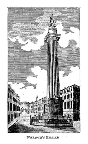
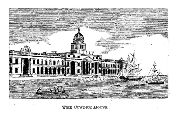
Like a modern guide book this guide starts with a short history of Dublin, followed by a contemporary description of the city and its inhabitants. It describes the public buildings and other sites worth visiting and it is illustrated with engraved plates showing the Bank of Ireland, College Green, the newly built Custom House, Nelson’s Pillar, and the Grand Canal at Portobello Harbour. Nitty-gritty details for the visitor are also included: lists of hotels, stage coaches, public baths, banks, newspapers, etc. An index makes the guide user friendly for the tourist.
One of the earliest maps of the city is that of John Speed, published in 1610, which is reproduced at the front of this volume. The map formed part of The Theatre of the Empire of Great Britain, published in London in 1610. This gives an idea of the historical shape of the city. The modern map of 1811, folding into the back of the guide, shows the plan of the streets with the main sites marked.
This guide allows the historical tourist to wander the streets of Dublin, admiring the many buildings, parks and statues, and experiencing the exhilaration of visiting a distant place: distant in time rather then space.
Alternatively download The Picture of Dublin (PDF, 4.48MB) using Adobe Acrobat. Cannot access PDF?