Rialto Bridge
Published on 16th February 2018
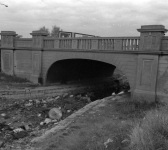
 Every day, thousands of people travel on the Red Line Luas from Tallaght or City West on their journeys to the city centre. What many may not realise is that the Luas follows the former Main Line of the Grand Canal – now filled in as a Linear Park from Davitt Road to the Basin Lane end of St. James’s Hospital. Enroute, the Luas passes under the former canal bridge at Rialto, the only remaining on the former Main Line from Griffith bridge to the old harbour at James' Street. Known today as Rialto Bridge, the proper name is Harcourt Bridge, called after the Chairman of the Grand Canal Company, the First Earl of Harcourt.
Photo: Rialto Bridge, filling in of the Grand Canal. Dublin City Council Photographic Collection.
A temporary timber bridge was constructed in 1766 to ensure uninterrupted progress for road traffic during the building the canal, as the main road to Kilmainham crossed at this point. Some time later, the Canal Company contracted a builder to replace this structure in stone budgeted at £1250, but difficulties arose with the standard of work and the contract was eventually terminated. Mr. Henry Roche then obtained the contract to construct an ornamental bridge costing £1200, which, when it was finally completed, was considered similar in shape and style to a bridge in Venice, called Ponte Di Rialto. The name 'Rialto', dating from 1795, eventually extended to the nearby district.
The bridge was reconstructed and widened in 1939 and further modified to comply with safety requirements when the Red Line Luas came into operation in September 2004. The next stop is called ‘Rialto’.
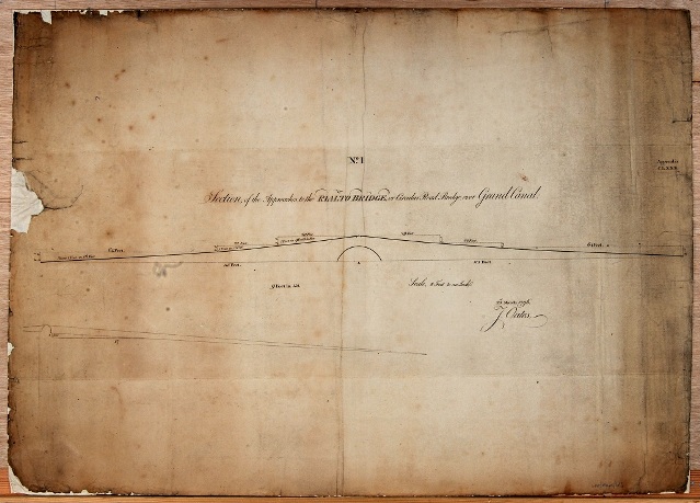
Wide Street Commission Map: Section of the approaches to the Rialto Bridge or Circular Road Bridge, over Grand Canal. 1796.
Ref WSC.Maps.613
Catherine Scuffil, Dublin City Council Historian in Residence, Dublin South Central Area
