North Circular Road (Dorset Street Lower to Amiens Street) Active Travel Scheme
The North Circular Road (Dorset Street Lower to Amiens Street) Active Travel Scheme will upgrade 1.1km of pedestrian, cycling and bus stop facilities along North Circular Road and Portland Row. This scheme will soon be in the Construction phase.
This scheme starts at the junction of North Circular Road and Dorset Street Lower and ends at the junction of Portland Row and Amiens Street. It will connect the existing segregated cycle tracks on Amiens Street and North Strand Road with the proposed Swords to City Centre BusConnects route at Dorset Street Lower.
The scheme forms part of Dublin City Council’s 314km Active Travel Network. To see where it fits into this citywide network, you can view our interactive GIS map.
Key features of the scheme include the following:
- Footpath widening at existing narrow sections/pinch points
- Localised footpath / roadway repairs
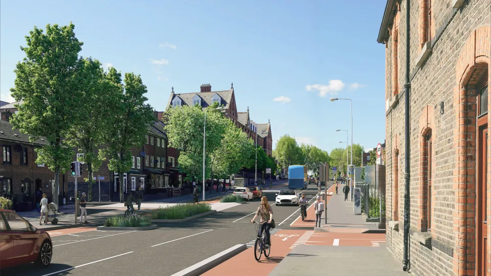
- Safer, upgraded junctions with better crossing facilities for pedestrians and cyclists
- Continuous footpaths across side roads to improve pedestrian priority
- 6 new bus stops to facilitate planned orbital bus route
- Segregated cycle lanes in both directions
- Additional planting and green spaces
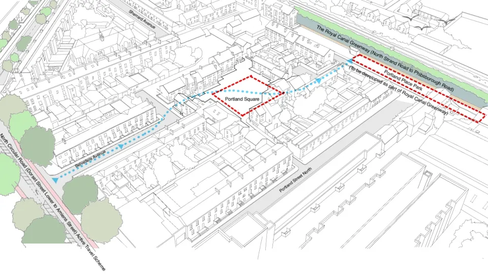
- Changes to vehicle access and reduction in ‘through traffic’ on Sherrard Street Lower, Sherrard Street Upper, Belvedere Place and Summerhill.
- Changes in car parking to improve safety
- Improved driver visibility from side roads
In January 2023, Dublin City Council completed a period of public consultation which sought the views of members of the public on Dublin City Council’s plan to install interim measures, such as bollard protected cycle lanes, along the 1.1 kilometre route. The scheme was updated to reflect feedback received and to align with the latest design standards. The public consultation report is available to view here.
A public information event to show the new designs took place on the 3rd of July 2025 at Croke Park Hotel. This event provided an opportunity for local residents and businesses to review the proposals and engage directly with the project team. Following feedback received at this event, the layout of the junctions at Sherrard Street Lower and Emmet Street were modified to allow vehicles to enter these streets from North Circular Road.
The tendering process to appoint a contractor to construct the scheme has been completed, and appointment of the contractor is expected to occur in the second half of July 2026.
All future updates regarding this project will be provided on this webpage.


The North Circular Road (Dorset Street Lower to Amiens Street) Active Travel scheme aims to improve the experience of walking and cycling along a 1.1km route within Dublin’s North Inner City.
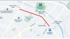
The scheme starts at the junction of Dorset Street Lower and North Circular Road and continues east along North Circular Road and Portland Row, before finishing at the junction of Portland Row and Amiens Street.
The scheme forms part of a wider network of active travel projects that are being delivered across Dublin City. A map of Dublin City Council’s proposed Active Travel Network.
- Footpath widening at existing narrow sections/pinch points and localised footpath repair.
- Provide segregated cycling facilities along the full length of the project route.
- Safer, upgraded junctions with better crossing facilities for pedestrians and cyclists.
- Support the objective of an Active Travel Network across Dublin City by providing a connection to existing and proposed infrastructure, such as the Clontarf to City Centre project.
- Continuous footpaths across side roads to improve pedestrian priority where appropriate.
- Make walking and cycling to Croke Park, The Mater Hospital, Connolly Station and many education centres much easier.
- Allow people of all ages to lead a more active lifestyle that helps improve physical and mental wellbeing.
- Contribute to a reduction in vehicular traffic and traffic-related pollution.
- Provide six new bus stops to facilitate the proposed Orbital bus service to be implemented under the BusConnects Dublin Network Redesign project.
- Improve landscaping and greening along the route.
- Resurfacing of the carriageway on North Circular Road and Portland Row, including localised carriageway repair.
- Upgrading public lighting along the route with energy-efficient luminaires.
Cyclists are most vulnerable at junctions, with almost half of serious injuries and a quarter of fatalities occurring at a junction (1). The introduction of protected junctions (which separate cyclists, pedestrians and motorists) at the North Circular Road/Belvidere Road/Belvedere Place/Sherrard Street and the North Circular Road/Summerhill Parade/Summerhill/Portland Row junctions will greatly improve their safety. In addition to the proposed protected junctions, safety improvements to the North Circular Road/Russell Street/Fitzgibbon Street junction and numerous side roads on the scheme will improve the safety of people walking and cycling in this area and encourage more people to use active travel.
By making it possible for more people to walk and cycle, the scheme will reduce traffic congestion and free up space for necessary vehicles.
There are active travel and public transport routes that connect into this scheme – for instance, the Clontarf to City Centre Active Travel scheme and the planned Orbital Bus Route on the North Circular Road and Portland Row. This scheme will also tie into the planned Swords to City Centre BusConnects scheme which when all combined, will facilitate safe and continuous walking and cycling journeys.
This scheme forms part of Dublin City Council’s overall 314km Active Travel Network, which aims to transform the way people travel in the city to achieve multiple benefits including:
- Reduced pollution and carbon emissions.
- Improved physical and mental health and wellbeing.
- More connected communities.
- More pleasant environments.
- Stimulated local business activity.
- ‘Cyclist spotlight report: fatalities and serious injuries’, Road Safety Authority (2025) Available at: https://www.rsa.ie/docs/default-source/road-safety/road-users/cyclist-spotlight-report-fatalities-and-serious-injuries-2020-2024.pdf?sfvrsn=cf6157b3_1 (Accessed 4th June 2025)
The revised design has undergone screenings for Environmental Impact Assessment (EIA) and an Appropriate Assessment (AA).
The Active Travel Programme Office has received a determination from Dublin City Council’s Planning Division confirming that the screenings carried out for Environmental Impact Assessment (EIA) and an Appropriate Assessment (AA) recommend that an EIA Report and an AA Natura Impact Statement are not required for the updated scheme.
Therefore, the Active Travel Programme Office considers that the proposed scheme is not required to proceed under the requirements of Part 8 of the Planning and Development Regulations 2001, as amended, nor does it require approval from An Coimisiún Pleanála. The proposal can be carried out under exempted development, as provided under Section 4(1)(e) and Section 179(6)(bb) of the Planning and Development Act 2000, as amended, and it is the intention of Dublin City Council’s Active Travel Programme Office (AcTPrO) to use the processes of Section 95 of the Road Traffic Act, 1961 as amended by Section 37 of the Road Traffic Act 1994, and Section 38 of the Road Traffic Act 1994 for implementation of the project.
The project is being funded by the National Transport Authority (NTA).
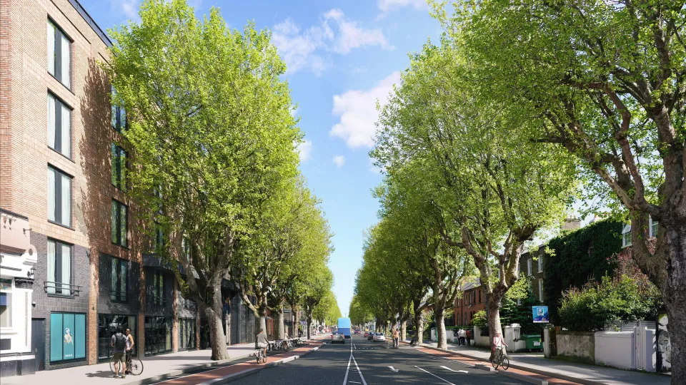
No trees are proposed to be removed. During detailed design, an arborist completed a tree survey to assess the possible impacts, as well as a tree protection plan to ensure protective measures are in place during construction. The contract for construction of the scheme requires the appointed works contractor to appoint a suitably qualified arborist to advise them in relation to all works near trees.
It is proposed to provide additional greening on the scheme, such as low-level planting at side road entrances and other suitable locations. Several locations have been identified on the drawings, which can be viewed here: Scheme Drawings.
To improve pedestrian and cyclist safety at junctions, the project proposes to change how vehicles access the following streets:
- Sherrard Street Upper
- Sherrard Street Lower
- Belvedere Place
- Summerhill
At the North Circular Road/Belvedere/Sherrard junction, there will be no vehicular access to Sherrard Street Upper, except for emergency service vehicles. Sherrard Street Upper will become two-way, with vehicular entry and exit at Gardiner Street Upper. Vehicular entry to Sherrard Street Lower will be maintained, but vehicles exiting the street will be diverted via Portland Place and Portland Street North. A ‘no left turn’ restriction from North Circular Road onto Belvedere Place is also being introduced; vehicles can divert via Fitzgibbon Street and Mountjoy Square East.
At the North Circular Road/Portland Row/Summerhill junction, a ‘no right turn’ restriction from North Circular Road onto Summerhill is being introduced; vehicles can divert via Portland Row, Killarney Street and Buckingham Street Upper.
Further details of these changes are shown on the drawings.
North Circular Road and Portland Row have approximately 167 on-street car parking spaces between the junctions with Dorset Street Lower and Amiens Street. These consist of 63 pay and display / residential permit spaces, 1 accessible space and 103 informal spaces. This scheme proposes to retain a total of 88 on-street car parking spaces (28 pay and display / residential permit spaces, 1 accessible space and 59 informal spaces). This is a reduction of 79 car parking spaces over the length of the scheme.
The rationale for this reduction in car parking spaces is to accommodate improved visibility for all road users at junctions, provide 6 new bus stops for the proposed BusConnects Route O orbital route, the introduction of additional greening along the route and increasing the size and number of loading bays to better serve local businesses and the DublinBikes docking stations on North Circular Road.
As many adjacent streets have resident permit parking / pay and display, it is not anticipated that a significant overflow of parking will move onto adjacent streets.
A 750mm buffer space will be provided between car parking areas and the cycle lane. This will allow vehicle users, including mobility-impaired users, to access their vehicle or attend to a child. Also, the accessible parking space will be improved with the addition of dropped kerbs to facilitate easier access.
The information leaflets can be downloaded here.
The scheme will include 6 new bus stops, which will serve the proposed orbital bus route planned under the Dublin Network Redesign project which is being delivered by the NTA to enhance bus services. The bus stops are shown on the scheme drawings.
In January 2023, Dublin City Council completed a period of public consultation for interim proposals. The consultation asked members of the public for their views on Dublin City Council’s plan to install interim walking and cycling facilities, such as bollard-protected cycle lanes, along the 1.1 kilometre route.
249 submissions were received during the public consultation period. Upon review of each submission, a majority (72%) were considered to view the scheme positively, whilst 11% of submissions were deemed to view the scheme negatively. 17% of responses were considered neither positive nor negative. Further details can be found in the Public Consultation Report for the North Circular Road (Dorset Street Lower to Amiens Street) Walking and Cycling Interim scheme.
Considering the substantial changes to the interim scheme’s design, a public information event was held in the Croke Park Hotel on the 3rd of July 2025 to give local residents and businesses an opportunity to engage with the project team and to discuss the updated plans. Following feedback received from local residents and businesses at this event, the scheme design was modified to allow vehicular traffic to turn from North Circular Road into both Sherrard Street Lower and Emmet Street.
Dublin City Council would like to thank each person who took the time and effort to make a submission to the public consultation and to attend the information event.
Appointment of a works contractor is due to take place in July 2026, with works expected to start in August 2026. A pre-construction public information event is scheduled for the Croke Park Hotel, between 4pm and 7pm on Thursday 30th July 2026.
The current estimate for construction is 18 to 20 months. More detailed information on the construction programme will be available once the appointed works contractor provides a construction programme to the project team.
- Updates regarding planned traffic restrictions to facilitate construction of the scheme will be posted here.
- You can also subscribe for free to our DCC Alerts service for email updates about the scheme here (Subscribe for Active Travel Alerts). You can unsubscribe at any time.