Clontarf to City Centre Active Travel Scheme
The Clontarf to City Centre Active Travel Scheme improves walking, wheeling and cycling infrastructure and bus routes between Clontarf Road and Amiens Street. This scheme is now complete.
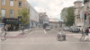
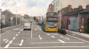
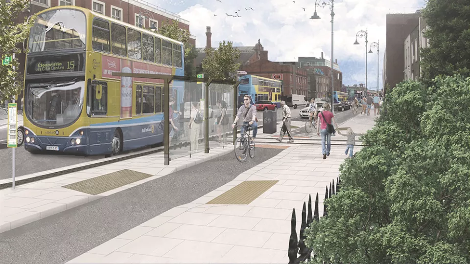
The Clontarf to City Centre Active Travel Scheme provides improved pedestrian facilities, segregated cycling facilities and bus priority infrastructure along a 2.7km route that extends from Clontarf Road at the junction with Alfie Byrne Road, to Amiens Street at the junction with Talbot Street.
This was identified as a primary route in the National Transport Authority's Greater Dublin Area Cycle Network Plan and will be part of Dublin City Council's Active Travel Network. A part of the Tolka Valley Greenway is also included in this scheme, linking Annesley Bridge Road to Alfie Byrne Road via Fairview Park.
View our interactive map to see where the scheme fits into the overall Active travel Network.
The scheme was officially opened on 28 November 2024. However, snagging works will continue along the scheme for several months. This slight delay is due to additional, necessary works, including community gain measures. These include additional works across a range of utility companies, the provision of two additional bus stops and delayed access to lands at Connolly Station due to ongoing conservation works.


Learn More About This Scheme

Key Changes
This scheme is a complex public infrastructure project that is delivering Active Travel facilities, bus priority infrastructure and a range of public amenities, including:
- Six major junction upgrades.
- 8km of upgraded pedestrian walkways.
- 6.8km of new and upgraded cycle lanes.
- 5.4km of upgraded bus lanes.
- 6.5km of new water mains, replacing century-old infrastructure.
- A variety of other utility upgrades, such as ESB, Bord Gáis and communications networks.
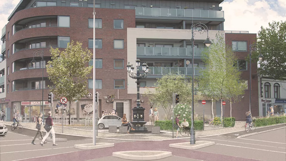
- Public realm improvements, including eight community plazas, greening measures and sustainable urban drainage.
- To provide high quality, continuous and consistent cycling facilities to cater for existing and future demand.
- To protect vulnerable road users through the delivery of a safe and attractive route for cyclists and to provide attractive, safe, segregated pedestrian facilities.
- To improve bus journey times and reliability.
- To simplify the interchange between bus services and other transport modes.
- To reduce reliance on private car transport.
- To reduce the growth in transport emissions.
- To improve the urban realm, landscape and built environment along the route.
- To enable national (Project Ireland 2040), regional (GDA Transport Strategy) and local (Dublin City Development Plan) strategic outcomes and deliver on relevant climate action targets.
The scheme went through a statutory Part 8 planning process described in the Planning and Development Act 2000 (as amended) and the Planning and Development Regulations 2001 (as amended). The scheme was approved at a Dublin City Council meeting on 2 October 2017 and has a planning reference number of 2039/17. For more information, visit our planning portal.
The National Transport Authority is funding the majority of the scheme, with Irish Water funding some watermains replacements.
The National Transport Authority approved funding at their board meeting in December 2021. Visit their website to read the minutes of the meeting.
The contractor is Clonmel Enterprises Ltd. The company was awarded the contract in January 2022. The company's details are:
- 24 Hour Emergency Contact: 086 032 4904.
- Email: [email protected].
- Website: www.clonmelent.com.
The scheme's designer is Roughan O’Donovan Consulting Engineers. The company's details are:
- Email: [email protected].
- Website: www.rod.ie.
During construction, temporary traffic management plans will be implemented to facilitate traffic and minimise disruptions. Notices of these plans will be published on this website.
The table below lists all the current bus stops and describes whether they are being kept and how far they are moving. The bus stop spacing was prepared based on a review of international best practice. It took account of the geometric constraints on the street and the level of demand at each location. (You can read our Bus Stop Spacing Report for more detail.)
The reorganisation should result in significantly faster and more reliable bus services in both directions, while also ensuring that all bus stops are located within a 3-5 minute walking catchment of the local community. For a visual representation, please view our drawing of the bus stop locations.
Specifically with reference to bus stop 617 (inbound at Strandville Avenue) and bus stop 4384 (outbound between Charleville Avenue and Bayview Avenue), a further review of the proposal to remove these bus stops was undertaken in June 2023. A report to summarise the design rationale was subsequently drafted.
From City Centre (Outbound)
| Stop Number | Location | Summary |
|---|---|---|
| 515 | Amiens Street near Portland Row. | Moves approx. 100 metres north. |
| 516 | North Strand Road near Health Centre. | Moves approx. 100 metres north. |
| 4384 | North Strand Road near Bayview Avenue. | To be removed. |
| 518 | North Strand Road near Waterloo Avenue. | To be removed. |
| 519 | North Strand Road near East Wall Road. | Retained. |
| 521 | Annesley Bridge Road near Addison Road. | To be removed. |
| 522 | Fairview near Merville Avenue. | Retained. |
| 523 | Fairview near Marino College. | Retained. |
| 1740 | Clontarf Road near Howth Road. | Moves approx. 50 metres east. |
| 1741 | Clontarf Road near Alfie Byrne Road. | Retained. |
From Clontarf (Inbound)
| Stop Number | Location | Summary |
|---|---|---|
| 1738 | Clontarf Road at Pitches near Dart Station. | Retained. |
| 1739 | Clontarf Road near Station and Westwood. | To be removed. |
| 668 | Malahide Road near Marino Crescent Park. | Retained. |
| 614 | Fairview at Footbridge. | Moves approx. 70 metres west. |
| 615 | Annesley Bridge Road near Addison. | To be removed. |
| 616 | North Strand Road at Fire Station. | Retained. |
| 617 | North Strand Road near Strandville Avenue. | To be removed. |
| 618 | North Strand Road near Newcomen Bridge / James Larkin House. | Retained. |
| 619 | Amiens Street near Portland Row and Seville Place. | Moves approx. 50 metres north. |
| 675 | Amiens Street near Buckingham Street Lower. | To be removed. |
The scheme was officially opened on 28 November 2024, but snagging works are likely to continue along the scheme for several months.
This slight delay is due to additional necessary works, including community gain measures. These include works across a range of utility companies, the provision of two additional bus stops and delayed access to lands at Connolly Station due to ongoing conservation works.