Parliamentary Commissions
Wide Streets Commissioners 1758 – 1851
The Commissioners for making Wide and Convenient Ways, Streets and Passages in the City of Dublin was established by an Act of Parliament in 1757.

The Commission had extensive powers with the authority to acquire property by compulsory purchase, demolish it, lay down new streets and set lots along the new streets to builders for development.
The Commission created Parliament Street, Westmoreland Street and D’Olier Street, widened Dame Street, built Carlisle Bridge (now O’Connell bridge), and extended lower Sackville Street (O’Connell) down to the river Liffey.
The Commission was abolished under the Dublin Improvement Act of 1849 with the final completion of its work in 1851.
The Collection contains a complete set of minute books; architectural drawings by leading architects; series of Jury Books and inquisitions containing valuations of properties purchased by the Commission; legal documents; series of leases to Henry Ottiwell; 800 manuscripts maps documenting the city before, during and after the work of the commission.
Search and browse the Archive of Wide Street Commission Collection online.
Viewing of original Wide Street Commission maps and architectural drawings is strictly by appointment only at Dublin City Library and Archive, Pearse Street. Email [email protected] for more information.
Wide Street Commission Maps
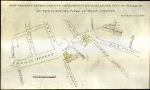
Maps were commissioned by the Wide Streets Commission between 1757-1851 from land-surveyors and cartographers including Jonathan Barker, A.R. Neville, John Roe, Thomas and David Henry Sherrard and Samuel Sproule. The maps document every aspect of the Wide Streets Commission’s work including acquisition of property; development plans; and layout of new streets. Geographically, most maps relate to the area between the Grand and Royal Canals.
Collection includes maps produced 1681-1750 by Dublin City Surveyors for Dublin City Assembly, relating to property purchased by Wide Streets Commission and includes property in Co. Dublin.
Dublin City Archives has an ongoing project to conserve and digitise the maps. Only maps which have been fully conserved are listed in the indexes and descriptive list below. In 2015, 16 more maps were conserved.
Search and browse the Wide Street Commission General Maps online.
Learn more about the Wide Street Commission and the ongoing map conservation project at Dublin City Library and Archive.
Conservation Notice: In order to reduce handling damage and to ensure the long term preservation of these fragile drawings, all researchers are requested to view the digitised images in the first instance. High-Res versions can be provided on request.
Viewing of original drawings is strictly by appointment only at Dublin City Library and Archive, Pearse Street. A minimum of 3 days notice is required to process your request and a maximum of 10 maps may be ordered per visit. Please apply to [email protected].
Wide Street Commission Architectural Drawings
The Wide Streets Commission had the authority to determine and regulate the facades of buildings erected along the line of new streets developed by it. The Commission decided on the heights of buildings, the number of houses in a terrace, the materials to be employed and the type and spacing of windows. Builders had to conform to specifications and the Commission could, and did, order re-building where its instructions had been flouted.
As a by-product of its interest in and impact on the architecture of Dublin in the period 1757-1849, the Wide Streets Commission amassed a total of 60 elevations of buildings and terraces.
Search and browse the Wide Street Commission Architectural Drawings online.
The WSC Architectural Drawing Catalogue was prepared by Dr Mary Clark, City Archivist and published by Dublin City Council in 1988. It provides detailed description of the full set of architectural drawings in the archives of the Wide Street Commission. The catalogue is now being published online, along with an image gallery of the architectural drawings.
Conservation Notice: In order to reduce handling damage and to ensure the long term preservation of these fragile drawings, all researchers are requested to view the digitised images in the first instance. High-Res versions can be provided on request.
Viewing of original drawings is strictly by appointment only. A minimum of three days notice is required to process your request and a maximum of 10 maps may be ordered per visit. Please apply to [email protected].