Parliamentary Commissions
Wide Streets Commissioners 1758 – 1851
The Commissioners for making Wide and Convenient Ways, Streets and Passages in the City of Dublin was established by an Act of Parliament in 1757.
The Commission had extensive powers with the authority to acquire property by compulsory purchase, demolish it, lay down new streets and set lots along the new streets to builders for development.
The Commission created Parliament Street, Westmoreland Street and D’Olier Street, widened Dame Street, built Carlisle Bridge (now O’Connell bridge), and extended lower Sackville Street (O’Connell) down to the river Liffey.
The Commission was abolished under the Dublin Improvement Act of 1849 with the final completion of its work in 1851.
The Collection contains a complete set of minute books; architectural drawings by leading architects; series of Jury Books and inquisitions containing valuations of properties purchased by the Commission; legal documents; series of leases to Henry Ottiwell; 800 manuscripts maps documenting the city before, during and after the work of the commission.
Search and browse the Archive of Wide Street Commission Collection online.
Viewing of original Wide Street Commission maps and architectural drawings is strictly by appointment only at Dublin City Library and Archive, Pearse Street. Email [email protected] for more information.
Wide Street Commission Maps
Maps were commissioned by the Wide Streets Commission between 1757-1851 from land-surveyors and cartographers including Jonathan Barker, A.R. Neville, John Roe, Thomas and David Henry Sherrard and Samuel Sproule. The maps document every aspect of the Wide Streets Commission’s work including acquisition of property; development plans; and layout of new streets. Geographically, most maps relate to the area between the Grand and Royal Canals.
Collection includes maps produced 1681-1750 by Dublin City Surveyors for Dublin City Assembly, relating to property purchased by Wide Streets Commission and includes property in Co. Dublin.
Dublin City Archives has an ongoing project to conserve and digitise the maps. Only maps which have been fully conserved are listed in the indexes and descriptive list below. In 2015, 16 more maps were conserved.
Search and browse the Wide Street Commission General Maps online.
Learn more about the Wide Street Commission and the ongoing map conservation project at Dublin City Library and Archive.
Conservation Notice: In order to reduce handling damage and to ensure the long term preservation of these fragile drawings, all researchers are requested to view the digitised images in the first instance. High-Res versions can be provided on request.
Viewing of original drawings is strictly by appointment only at Dublin City Library and Archive, Pearse Street. A minimum of 3 days notice is required to process your request and a maximum of 10 maps may be ordered per visit. Please apply to [email protected].
Wide Streets Commission Map Collection
Archive Reference: IE/DCLA/WSC/Maps
Title: Wide Streets Commission Map Collection
Creation Dates: 1681–1851
Level of Description: Series
Extent & Medium: 758 items
Context
Creators
Wide Streets Commission; Dublin City Assembly.
Administrative and Biographical History
Maps were commissioned by the Wide Streets Commission between 1757 and 1851 from surveyors and cartographers including Jonathan Barker, A.R. Neville, John Roe, Thomas and David Henry Sherrard, and Samuel Sproule. The collection also includes maps created between 1681 and 1750 by Dublin City Surveyors for the Dublin City Assembly concerning property later purchased by the Commission.
Archival History
The Commission’s records were transferred to Dublin City Council in 1851 and placed in the Royal Exchange (now City Hall). In 1954, most of these archives, including the map collection, were transferred on long‑term loan to the Public Record Office of Ireland. They were returned to City Hall in 1982 and placed under the custody of Dublin City Archives. The collection was stored at Dublin Civic Museum from 1995 to 2002 and moved to Dublin City Library & Archive in 2003. A conservation programme began in 1988.
Content and Structure
Scope & Content
The collection consists of manuscript maps documenting all aspects of the Wide Streets Commission’s activities between 1758 and 1851, including property acquisition, development proposals and the layout of new streets. Most maps relate to areas between the Grand Canal and Royal Canal, with additional material relating to county Dublin properties purchased by the Commission.
Arrangement
The maps were arranged in 1892 by J.P. McEvoy of the Town Clerk’s Office on a street‑by‑street alphabetical basis. The sequence was re‑arranged by Dr. Nuala Burke between 1970 and 1974, before the original order was restored in 1976 by archivist Miriam Lambe under the supervision of Dr. Philomena Connolly (Public Record Office of Ireland).
Conditions of Access & Use
Access Conditions
Viewing of original maps is strictly by appointment only. Requests must be submitted to [email protected], including reference numbers for the maps required. A minimum of three days’ notice is necessary, and up to ten maps may be requested per visit.
Conditions Governing Reproduction
Reproduction is permitted in accordance with Dublin City Library & Archive Reading Room Terms of Membership and applicable copyright legislation.
Language/Script of Material
English
Physical Characteristics & Technical Requirements
Some maps are rolled or oversized; all items are fragile.
Finding Aids
Descriptive list (this document).
Allied Materials
- Wide Streets Commission Architectural Drawings
- Wide Streets Commission Deeds
- Wide Streets Commission Minute Books
Publication Note
Digitised versions of conserved maps are available via the Dublin City Library & Archive Digital Repository.
Contact Information
Dublin City Library and Archive
138–144 Pearse Street
Dublin 2
Tel: 00 353‑1‑674 4996 / 4997 / 4848
Email: [email protected]
Website: www.dublincityarchives.ie
Twitter: @dclareadingroom
17th Century (1600–1699)
Document No: WSC/Maps/563
Description: Map of a parcel of ground, called “The Pipes”, in the parish of St. James and County Dublin. Leased to Giles Mee in 1670, from the Cistern at James’s Gate in 1670, along the course of Lord Limerick’s tenants, under the Basin Wall, and to Dolphin’s Barn — with surveyor's note.
Date: 1670
Scale: 150′ = 1″
1680 — Ground at corner of Nassau St & Grafton St (Pooley Lease)
Document No: WSC/Maps/564
Description: “This is a plott or parcell of ground lying between the east side of the way leading from College Green to Stephen’s Green, and the House and Garden of Mr. Burnyates”, surveyed 17 January 1680 by order of the Lord Mayor.
Date: 1680
Scale: 10′ = 1″
1680 — Ground at corner of Nassau St & Grafton St (Waller Tenements)
Document No: WSC/Maps/565/1
Description: Map described as: “This is a plott of a parcell of ground, between ye East side of the way leading from College Green, and several tenements belonging to Mr. Waller.”
Date: 1680
Scale: 10′ = 1″
1682 — Parcel bounded by Grafton St, College Green & Chequer Lane
Document No: WSC/Maps/567/1–3
Description: Three copies of a map of a parcel of ground bounded by Grafton Street, College Green and Chequer Lane; leased to Mr. Pooley.
Date: 1682
Scale: 3 perches (21 yards) = 1″
1693 — Tenement on North side of St James’s Street
Document No: WSC/Maps/569/1
Description: Survey of a tenement, back, side and garden on the North side of St James’s Street, showing situation of Lord Santry’s land.
Date: 1693
Scale: 20′ = 1″
1695 — Ground on East side of College Street
Document No: WSC/Maps/569/2
Description: Survey of ground on the East side of College Street.
Date: 1695
Scale: 20′ = 1″
18th Century (1700–1749)
1709 — Ground near Lazar’s Hill, River Liffey
Document No: WSC/Maps/651
Description: Survey of a piece of ground on the south side of the River Liffey near Lazar’s Hill, bounded by Mercer’s and Barkey’s holdings, by a reserved City strip, by the Strand and by the river. Surveyed by Jos. Moland, C.S.
Date: 1709
Scale: 80′ = 1″
1716 — High Street & Back Lane, City Estate (Lease of Lives)
Document No: WSC/Maps/601/1–3
Description: Map of ground between High Street and Back Lane, let to William Quaile by lease of lives renewable forever.
Date: 1716
Scale: 20′ = 1″, 20′ = 1″, 10′ = 1″
1718–1722 — City Plot at Blind Quay & South Strand (Dockwra v Corporation Award)
Document No: WSC/Maps/653/1–2
Description: Survey of a City-owned plot on the River Liffey adjoining Sir John Rogerson’s ground, Lazar’s Hill and Hawkins Street, with the copy of an award (1722) concerning water supply.
Dates: 1718–1722
Scale: 10 perches = 1″
1721 — Essex Quay, Blind Quay, Exchange Street (City Wall & Gates)
Document No: WSC/Maps/654
Description: Ground plots belonging to the City, including Essex Gate, Dame Gate, Dames Mill and a branch of the River Dodder.
Date: 1721
Scale: 240′ = 1″
1722 — Werburgh Street & Bride Street (City Estate)
Document No: WSC/Maps/608/1
Description: Plots on Werburgh Street and Bride Street including part of the town wall and ditch; leased to Alderman Pearson, renewable forever.
Date: 1722
Scale: 20′ = 1″
1722 — Golden Lane & Chancery Lane (City Estate)
Document No: WSC/Maps/570
Description: City Estate on the south side of Golden Lane, demised to Edward Slicer, including Chancery Lane Nos. 37–42.
Date: 1722
Scale: 20′ = 1″
1723–1781 — Blind Quay & Essex Quay (Multiple Leases)
Document No: WSC/Maps/694
Description: Collection of lease maps for plots on Blind Quay and Essex Quay (Edward Ford 1723; Daniel Cooke 1716; Jane Jacob 1726; Augustine Thwaites 1733; David Reid 1741; Coales & Mullen 1781).
Dates: 1716–1781
Scale: 20′ = 1″
1726 — Back Lane (City Wall Parcel)
Document No: WSC/Maps/571
Description: Parcel forming part of the City Wall near Nicholas Gate, leased to John Collins for 99 years.
Date: 1726
Scale: 20′ = 1″
1726 — Coombe (Estate of Richard Falkner)
Document No: WSC/Maps/328
Description: Parcel adjoining the south side of Francis Street, originally a ditch, dated from a 1726 lease with references.
Date: 1726
Scale: 30′ = 1″
1728 — Big Booter Lane (Bishop Street)
Document No: WSC/Maps/572
Description: Lease of lives for property along Big Booter Lane (now Bishop Street).
Date: 1728
Scale: 20′ = 1″
1730 — Grafton St, Suffolk St & Chequer Lane
Document No: WSC/Maps/566
Description: Survey of part of Colonel Paul’s estate along these streets, with surveyor observations.
Date: 1730
Scale: Not stated
1735 — Temple Bar, Crown Alley & Ardill Row
Document No: WSC/Maps/657
Description: Lease renewable forever to John Temple, covering Temple Lane, Fownes Street, Bagnio Slip and access to Iron Bridge.
Date: 1735
Scale: 40′ = 1″
1747 — Marlboro Green & Lower Abbey Street (with 1797 version)
Document No: WSC/Maps/219/1–4
Description: Survey of Viscount Mountjoy's estate, tenants named, covering Potter's Alley, Glass House, Rope Walk and North Strand. Note: item (4) dated 1797.
Date: 1747 (1797 for item 4)
Scale: 40′ = 1″; 80′ = 1″; N.S.; 40′ = 1″
18th Century (1750–1774)
1755 — Temple Bar, Porter’s Row & Anglesea Street
Document No: WSC/Maps/575
Description: Map of part of the City Estate, including Temple Bar, Porter’s Row and Anglesea Street. Formerly set to Henry Markham and Henry Aston; reverted to the City in March 1755, with committee report and remarks.
Date: 1755
Scale: Not stated
1757 — Principal Avenue to Dublin Castle (Early Parliament Street Plan)
Document No: WSC/Maps/329
Description: Plan for opening and widening an avenue to the Castle, later known as Parliament Street, showing Dame Street, Castle Street and adjoining avenues.
Date: 1757
Scale: 100′ = 1″
1760 — Essex Bridge to Essex Quay (Intended Street)
Document No: WSC/Maps/330
Description: Plan of houses and yards between Essex Street and Essex Quay showing the site of an intended new street, with lessees listed.
Date: 1760
Scale: Not stated
1760 — Aston’s Quay & Fleet Street (Lease to Henry Aston)
Document No: WSC/Maps/662
Description: Map of a piece of ground on Aston’s Quay and Fleet Street included in a lease to Henry Aston.
Date: 1760
Scale: 50′ = 1″
1761 — Essex Street, Dame Street, Cork Hill & Crane Lane
Document No: WSC/Maps/332
Description: Map of houses and yards between Essex Street and Dame Street, with reference to lessees and owners in Cork Hill, Crane Lane and Essex Street.
Date: 1761
Scale: 20′ = 1″
1764 — Ground from James’s Gate to Dolphin’s Barn (City Water Course)
Document No: WSC/Maps/578
Description: Survey of ground from the cistern at James’s Gate to a stone wall behind houses at Dolphin’s Barn, formerly leased to Giles Mee.
Date: 1764
Scale: Not stated
1764 — Castle Lane, Dame Street & Cork Hill
Document No: WSC/Maps/88/1
Description: Map of Castle Lane, Dame Street and Cork Hill prepared by H.H. Adams.
Date: 1764
Scale: 40′ = 1″
1766 — Castle Alley, Castle Lane & Cork Hill (Royal Exchange Site)
Document No: WSC/Maps/94/1 & 94/3–7
Description: Maps showing Castle Alley, Castle Lane, Dame Street and Cork Hill. Includes the lot reserved for the future Royal Exchange (now City Hall).
Date: 1766
Scale: Various (mostly Not stated; one at 20′ = 1″)
1766 — Castle Lane, Dame Street & Cork Hill (Sale Maps)
Document No: WSC/Maps/95/1–5
Description: Maps by Jonathan Barker for sale of plots along Castle Lane, Dame Street and Cork Hill.
Date: 1766
Scale: Mixed (20′ = 1″ and Not stated)
1766 — Castle Lane, Dame Street & Cork Hill (Additional Sale Plans)
Document No: WSC/Maps/96/1–7 & 96/9
Description: Additional sale plans for properties around Castle Lane, Dame Street and Cork Hill.
Date: 1766
Scale: All Not stated
1768 — Lease for Lives, Winetavern Street
Document No: WSC/Maps/693
Description: Parcel on the east side of Winetavern Street leased to John Gillmer for lives renewable forever.
Date: 1768 (map drawn 1781)
Scale: 20′ = 1″
1769 — Castle Street (Five Maps)
Document No: WSC/Maps/93/1–12
Description: Series of maps of Castle Street from 1766–1813, several dated 1769.
Date: 1769
Scale: Mixed (5′ = 1″, 10′ = 1″, 20′ = 11″)
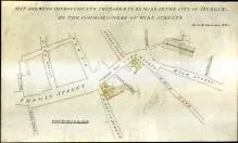
1769 — North Side Thomas Street (Cooke Estate)
Document No: WSC/Maps/667
Description: Map of a piece of ground on the north side of Thomas Street, part of Alderman Thomas Cooke’s estate.
Date: 1769
Scale: 40′ = 1″
1774 — Essex Bridge & Blind Quay (Booker Estate)
Document No: WSC/Maps/586
Description: Maps of plots at Essex Bridge and Blind Quay, property of Alderman Francis Booker, with tenant references.
Date: 1774
Scale: 15′ = 1″
18th Century (1775–1799)
1776 — North Side of Lazer’s Hill & South City
Document No: WSC/Maps/676
Description: Map of a parcel of ground on the North side of Lazer’s Hill and South City.
Date: 1776
Scale: 100′ = 1″
1778 — Ground on the North Side of Thomas Street
Document No: WSC/Maps/679
Description: Map of ground on the North side of Thomas Street.
Date: 1778
Scale: 20′ = 1″
1778 — Dame Street, North & South Vicinity (with Reference)
Document No: WSC/Maps/111
Description: Map of Dame Street, north and south sides, and vicinity, with reference.
Date: 1778
Scale: 40′ = 1″
1779 — Part of Thomas Street (Croker’s Lane & Inns)
Document No: WSC/Maps/681
Description: Map of a parcel of ground on the North side of Thomas Street, including “Churn & Sun Inns”.
Date: 1779
Scale: 30′ = 1″
1779 — Lazer’s Hill to Gloucester Street (Deficiency Map)
Document No: WSC/Maps/682
Description: Map showing deficiencies in the east and west lines from Lazer’s Hill to Gloucester Street.
Date: 1779
Scale: 100′ = 1″
1779 — Thomas Street & Fitzpatrick’s Field (Yellow Lyon Inn)
Document No: WSC/Maps/683
Description: Map showing the Yellow Lyon Inn, Cherry Tree Inn, Dirty Lane and Fitzpatrick’s Field.
Date: 1779
Scale: 30′ = 1″
1779 — City Estate Partition (Power & Walsh Holdings)
Document No: WSC/Maps/593
Description: Partition map from deed of 1 November 1779, showing Power & Walsh holdings (drawn 1811 by Neville).
Date: 1779
Scale: 20′ = 1″
1779 — Suffolk Street, Grafton Street & Exchequer Street
Document No: WSC/Maps/598
Description: Two parcels of ground situate on Suffolk Street, Grafton Street and Exchequer Street.
Date: 1780 (surveyed 1780, but 18th‑century context)
Scale: 30′ = 1″
1780 — New Hall Market (City Estate)
Document No: WSC/Maps/594/1
Description: Map of New Hall Market, part of the City Estate.
Date: 1780
Scale: 20′ = 1″
1781 — Piece of Ground South Side of Temple Bar
Document No: WSC/Maps/599
Description: Map of ground let to Henry Aston on the south side of Temple Bar.
Date: 1781
Scale: 40′ = 1″
1781 — Temple Bar, Exchange Street, Blind Quay (Multiple Leases)
Document No: WSC/Maps/694
Description: Series of maps for leases renewable forever along Temple Bar and Blind Quay.
Date: 1781
Scale: 20′ = 1″
1781 — Meeting House Yard (Tower & City Wall)
Document No: WSC/Maps/690
Description: Map of ground on the East side of Meeting House Yard and the City Wall tower.
Date: 1781
Scale: 20′ = 1″
1781 — North Lotts — Church Road
Document No: WSC/Maps/692
Description: Map of a North Lott at the north side of Church Road.
Date: 1781
Scale: 8 perches = 1″
1782 — Croker’s Lane & Collins’s Fields
Document No: WSC/Maps/373
Description: Survey of a piece of ground on the North side of Thomas Street including Collins’s Fields.
Date: 1782
Scale: 20′ = 1″
1784 — Ram Alley & Lamb Alley
Document No: WSC/Maps/345/1–2
Description: Maps of premises in Ram Alley and Lamb Alley.
Date: 1786 (maps drawn 1786; part of 18th-century sequence)
Scale: 20′ = 1″ (one map), another N.S.
1784 — Dame Street into College Green (Early Street Improvement)
Document No: WSC/Maps/340/1
Description: Plan for extending Dame Street into College Green; includes Trinity Street opening.
Date: 1784
Scale: 40′ = 1″
1785 — Dame Street, Dame Court & South Great George’s Street
Document No: WSC/Maps/118
Description: Map of Dame Street, Dame Court and South Great George’s Street.
Date: 1785
Scale: 10′ = 1″
1786 — Castle Street Section (Road to Island Bridge)
Document No: WSC/Maps/346
Description: Survey of Barrack Street to Island Bridge (now Conyngham Road).
Date: 1786
Scale: 80′ = 1″ (plan), 20′ = 1″ (sections)
1787 — Part of City near Grand Canal (Multiple Streets)
Document No: WSC/Maps/348
Description: Large survey showing Bason Lane, Crane Lane, Meath Row, Marrowbone Lane and many others.
Date: 1787
Scale: 140′ = 1″
1789 — College Green (North Side)
Document No: WSC/Maps/349
Description: Map of College Green north side, Anglesea Street west side, Cope Street and Old Post Office Yard.
Date: 1789
Scale: 40′ = 1″
1790 — Thomas Street, Meath Row & Hanbury Lane
Document No: WSC/Maps/354
Description: Map with reference to names of lessees.
Date: 1791 (survey spans 1790–1791)
Scale: 20′ = 1″
1791 — Plans for Fitzwilliam Street & Merrion Square
Document No: WSC/Maps/357
Description: Section of Fitzwilliam Street and east side of Merrion Square.
Date: 1791
Scale: 40′ = 1″
1793 — Temple Bar, Essex Bridge & Wellington Quay
Document No: WSC/Maps/522 (from list sequence)
Description: Proposed quay wall works, Essex Street to Essex Bridge.
Date: 1793
Scale: 40′ = 1″
1799 — George’s Quay, Whites Lane & Poolbeg Street
Document No: WSC/Maps/372
Description: Map of George’s Quay showing Whites Lane, Poolbeg Street and the site of Sweetman’s Brewery.
Date: 1799
Scale: 20′ = 1″
19th Century (1800–1899)
1800 — Survey of part of the estate of Thomas Proby (Parkgate Street)
Document No: WSC/Maps/320
Description: Survey of holdings in Parkgate Street sold by the representatives of the late Thomas Proby.
Date: 1800
Scale: 40′ = 1″
1800 — Iron Yard & Abbey Street (Marlboro’ Street)
Document No: WSC/Maps/321
Description: Survey of the Iron Yard and adjoining holdings, showing that Marlboro’ Street did not then extend to the quays.
Date: 1800
Scale: 40′ = 1″
1800 — Thomas Court & Meath Street (Market House area)
Document No: WSC/Maps/390/1–2
Description: Plan of a proposed Market House adjoining Thomas Street, Vicar Street, Market Street and Francis Street.
Date: 1801 (survey early 1800s)
Scale: Not stated
1801 — Westmoreland Street (Leland Crosthwaite)
Document No: WSC/Maps/385
Description: Survey of a holding in Westmoreland Street sold to Leland Crosthwaite.
Date: 1801
Scale: 10′ = 1″
1801 — Fleet Street & College Street (Watch House)
Document No: WSC/Maps/387
Description: Survey of holdings including the site of the Old Watch House.
Date: 1801
Scale: 40′ = 1″
1801 — South Great George’s Street (Castle Stables & Barrack Ground)
Document No: WSC/Maps/389/1–2
Description: Survey of several holdings with references.
Date: 1801
Scale: 20′ = 1″
1802 — Old Custom House Quay / Essex Street
Document No: WSC/Maps/370
Description: Survey of Old Custom House, Custom House Quay and Essex Street.
Date: 1798–1802
Scale: Not stated
1802 — Fleet Market, Hawkins Street & Townsend Street
Document No: WSC/Maps/380/1–2
Description: Maps showing Fleet Market, Poolbeg Street, Dublin Society Stores, etc.
Date: 1800–1802
Scale: 20′ = 1″
1802 — Parliament House Ground Plan
Document No: WSC/Maps/402
Description: Ground plan of the Parliament House (College Green).
Date: 1802
Scale: Not stated
1802 — Anglesea Street & Parliament House
Document No: WSC/Maps/404
Description: Map of Anglesea Street and vicinity of Parliament House.
Date: 1802
Scale: Not stated
1802 — Dame Street, Temple Lane, Fownes Street
Document No: WSC/Maps/405/1–3
Description: Street improvement maps covering Dame Street, Fownes Street and Crow Street.
Date: 1830 (maps based on earlier surveys)
Scale: Mixed
1803 — North Dock (Secretary’s Office Facsimile)
Document No: WSC/Maps/36
Description: Facsimile of a map held in Dublin Castle relating to the proposed North Dock.
Date: 1803
Scale: 200′ = 1″
1806 — Watling Street (James’s Street)
Document No: WSC/Maps/192
Description: Map of Watling Street.
Date: 1806
Scale: 20′ = 1″
1807 — Nettleton’s Holding (Cuffe Street)
Document No: WSC/Maps/621
Description: Holdings on the east side of Kevin’s Port and reres of Cuffe Street houses.
Date: 1807
Scale: 30′ = 1″
1808 — Custom House Docks (North Wall)
Document No: WSC/Maps/35/1–4
Description: Four maps of Custom House Docks, North Wall.
Date: 1808
Scale: 80′ = 1″
1808 — Westmoreland Street, D’Olier Street & Vicinity
Document No: WSC/Maps/634/1
Description: Map showing Westmoreland Street, D’Olier Street and surrounding areas.
Date: 1808
Scale: 40′ = 1″
1809 — Tholsell Ground (Nicholas Street / Skinners Row)
Document No: WSC/Maps/625/1–2
Description: City estate ground formerly Souther’s Lane, laid out for building.
Date: 1812 (survey based on 1809 work)
Scale: 10′ = 1″
1810 — Ormond Quay, Capel Street, Mary’s Abbey
Document No: WSC/Maps/203
Description: City Survey showing Ormond Quay and adjoining streets.
Date: 1811 (survey covers 1810–1811)
Scale: 40′ = 1″
1811 — Pill Lane & Greek Street (Domville Estate)
Document No: WSC/Maps/419
Description: Holdings taken from a lease dated 31 August 1805.
Date: 1814 (survey includes earlier dates)
Scale: Not stated
1812 — Belvedere Place, Lower Sherrard Street, Drumcondra Road
Document No: WSC/Maps/204
Description: Map of Belvedere Place and vicinity.
Date: 1812
Scale: 80′ = 1″
1812 — Exchequer Street & St Andrew Street
Document No: WSC/Maps/125
Description: Map by A. Neville, City Surveyor.
Date: 1830 (based on earlier map)
Scale: Not stated
1812 — Holdings in St. Andrew’s Parish (Foster Place)
Document No: WSC/Maps/135
Description: Survey of a lot of ground in Foster Place, parish of St Andrew, sold to Edward Bellingham Swan by the Wide Streets Commissioners.
Date: 1788 (noted but included in later archival sequence)
Scale: 10′ = 1″
1813 — Essex Street & Parliament Street (Old Custom House)
Document No: WSC/Maps/124
Description: Map showing Essex Street, Parliament Street, Essex Bridge and Old Custom House by T. & D.H. Sherrard.
Date: 1813
Scale: 40′ = 1″
1813 — Premises for Valuation by Jury (Cock Hill to Patrick’s Close)
Document No: WSC/Maps/100/1–2
Description: Jury maps covering Cock Hill, Michael’s Lane, Winetavern Street, John’s Lane, Christchurch, Patrick Street and Patrick’s Close.
Date: 1813
Scale: 40′ = 1″
1814 — Pill Lane & Greek Street (Domville Estate)
Document No: WSC/Maps/419
Description: Survey of holdings in Pill Lane and Greek Street from the Domville estate.
Date: 1814
Scale: Not stated
1814–1816 — Patrick Street & Cross Poddle (Cathedral Vicinity)
Document No: WSC/Maps/417/1–3
Description: Maps showing Patrick Street, Patrick’s Close, the Poddle, Cross Poddle and Kevin Street.
Date: 1814–1816
Scale: 40′ = 1″ (two maps), one N.S.
1814–1815 — Lower Abbey Street & Marlborough Street (Jury Maps)
Document No: WSC/Maps/226/1–2
Description: Jury maps relating to properties in Lower Abbey Street and Marlborough Street.
Date: 1814–1815
Scale: 40′ = 1″
1815 — Ormond Quay, Arran Street & Mary’s Abbey (City Survey)
Document No: WSC/Maps/203
Description: Survey showing Ormond Quay, Arran Street, Mary’s Abbey, Little Strand Street, Capel Street and Essex Bridge.
Date: 1811 (recorded in 1815 sequence)
Scale: 40′ = 1″
1816 — Mountjoy Estate (Blessington St., Mountjoy St., Eccles St.)
Document No: WSC/Maps/64
Description: Map of lands demised by Lord Mountjoy and Mr. Eccles showing Blessington Street and adjacent streets.
Date: 1816
Scale: N.S.
1817 — Improvements at Christ Church Place (Skinners Row)
Document No: WSC/Maps/421
Description: Map of the precincts of Christ Church, including premises taken by the Commissioners for widening Skinners Row.
Date: 1817
Scale: 20′ = 1″
1817 — Proposed City Improvements (Thomas St. to Kevin St.)
Document No: WSC/Maps/757
Description: Map showing proposed improvements for Thomas Street, High Street, Winetavern Street, Skinner Row, Werburgh Street, Patrick Street, Kevin Street, Bishop Street and The Coombe by Thomas Sherrard.
Date: 1817
Scale: 200′ = 1″
1818 — Lots in North Strand & Lower Abbey Street (Griffith Lloyd Estate)
Document No: WSC/Maps/219/2
Description: Map showing Lloyd’s Rope Walk, Glass House and lands on the North Strand.
Date: 1797 (archived in later sequence)
Scale: 40′ = 1″
1818 — Streets around Mary’s Abbey & Boot Lane
Document No: WSC/Maps/57
Description: Plan showing streets around Mary’s Abbey and Boot Lane (“Old Bank”).
Date: 1811 (archived 1818)
Scale: N.S.
1818 — Mail Coach Road (Blessington Street to Cabra)
Document No: WSC/Maps/55
Description: Map of new line of road connecting Blessington Street to Cabra on the Navan Turnpike Road.
Date: 1818
Scale: 16 perches = 1″
1819 — St. Patrick’s Cathedral & Vicinity
Document No: WSC/Maps/184/1–4
Description: Four maps showing St Patrick’s Cathedral, Patrick Street and surrounding streets.
Date: 1819
Scale: 80′ = 1″; 40′ = 1″; others N.S.
1820 — Bride Street & Chancery Lane
Document No: WSC/Maps/424
Description: Map of premises in Bride Street and Chancery Lane.
Date: 1820
Scale: 80′ = 1″
1820 — Thomas Court, Rainsford Street
Document No: WSC/Maps/436/1–2
Description: Maps showing Thomas Court, Rainsford Street, Catherine’s Court and Hanbury Lane.
Date: 1824 (surveyed earlier)
Scale: 40′ = 1″; one N.S.
1821 — Cornmarket, Cook Street, Wormwood Gate
Document No: WSC/Maps/484
Description: Map showing Bridge Street, Cook Street, Wormwood Gate, Meeting House Yard, New Row and Cutpurse Row.
Date: Not stated (early 1820s)
Scale: N.S.
1820 — Bride Street & Chancery Lane
Document No: WSC/Maps/424
Description: Map of premises in Bride Street and Chancery Lane.
Date: 1820
Scale: 80′ = 1″
1820–1824 — Meath Row, Mark’s Alley & Dirty Lane
Document No: WSC/Maps/425/1–2
Description: Maps showing Meath Row, Mark’s Alley, Dirty Lane, Bridgefoot Street, Mass Lane, Thomas Street and St. Catherine’s Church.
Date: 1820–24
Scale: 40′ = 1″ and N.S.
1821 — Thomas Street & Hanbury Lane (John Walsh holdings)
Document No: WSC/Maps/426
Description: Map of several houses and premises on the east side of Meath Row, property of John Walsh, showing the situation of Thomas Street, Hanbury Lane and the site of a chapel.
Date: 1821
Scale: 20′ = 1″
1821 — Proposed Elevation of Houses in Winetavern Street
Document No: WSC/Maps/427/A
Description: Proposed elevation for houses in Winetavern Street.
Date: 1821
Scale: 10′ = 1″
1821 — Cornmarket & Environs (Cooke Street, Wormwood Gate)
Document No: WSC/Maps/484
Description: Map showing Bridge Street, Cook Street, Wormwood Gate, Meeting House Yard, New Row and Cutpurse Row.
Date: circa 1821
Scale: N.S.
1822 — Four Courts Vicinity (Pill Lane & Greek Street)
Document No: WSC/Maps/419
Description: Holdings on Pill Lane and Greek Street, property of Compton Domville, taken from a lease dated 31 August 1805.
Date: 1814 (within 1820s archival grouping)
Scale: N.S.
1822 — Chapter Court (Michael’s Lane & Christ Church)
Document No: WSC/Maps/482
Description: Map of part of Chapter Court to be valued by jury, showing Michael’s Lane, St. Michael’s Church and Christ Church Cathedral.
Date: 1822
Scale: 40′ = 1″
1822 — Abbey Street & Burgh Quay (Elevation Overview)
Document No: WSC/Maps/233/1–2
Description: Elevation of Abbey Street and Burgh Quay.
Date: 1804 (archived with 1820s material)
Scale: N.S.
1823 — Map of Kilby’s Houses, High Street
Document No: WSC/Maps/147
Description: Kilby’s houses in High Street; Richard Jackson lessee.
Date: 1829 (survey of earlier lease)
Scale: 10′ = 1″
1823 — Mabbot Street & Alderman Darley’s Property
Document No: WSC/Maps/244
Description: Map of a lot of ground and houses in Mabbot Street.
Date: 1823
Scale: 20′ = 1″
1823 — Lower Abbey Street (Ferrell & Gibbs Holdings)
Document No: WSC/Maps/272/1
Description: Holdings of Ferrell and Gibbs on Lower Abbey Street.
Date: 1823–24
Scale: 40′ = 1″
1823 — Phoenix Porter House, Meath Row
Document No: WSC/Maps/431
Description: Map of the Phoenix Porter House, Meath Row.
Date: 1823
Scale: N.S.
1823 — James’s Street, Bason Lane & Grand Canal Place
Document No: WSC/Maps/729
Description: Map showing James’s Street, Bason Lane, Echlin’s Lane, Grand Canal Place, City Basin and Grand Canal Harbour.
Date: Not stated (early 1820s)
Scale: 40′ = 1″
1824 — Cornmarket Improvements
Document No: WSC/Maps/107
Description: Map of Cornmarket and vicinity improvements.
Date: 1845 (based on 1824 plans)
Scale: 80′ = 1″
1824 — Patrick Street, Three‑Stone‑Alley & The Coombe
Document No: WSC/Maps/168
Description: Map showing Patrick Street, Patrick’s Close, Three‑Stone‑Alley (later New Street), Cross Kevin Street and Cross Poddle.
Date: 1813 (archived in 1820s)
Scale: 40′ = 1″
1824 — Corn Exchange (Hawkins Street & Poolbeg Street)
Document No: WSC/Maps/432
Description: Map of the Corn Exchange and surrounding streets.
Date: c.1823–24
Scale: 20′ = 1″
1824 — Bride Street (Fitzpatrick’s Warehouse)
Document No: WSC/Maps/425/3
Description: Map showing Fitzpatrick’s warehouse on Bridgefoot Street.
Date: Not stated (1820s)
Scale: 20′ = 1″
1830 — Castle Street (Map Series)
Document No: WSC/Maps/93/1–12
Description: A series of maps of Castle Street dated 1766–1813, including several items referenced in the 1830 archival sequence.
Date: 1830 archival grouping
Scale: Mixed (5′, 10′, 20′ = 1″ and N.S.)
1830 — Church Street & Charles Street (White Cross Inn)
Document No: WSC/Maps/725
Description: Map showing Church Street, Charles Street, Inn’s Quay, the White Cross Inn, the rere of the Four Courts and Usher's Quay.
Date: 1833 (based on 1830 era holdings)
Scale: N.S.
1830 — Lower Abbey Street, Sackville Street & Eden Quay
Document No: WSC/Maps/12/1–3
Description: Maps of premises on Lower Abbey Street, Lower Sackville Street and Eden Quay.
Date: 1818 (archived 1830)
Scale: Mixed (N.S. and 40′ = 1″)
1830 — Exchequer Street (Late Holding of James Donlan)
Document No: WSC/Maps/126
Description: Map of Exchequer Street, including holding of James Donlan (A.R. 169, rent £13.15.0).
Date: 1830
Scale: 10′ = 1″
1830 — Exchequer Street (Paint & Paper Staining Factory)
Document No: WSC/Maps/127
Description: Map showing premises at Exchequer Street including Patrick Boylan’s paint and paper factory.
Date: 1830
Scale: N.S.
1830 — Exchequer Street (Shakespeare Gallery)
Document No: WSC/Maps/128
Description: Map of Exchequer Street including Shakespeare Gallery by A. Neville.
Date: 1830
Scale: 10′ = 1″
1830 — Exchequer Street (Second Shakespeare Gallery Plan)
Document No: WSC/Maps/129
Description: Additional plan of Shakespeare Gallery, Exchequer Street.
Date: 1830
Scale: 10′ = 1″
1830 — St. Michael’s Parish (James Hanan Holding)
Document No: WSC/Maps/166
Description: Survey of the late holding of James Hanan (A.H. 64) on Pitt Street. Rent £1.17.0.
Date: 1830
Scale: 10′ = 1″
1830 — South Great George’s Street (Thomas Keating Holding)
Document No: WSC/Maps/188
Description: Holding of Thomas Keating in South Great George’s Street.
Date: 1830
Scale: 10′ = 1″
1830 — High Street (Robert Jackson Holdings)
Document No: WSC/Maps/724
Description: Map of premises in High Street set to Robert Jackson (No. 34).
Date: 1830
Scale: 10′ = 1″
1830 — Essex Street (Elizabeth Moore’s Holding)
Document No: WSC/Maps/723
Description: Map of the late holding of Elizabeth Moore in Essex Street.
Date: 1830
Scale: 10′ = 1″
1831 — Capel Street (King Street, Bolton Street & Boot Inn)
Document No: WSC/Maps/207/1–2
Description: Maps of premises in Capel Street showing King Street, Bolton Street and Boot Inn.
Date: 1821 (archived 1831)
Scale: 40′ = 1″
1831 — St. Mary's Place & Dorset Street
Document No: WSC/Maps/449
Description: Survey of St. Mary’s Place and Dorset Street.
Date: 1831
Scale: 40′ = 1″
1831 — D’Olier Street & Hawkins Street (Dublin Library Location)
Document No: WSC/Maps/448
Description: Map of D’Olier Street and Hawkins Street showing the site of the Dublin Library.
Date: 1831
Scale: 40′ = 1″
1831 — Clonturk (1st & 2nd Divisions)
Document No: WSC/Maps/30/2–3
Description: Surveys of the first and second divisions of Clonturk.
Date: 1831
Scale: 10 perches = 1″
1832 — Proposed Improvements on Dame Street (Elevation)
Document No: WSC/Maps/453
Description: Elevation for houses to be erected on the north side of Dame Street between Fownes Street and Crow Street.
Date: 1832
Scale: 10′ = 1.5″
1832 — Wellington Quay & Essex Street
Document No: WSC/Maps/452/1–2
Description: Two maps of Wellington Quay and Essex Street.
Date: 1832
Scale: 80′ = 1″ and N.S.
1832 — Proposed Retaining Wall (Winetavern Street)
Document No: WSC/Maps/451
Description: Design and section of a retaining wall and parapet for the east side of Winetavern Street.
Date: 1832
Scale: 20′ = 1″
1832 — Baggot Street Improvement (B. Norwood Proposal)
Document No: WSC/Maps/450/1–2
Description: Elevation and sketch of improvements to Baggot Street between Lad Lane and Fitzwilliam Street.
Date: 1832
Scale: 20′ = 1″
1833 — Erne Place & South Cumberland Street
Document No: WSC/Maps/85/1–3
Description: Bridges on Dublin & Kingstown Railway Line: Erne Place and South Cumberland Street.
Date: 1833
Scale: 12′ = 1″; N.S.
1833 — Herbert Place & Upper Mount Street
Document No: WSC/Maps/455
Description: Map of Herbert Place and adjacent avenues including Upper Baggot Street and Warrington Place.
Date: 1833
Scale: N.S.
1834 — Merchant’s Quay, Wood Quay & Winetavern Street
Document No: WSC/Maps/457/1–5
Description: Maps showing proposed improvements at Merchant’s Quay, Wood Quay, Winetavern Street and nearby lanes.
Date: 1834
Scale: Mixed (40′ = 1″, N.S.)
1834 — Lower Pembroke Street & Baggot Street (Cottages Elevations)
Document No: WSC/Maps/458/3–4
Description: Plans and elevations of cottages on Lower Pembroke Street and Baggot Street by Patrick Byrne.
Date: 1834
Scale: 5′ = 1″
1835 — Royal Exchange (City Hall) – Alterations to West Front
Document No: WSC/Maps/461
Description: Alterations proposed for the west front of the Royal Exchange (now City Hall).
Date: 1835
Scale: N.S.
1835 — Great Brunswick Street & Adjoining Streets
Document No: WSC/Maps/462
Description: Extensive map showing Great Brunswick Street, Shaw Street, Moss Street, Gloucester Street South, Westland Row, Lower Merrion Street, Merrion Square (North & West), Clare Street and Park Street.
Date: 1835
Scale: 200′ = 1″
1836 — Improvement Scheme (Constitution Hill to Inns Quay)
Document No: WSC/Maps/208/1–2
Description: Maps showing proposed improvements from Constitution Hill to Inn’s Quay, including Lurgan Street, Lisburn Street, Linen Hall Street, Coleraine Street and Mountrath Street.
Date: 1836
Scale: 80′ = 1″
1837 — Camden Street Upper & Charlotte Street
Document No: WSC/Maps/87/1–2
Description: Maps of Camden Street Upper and Charlotte Street.
Date: 1841 (based on 1837 plans)
Scale: 40′ = 1″
1837 — College Green: Proposed Improvements (Nassau St, Leinster St, Clare St)
Document No: WSC/Maps/157/1–3
Description: Improvements proposed by the Wide Streets Commissioners for College Park area.
Date: 1840 (plans dated 1837–40)
Scale: Mixed (40′ and 25′ = 1″)
1839 — Hatch Street (Line Alteration)
Document No: WSC/Maps/46
Description: Plan showing alteration to the line of Hatch Street dated 8 May 1839.
Date: 1839
Scale: 80′ = 1″
1839 — Grafton Street & Vicinity
Document No: WSC/Maps/140
Description: Map of Grafton Street and adjacent areas.
Date: 1839
Scale: N.S.
1840 — Proposed Improvements at College Park (Nassau St, Leinster St, Clare St)
Document No: WSC/Maps/157/1–3
Description: Map of proposed improvements in the College Park area, affecting Nassau Street, Leinster Street and Clare Street. Prepared by David Henry Sherrard.
Date: 1840
Scale: (1) 40′ = 1″, (2) 25′ = 1″, (3) 40′ = 1″
1840 — Proposed New Fence around Trinity College
Document No: WSC/Maps/158
Description: Plan of a proposed new perimeter fence for Trinity College Dublin.
Date: 1840
Scale: 40′ = 1″
1840 — Wilton Parade (Estate of Sidney Herbert)
Document No: WSC/Maps/199/1
Description: Map of part of the estate of Sidney Herbert called Wilton Parade, showing proposed sites for building along Baggot Street, Fitzwilliam Place and Grand Canal.
Date: 1840
Scale: 80′ = 1″
1840 — Proposed Houses in Dean Street (George Taylor)
Document No: WSC/Maps/472
Description: Elevation of a proposed range of houses to be built by Mr George Taylor on a plot in Dean Street.
Date: 1840
Scale: N.S.
1841 — Lower Abbey Street (New Music Hall, Front Elevation)
Document No: WSC/Maps/6
Description: Plan and front elevation of the new Music Hall on Lower Abbey Street.
Date: 1841
Scale: 25′ = 1″
1841 — Camden Street Upper & Charlotte Street
Document No: WSC/Maps/87/1–2
Description: Maps of Camden Street Upper and Charlotte Street, showing property lines and proposed improvements.
Date: 1841
Scale: 40′ = 1″
1841 — New Approach from Military Road to King’s Bridge (Retaining Walls & Counter‑Forts)
Document No: WSC/Maps/154
Description: Plans, elevations and sections for retaining walls and counter‑fort construction along the new approach from Military Road to King’s Bridge and onwards to Aston Quay.
Date: 1831 (archived 1841 sequence)
Scale: 10′ = 1″
1841 — Improvements from Military Road to King’s Bridge
Document No: WSC/Maps/155
Description: Map showing the extended approach from Military Road to King’s Bridge and along the quays.
Date: 1841
Scale: 200′ = 1″
1841 — Stables of the Provost of Trinity College (Nassau Street & Clare Street Improvements)
Document No: WSC/Maps/190/1–7
Description: Series of seven maps, including floor plans and site improvements around Nassau Street, the College stables and Clare Street.
Date: 1841
Scale: Mostly 10′ = 1″ (map 7 N.S.)
1842 — Lower Abbey Street (Proposed Porch to Music Hall)
Document No: WSC/Maps/7
Description: Plan of a proposed porch for the new Music Hall on Lower Abbey Street.
Date: 1842
Scale: N.S.
1842 — Leinster Street & Nassau Street (Terrace Elevations)
Document No: WSC/Maps/750
Description: Plan, section and elevation of houses on the south side of Leinster and Nassau Streets by Charles Tarrant Jr.
Date: 1842
Scale: 10′ = 1″
1843 — Dublin & Drogheda Railway (Crossing Sheriff Street)
Document No: WSC/Maps/38
Description: Plan showing the Dublin–Drogheda Railway crossing Sheriff Street; approved 20 Sept 1843.
Date: 1843
Scale: 10′ = 2.5″
1843 — Barrett’s House, 43 Grafton Street (Elevation)
Document No: WSC/Maps/475
Description: Elevation of Barrett’s House, 43 Grafton Street.
Date: 1843
Scale: N.S.
1843 — Public Room (Conciliation Hall), Burgh Quay
Document No: WSC/Maps/474
Description: Elevation of a proposed public room to be erected on Burgh Quay at the corner of Whites Lane.
Date: 1843
Scale: N.S.
1843–1845 — Pill Lane & Four Courts Rere (Queen’s Inns / Public Works)
Document No: WSC/Maps/169/1 & 169/3
Description: Maps of ground at Pill Lane behind the Four Courts, showing portions purchased by the Benchers, the Queen’s Inns and the Commissioners of Public Works.
Date: 1843 and 1825
Scale: (1) 40′ = 1″, (3) N.S.
1844 — Elevation of Premises, Grafton Street
Document No: WSC/Maps/476
Description: Elevation of premises on Grafton Street.
Date: 1844
Scale: N.S.
1845 — Lower Abbey Street, Marlborough Street & Naylor’s Lane
Document No: WSC/Maps/283
Description: Map of Lower Abbey Street, Marlboro’ Street and Naylor’s Lane.
Date: 1812 (listed among 1845 holdings)
Scale: 40′ = 1″
1845 — Thomas Street & Watling Street (Mr Guinness’s Place)
Document No: WSC/Maps/149/1–2
Description: Maps of James’s Gate, James Street, Thomas Street and Watling Street including Guinness holdings.
Date: 1845 and 1849
Scale: 40′ = 1″
1845 — Cornmarket & Cutpurse Row (Tracings & Improvements)
Document No: WSC/Maps/146
Description: Map and tracing of premises in Cornmarket, Cutpurse Row and vicinity.
Date: 1849 (based on 1845 survey)
Scale: 40′ = 1″
1845 — North Wall (Plan Approved)
Document No: WSC/Maps/68/1–2
Description: Maps of the North Wall area, one approved plan dating to 1790.
Date: 1845 sequence
Scale: N.S. and 40′ = 1″
1845 — Eden Quay & Adjoining Quays (Beresford Instructions)
Document No: WSC/Maps/40
Description: Map of Eden Quay, Burgh Quay, George’s Quay and City Quays created per instructions from Alderman Beresford.
Date: 1832 (archived in 1845 decade)
Scale: 80′ = 1″
1845 — Marlboro Street, Sackville Street & Earl Street (Mountjoy Estate)
Document No: WSC/Maps/56/1–2
Description: Two maps covering Marlboro Street, Sackville Street, Earl Street, Elephant Lane, Cope Street North and residences of Lord Annesley and the Marquis of Waterford.
Date: 1795 (archived in 1845 grouping)
Scale: 80′ = 1″
1846 — Cornmarket, Cutpurse Row, Lamb Alley (Improvements)
Document No: WSC/Maps/106/1–3
Description: Improvements proposed for Cornmarket, Cutpurse Row, Lamb Alley, Francis Street and entrance to St Patrick’s Cathedral.
Date: 1845–46
Scale: 80′ = 1″
1847 — Improvements on Conyingham Road (Kingsbridge to Island Bridge)
Document No: WSC/Maps/33/1–5
Description: Multiple large-scale maps showing improvement works proposed for Conyingham Road.
Date: 1847
Scale: Mixed (80′, 40′ = 1″)
1847 — Whitehorse Yard (Winetavern Street)
Document No: WSC/Maps/198/1
Description: Map of Whitehorse Yard near Winetavern Street by Arthur Neville.
Date: 1847
Scale: 16 perches = 1″
1847 — Aughrim Street & North Circular Road
Document No: WSC/Maps/201/1–2
Description: Maps of Aughrim Street and North Circular Road, including block plans of houses erected for the Dublin Building Society.
Date: 1847
Scale: 100′ = 1″ and 30′ = 1″
1848–1849 — James’s Gate, James Street & Watling Street
Document No: WSC/Maps/148/1 & 148/3
Description: Maps showing the north side of James’s Gate and portions of James’s Street and Watling Street.
Date: 1845–1849
Scale: 40′ = 1″ and 125′ = 1″
1849 — Cornmarket, Cutpurse Row & Vicinity (Tracing & Map)
Document No: WSC/Maps/146
Description: Composite map and tracing of Cornmarket, Cutpurse Row and adjacent premises.
Date: 1849
Scale: 40′ = 1″
1851 — Saint Andrew Street, Trinity Street & Exchequer Street Boundary
Document No: WSC/Maps/173
Description: Map of part of the estate of the Corporation of Dublin on the west side of Saint Andrew Street, showing the boundary dividing it from Trinity College lands, extending from Trinity Street northwards to Exchequer Street and including Pye Corner.
Date: 1851
Scale: 10′ = 1″
1850s — No additional 1850s‑dated maps listed
The provided Wide Streets Commission map inventory contains relatively few items dated strictly within the 1850–1859 period. The principal explicitly dated entry for the decade is the 1851 Saint Andrew Street boundary map listed above. All remaining undated or earlier‑century maps have already been included in previous sections according to the date ranges given in the original archival list.
1860–1899 — No dated Wide Streets Commission maps in this period
The archival list supplied contains no Wide Streets Commission map entries dated between 1860 and 1899. All late‑series items in the source document are either:
- Undated (N.S.)
- Or dated earlier (17th–early 19th century)
- Or cross
20th Century (1900–1999)
1900–1999 — No Wide Streets Commission maps for this period
The archival list provided contains no entries dated between 1900 and 1999. All Wide Streets Commission mapping activity concluded in the 19th century, with the latest dated item appearing in 1851. No new maps, surveys or tracings in the record fall into the 20th century.
This wrapper is provided for structural completeness and to maintain a consistent accordion layout across all centuries.
21st Century (2000–2099)
2000–2099 — No Wide Streets Commission maps in this period
The Wide Streets Commission concluded its operations in the mid‑19th century, and the archival list supplied contains no 21st‑century maps, surveys, tracings or related cartographic items. No new material was created after the final dated entries in the early 1800s.
This wrapper is included solely to maintain a clear and consistent structure across the full chronological
Wide Street Commission Architectural Drawings
The Wide Streets Commission had the authority to determine and regulate the facades of buildings erected along the line of new streets developed by it. The Commission decided on the heights of buildings, the number of houses in a terrace, the materials to be employed and the type and spacing of windows. Builders had to conform to specifications and the Commission could, and did, order re-building where its instructions had been flouted.
As a by-product of its interest in and impact on the architecture of Dublin in the period 1757-1849, the Wide Streets Commission amassed a total of 60 elevations of buildings and terraces.
Search and browse the Wide Street Commission Architectural Drawings online.
The WSC Architectural Drawing Catalogue was prepared by Dr Mary Clark, City Archivist and published by Dublin City Council in 1988. It provides detailed description of the full set of architectural drawings in the archives of the Wide Street Commission. The catalogue is now being published online, along with an image gallery of the architectural drawings.
Conservation Notice: In order to reduce handling damage and to ensure the long term preservation of these fragile drawings, all researchers are requested to view the digitised images in the first instance. High-Res versions can be provided on request.
Viewing of original drawings is strictly by appointment only. A minimum of three days notice is required to process your request and a maximum of 10 maps may be ordered per visit. Please apply to [email protected].
| Location | Location Notes | Map Reference |
|---|---|---|
| ABBEY STREET LR. Marlboro Street & Nailors lane | WSC/Maps/001 | |
| ABBEY STREET LR. (Music Hall in) | WSC/Maps/006 | |
| ABBEY STREET LR. (Music Hall in) | WSC/Maps/007 | |
| ABBEY STREET LR. (Mr. Glasson's Ground) | WSC/Maps/009 | |
| ABBEY STREET LR. | WSC/Maps/010 | |
| ABBEY STREET LR. (New Baptist Church) | WSC/Maps/011 | |
| ABBEY STREET LR. | WSC/Maps/012 | |
| ABBEY STREET LR. | WSC/Maps/202 | |
| ABBEY STREET LR. | WSC/Maps/219 | |
| ABBEY STREET LR. Lr., Jury Map | WSC/Maps/226/1-2 | |
| ABBEY STREET LR. Elevation of | WSC/Maps/233 | |
| ABBEY STREET LR. Lr. | WSC/Maps/235 | |
| ABBEY STREET LR. Portion of | WSC/Maps/236 | |
| ABBEY STREET LR. Lotts | WSC/Maps/238 | |
| ABBEY STREET LR. Let to Michael Maley | WSC/Maps/243 | |
| ABBEY STREET LR. to Beresford Place | WSC/Maps/252 | |
| ABBEY STREET LR. & vicinity | WSC/Maps/270 | |
| ABBEY STREET LR. Lr. | WSC/Maps/283 | |
| ABBEY STREET LR. Improvements near | WSC/Maps/299 | |
| ABBEY STREET LR. Iron Yard | WSC/Maps/321 | |
| ADELAIDE ROAD New street from, to Hatch Street | WSC/Maps/159 | |
| ALL HALLOWS | 14 Henrietta Lancaster's holding in South Grt George's Street | WSC/Maps/144 |
| ALL HALLOWS | 64 James Horan's holding in Pitt Street | WSC/Maps/166 |
| ANCIENT REVENUE | 169 James Dolan's holding in Exchequer Street | WSC/Maps/126 |
| ANCIENT REVENUE | 169 52 Exchequer Street | WSC/Maps/127 |
| ANCIENT REVENUE | 69 McGowan's Lease, Copper Alley | WSC/Maps/104 |
| ANGLESEA STREET Corner of Dame Street | WSC/Maps/084 | |
| ANGLESEA STREET & North side of College Green | WSC/Maps/162 | |
| ANGLESEA STREET N. S. etc. | WSC/Maps/349 | |
| ANGLESEA STREET | WSC/Maps/501 | |
| ANGLESEA STREET Corner of College Green | WSC/Maps/530 | |
| ANGLESEA STREET & passage to Iron Bridge | WSC/Maps/657 | |
| ANGLESEA STREET | WSC/Maps/575 | |
| ARBOUR HILL | WSC/Maps/014 | |
| ARBOUR HILL & vicinity | WSC/Maps/015 | |
| ARBOUR HILL West | etc. | WSC/Maps/460 |
| ARDILLS ROW | WSC/Maps/108 | |
| ARDILLS ROW | WSC/Maps/423/1-4 | |
| ARDILLS ROW | WSC/Maps/657 | |
| ARRAN QUAY | WSC/Maps/016 | |
| ARRAN QUAY | WSC/Maps/017 | |
| ARRAN QUAY | WSC/Maps/325 | |
| ARRAN STREET | WSC/Maps/203 | |
| ARRAN STREET | WSC/Maps/295 | |
| ARRAN STREET West | etc. | WSC/Maps/325 |
| ASTON'S QUAY | " " " " | WSC/Maps/155 |
| ASTON'S QUAY | WSC/Maps/174 | |
| ASTON'S QUAY | WSC/Maps/367 | |
| ASTON'S QUAY | WSC/Maps/383 | |
| ASTON'S QUAY | WSC/Maps/422 | |
| ASTON'S QUAY | WSC/Maps/423/1-4 | |
| ASTON'S QUAY | WSC/Maps/497 | |
| ASTON'S QUAY | WSC/Maps/524 | |
| ASTON'S QUAY | WSC/Maps/616 | |
| ASTON'S QUAY | WSC/Maps/662 | |
| ASTON'S QUAY From, to King's Bridge | WSC/Maps/154 | |
| AUGHRIM STREET & North Circular Road | WSC/Maps/201 | |
| AUNGIER STREET | WSC/Maps/491 | |
| AUNGIER STREET | WSC/Maps/512 | |
| AVENUE | to the Castle Parliament St. | WSC/Maps/329 |
| BACHELOR'S WALK | WSC/Maps/235 | |
| BACK LANE | WSC/Mpas/086 | |
| BACK LANE | WSC/Maps/435 | |
| BACK LANE | WSC/Maps/571 | |
| BACK LANE Ground between, and High St. | WSC/Maps/601 | |
| BACK QUAY Essex Quay | WSC/Maps/654 | |
| BAGGOT STREET & vicinity | WSC/Mpas/355 | |
| BAGGOT STREET Proposed improvement of | WSC/Maps/450 | |
| BAGGOT STREET (Upper) | WSC/Maps/455 | |
| BAGGOT STREET | WSC/Maps/458 | |
| BAGNIO SLIP | WSC/Maps/414 | |
| BAGNIO SLIP | WSC/Maps/420 | |
| BAGNIO SLIP | WSC/Maps/422 | |
| BAGNIO SLIP | WSC/Maps/514 | |
| BAGNIO SLIP | WSC/Maps/657 | |
| BALLYBOUGH Bridge Turnpike House at | WSC/Maps/257 | |
| BALLYCULLANE Grange | WSC/Maps/261 | |
| BALLYMUN Santry | WSC/Maps/558 | |
| BANK OF IRELAND | " " | WSC/Maps/057 |
| BAPTIST CHAPEL Lwr Abbey Street | WSC/Maps/011 | |
| BARLEYFIELDS etc. Dorset Street | WSC/Maps/018 | |
| BARLEYFIELDS | " | WSC/Maps/019 |
| BARRACK STREET and environs | WSC/Maps/014 | |
| BARRACK STREET | WSC/Maps/326 | |
| BARRACK STREET | WSC/Maps/460 | |
| BARRACKS, ROYAL and vicinity | WSC/Maps/015 | |
| BARRACKS, ROYAL (DMP) Kevin St. Gates, etc. | WSC/Maps/150 | |
| BARROW STREET | WSC/Maps/177 | |
| BASIN LANE | WSC/Maps/348 | |
| BASIN LANE | WSC/Maps/735 | |
| BASIN LANE | WSC/Maps/729 | |
| BEAVER STREET and Montgomery Street | WSC/Maps/230 | |
| BEDFORD STREET | WSC/Maps/697 | |
| BELLVIEW | WSC/Maps/348 | |
| BELVEDERE PLACE and vicinity | WSC/Maps/204 | |
| BELVEDERE PLACE | WSC/Maps/256 | |
| BENSON STREET | WSC/Maps/267 | |
| BERESFORD PLACE (Mr. Glasson's ground) | WSC/Maps/009 | |
| BERESFORD PLACE Lots, | survey of | WSC/Maps/021 |
| BERESFORD PLACE (Northumberland Buildings) | WSC/Maps/022 | |
| BERESFORD PLACE (Royal Circus) | WSC/Maps/023 | |
| BERESFORD PLACE | WSC/Maps/202 | |
| BERESFORD PLACE | WSC/Maps/228 | |
| BERESFORD PLACE | WSC/Maps/239 | |
| BERESFORD PLACE | WSC/Maps/246 | |
| BERESFORD PLACE To Abbey Street | WSC/Maps/252 | |
| BERESFORD PLACE Elevation of flagging | WSC/Maps/318 | |
| BIG BOOTER'S LANE see also Bishop Street | WSC/Maps/572 | |
| BINNS BRIDGE Royal Canal | WSC/Maps/204 | |
| BISHOP STREET | WSC/Maps/512 | |
| BISHOP STREET (Big Booter's Lane) | WSC/Maps/572 | |
| BLACKHALL PLACE New Street, to the Quay | WSC/Maps/025 | |
| BLACKHALL PLACE to Ellis's Quay | WSC/Maps/061 | |
| BLACKROCK ROAD | WSC/Maps/364 | |
| BLESSINGTON STREET Plan of mail Coach Road to Cabra, through | WSC/Maps/055 | |
| BLESSINGTON STREET New line of road commencing at, | WSC/Maps/060 | |
| BLESSINGTON STREET | WSC/Maps/064 | |
| BLESSINGTON STREET | WSC/Maps/255 | |
| BLIND QUAY SS Michael & John's Chapel | WSC/Maps/412 | |
| BLIND QUAY | WSC/Maps/537 | |
| BLIND QUAY East side of | WSC/Maps/586 | |
| BLIND QUAY | WSC/Maps/654 | |
| BLIND QUAY | WSC/Maps/694 | |
| BLIND QUAY | WSC/Maps/694 | |
| BLUE COAT Boys Hospital Estate | WSC/Maps/263 | |
| BLUE COAT | WSC/Maps/460 | |
| BOLTON STREET | WSC/Maps/207 | |
| BOND STREET | WSC/Maps/348 | |
| BONHAM STREET Greenhide Crane | WSC/Maps/626 | |
| BOOT INN | WSC/Maps/207 | |
| BOOT LANE Plan of streets about, include. Old Bank | WSC/Maps/057 | |
| BOOT LANE | WSC/Maps/220 | |
| BOOT LANE | WSC/Maps/275 | |
| BOOT LANE | WSC/Maps/295 | |
| BOTANIC GARDEN Proposed new road to | WSC/Maps/032 | |
| BOW LANE | WSC/Maps/325 | |
| BOW LANE | WSC/Maps/491 | |
| BOW STREET | WSC/Maps/325 | |
| BOWLING GREEN | WSC/Maps/274 | |
| BOYNE STREET | WSC/Maps/359 | |
| BRACKENSTOWN Road between, and Gt. Forrest | WSC/Maps/077 | |
| BRADY'S LANE | WSC/Maps/225 | |
| BRAITHWAITE STREET | WSC/Maps/348 | |
| BRIDE STREET | WSC/Maps/176 | |
| BRIDE STREET | WSC/Maps/407 | |
| BRIDE STREET Site of Amphitheatre in, now Molyneaux Church | WSC/Maps/413 | |
| BRIDE STREET | WSC/Maps/424 | |
| BRIDE STREET | WSC/Maps/608 | |
| BRIDGE STREET | WSC/Maps/086 | |
| BRIDGE STREET & Little Ship Street, | improvements in, | WSC/Maps/176 |
| BRIDGE STREET | WSC/Maps/690 | |
| BRIDGE STREET Upper | WSC/Maps/700 | |
| BRIDGEFOOT STREET | WSC/Maps/425 | |
| BRIDGES Railway | WSC/Maps/085 | |
| BRITAIN STREET Great | WSC/Maps/043 | |
| BRITAIN STREET Little | WSC/Maps/172 | |
| BRITAIN STREET Great | WSC/Maps/211 | |
| BRITAIN STREET | `` & Cavendish Row | WSC/Maps/224 |
| BRITAIN STREET | `` No. 59 & 24 Sackville Street | WSC/Maps/287 |
| BRITAIN STREET | `` | WSC/Maps/309 |
| BRITAIN STREET | `` Widows Alms House in, | WSC/Maps/323 |
| BROAD STONE Royal Canal vicinity | WSC/Maps/071 | |
| BROAD STONE Royal Canal vicinity | WSC/Maps/073 | |
| BRUNSWICK STREET | WSC/Maps/054 | |
| BRUNSWICK STREET | WSC/Maps/462 | |
| BRUNSWICK STREET Great etc. | WSC/Maps/359 | |
| BURGH QUAY | WSC/Maps/040 | |
| BURGH QUAY Elevation of, | WSC/Maps/233 | |
| BURGH QUAY | WSC/Maps/430 | |
| BURGH QUAY | WSC/Maps/474 | |
| BURGH QUAY Wilson's holding | WSC/Maps/489 | |
| BURGH QUAY | WSC/Maps/620 | |
| BUZZARDSTOWN | WSC/Maps/562 | |
| CABRA Mail coach road, through Blessington Road to | WSC/Maps/055 | |
| CAMDEN STREET Upper | WSC/Maps/087 | |
| CAMDEN STREET No. 15 | WSC/Maps/536 | |
| CANAL BANK | WSC/Maps/348 | |
| CANAL DOCKS North Wall | WSC/Maps/037 | |
| CANAL PLACE | WSC/Maps/348 | |
| CAPEL STREET | WSC/Maps/203 | |
| CAPEL STREET | WSC/Maps/207 | |
| CAPEL STREET | WSC/Maps/249 | |
| CAPEL STREET Holdings in, | WSC/Maps/291 | |
| CARLISLE BRIDGE New street opposite, continuation of Sackville St | WSC/Maps/160 | |
| CARLISLE BRIDGE etc now O'Connell Bridge | WSC/Maps/202 | |
| CASTLE ALLEY | WSC/Maps/094 | |
| CASTLE LANE | WSC/Maps/088 | |
| CASTLE LANE | WSC/Maps/094 | |
| CASTLE LANE | WSC/Maps/095 | |
| CASTLE LANE | WSC/Maps/096 | |
| CASTLE LANE Palace Street | WSC/Maps/490 | |
| CASTLE LANE Palace Street | WSC/Maps/499 | |
| CASTLE LANE | WSC/Maps/537 | |
| CASTLE STREET | WSC/Maps/093 | |
| CASTLE STREET | WSC/Maps/097 | |
| CASTLE STREET | WSC/Maps/329 | |
| CASTLE STREET | WSC/Maps/408 | |
| CASTLE STREET | WSC/Maps/499 | |
| CASTLE STREET | WSC/Maps/537 | |
| CASTLE YARD | WSC/Maps/090 | |
| CASTLE YARD | WSC/Maps/092 | |
| CASTLE YARD & vicinity | WSC/Maps/499 | |
| CASTLE YARD Lower | WSC/Maps/181 | |
| CASTLE YARD | WSC/Maps/183 | |
| CATHEDRAL LANE | WSC/Maps/152 | |
| CATHERINE'S CHURCH | WSC/Maps/425 | |
| CATHERINE'S COURT | WSC/Maps/436/1-2 | |
| CAVENDISH ROW | WSC/Maps/043 | |
| CAVENDISH ROW Angle of, | WSC/Maps/206 | |
| CAVENDISH ROW and Great Britain Street | WSC/Maps/224 | |
| CAVENDISH ROW Great Britain Street | WSC/Maps/026 | |
| CECILIA STREET & site of Old Theatre | WSC/Maps/360 | |
| CHANCERY LANE | WSC/Maps/424 | |
| CHANCERY LANE Nos 37 to 42 | WSC/Maps/570 | |
| CHANCERY LANE Shut up | WSC/Maps/537 | |
| CHANGE LANE | WSC/Maps/496 | |
| CHANGE LANE | WSC/Maps/537 | |
| CHAPELIZOD to Island Bridge | WSC/Maps/052 | |
| CHAPTER COURT | WSC/Maps/482 | |
| CHAPTER PLACE Mitre Alley | WSC/Maps/163 | |
| CHARLEMONT PARADE | WSC/Maps/434 | |
| CHARLEMONT STREET new, improvements in | WSC/Maps/142 | |
| CHARLES STREET Holdings changed in | WSC/Maps/048 | |
| CHARLES STREET | WSC/Maps/249 | |
| CHARLOTTE QUAY and environs | WSC/Maps/177 | |
| CHARLOTTE STREET | WSC/Maps/087 | |
| CHEQUER LANE | WSC/Maps/567 | |
| CHEQUER LANE | WSC/Maps/732 | |
| CHEQUER LANE | WSC/Maps/732 | |
| CHEQUER STREET | WSC/Maps/334 | |
| CHERRY LANE | WSC/Maps/254 | |
| CHESTER ALLEY | WSC/Maps/412 | |
| CHRISTCHURCH Skinners Row etc | WSC/Maps/098 | |
| CHRISTCHURCH Dean & Chapter of holdings | WSC/Maps/099 | |
| CHRISTCHURCH | WSC/Maps/100 | |
| CHRISTCHURCH Precincts of | WSC/Maps/421 | |
| CHRISTCHURCH LANE | WSC/Maps/145 | |
| CHRISTCHURCH PLACE | WSC/Maps/421 | |
| CHURCH LANE | WSC/Maps/344 | |
| CHURCH LANE General reference to tenants etc | WSC/Maps/498 | |
| CHURCH LANE | WSC/Maps/692 | |
| CHURCH ROAD | WSC/Maps/692 | |
| CHURCH ROAD | WSC/Maps/709 | |
| CHURCH STREET and vicinity Lot 77 | WSC/Maps/017 | |
| CHURCH STREET Late holding of Nathaniel Cavanagh | WSC/Maps/027 | |
| CHURCH STREET M. A. I. | WSC/Maps/028 | |
| CHURCH STREET Upper | WSC/Maps/054 | |
| CHURCH STREET | WSC/Maps/099 | |
| CHURCH STREET Upper | WSC/Maps/263 | |
| CHURCH STREET New | WSC/Maps/274 | |
| CHURCH STREET New | WSC/Maps/325 | |
| CIRCULAR ROAD North, vicinity of | WSC/Maps/237/1-2 | |
| CIRCULAR ROAD North - Eccles Street | etc. | WSC/Maps/314 |
| CIRCULAR ROAD North | Plan of houses on | WSC/Maps/201 |
| CIRCULAR ROAD North | Plan of houses on | WSC/Maps/204 |
| CIRCULAR ROAD South | Hatch Street | WSC/Maps/153 |
| CIRCULAR ROAD South | etc. | WSC/Maps/613 |
| CIRCUS Proposed at St Michael's, Winetavern Street | WSC/Maps/178 | |
| CITY Ground belonging to, in vicinity of Sir J Rogerson's Quay | WSC/Maps/653 | |
| CITY BASIN | WSC/Maps/729 | |
| CITY HALL Royal Exchange alterations | WSC/Maps/461 | |
| CITY HALL Royal Exchange site on which built | WSC/Maps/094 | |
| CITY QUAY | WSC/Maps/040 | |
| CITY QUAY | WSC/Maps/138 | |
| CITY QUAY and John Rogerson's Quay | WSC/Maps/202 | |
| CITY QUAY Lots of ground on | WSC/Maps/680 | |
| CITY QUAY | WSC/Maps/689 | |
| CITY WALL Part of | WSC/Maps/571 | |
| CITY WALL Part of etc. | WSC/Maps/654 | |
| CITY WALL Part of etc. | WSC/Maps/690 | |
| CITY WATER Course etc. | WSC/Maps/729 | |
| CLANBRASSIL STREET UPPER | WSC/Maps/520 | |
| CLARE STREET and Nassau Street | WSC/Maps/157/1-3 | |
| CLARE STREET Improvement of, | WSC/Maps/190 | |
| CLARE STREET | WSC/Maps/462 | |
| CLARKE'S BRIDGE Summer Hill | WSC/Maps/066 | |
| CLONLIFFE ROAD | WSC/Maps/257 | |
| CLONMEL STREET Proposed new street | WSC/Maps/467 | |
| CLONMEL STREET House, lawn of for building ground | WSC/Maps/469 | |
| CLONMEL STREET | WSC/Maps/470 | |
| CLONTURK Part of | WSC/Maps/029 | |
| CLONTURK Survey of 1st and 2nd Divisions | WSC/Maps/030 | |
| COBURG GARDENS | WSC/Maps/467 | |
| COCK HILL | WSC/Maps/100 | |
| COCK HILL | WSC/Maps/145 | |
| COCK HILL | WSC/Maps/427 | |
| COCK PIT | WSC/Maps/348 | |
| COLERAINE STREET | WSC/Maps/054 | |
| COLERAINE STREET | WSC/Maps/263 | |
| COLE'S LANE | WSC/Maps/264 | |
| COLLEGE GREEN | WSC/Maps/084 | |
| COLLEGE GREEN Alias Hoggin Green | WSC/Maps/101 | |
| COLLEGE GREEN North side of, | and Anglesea Street | WSC/Maps/102 |
| COLLEGE GREEN South side of, and vicinity | WSC/Maps/103 | |
| COLLEGE GREEN and avenues thereof | WSC/Maps/344 | |
| COLLEGE GREEN and vicinity | WSC/Maps/349 | |
| COLLEGE GREEN | WSC/Maps/356 | |
| COLLEGE GREEN | WSC/Maps/362 | |
| COLLEGE GREEN | WSC/Maps/396 | |
| COLLEGE GREEN | WSC/Maps/402 | |
| COLLEGE GREEN General reference to tenants and leases | WSC/Maps/498 | |
| COLLEGE GREEN | WSC/Maps/501 | |
| COLLEGE GREEN Section of house on South side | WSC/Maps/528 | |
| COLLEGE GREEN | WSC/Maps/334 | |
| COLLEGE STREET | WSC/Maps/362 | |
| COLLEGE STREET | WSC/Maps/367 | |
| COLLEGE STREET Site of Old Watch House | WSC/Maps/387 | |
| COLLEGE STREET | WSC/Maps/415 | |
| COLLEGE STREET Sketch of three new houses | WSC/Maps/445 | |
| COLLEGE STREET | WSC/Maps/542 | |
| COLLEGE STREET | WSC/Maps/616 | |
| COLLEGE STREET | WSC/Maps/569A | |
| COLLINS FIELDS formerly Croker's Lane | WSC/Maps/373 | |
| COMMERCIAL COFFEE HOUSE AND HOTEL now the Commercial buildings | WSC/Maps/615 | |
| COMMISSIONERS OF WIDE STREETS ground belonging to | WSC/Maps/246 | |
| COMMONS STREET | WSC/Maps/202 | |
| COMMONS STREET | WSC/Maps/034 | |
| CONSTITUTION HILL | WSC/Maps/032 | |
| CONSTITUTION HILL and Richmond Bridge, | improvement of street between | WSC/Maps/070 |
| CONSTITUTION HILL | WSC/Maps/073 | |
| CONSTITUTION HILL Section of | WSC/Maps/213 | |
| CONSTITUTION HILL Inns of Court, intended site for, | near | WSC/Maps/215 |
| CONYNGHAM ROAD Improvement on | WSC/Maps/033 | |
| CONYNGHAM ROAD Section of, | WSC/Maps/223 | |
| CONYNGHAM ROAD Section of part of, | WSC/Maps/279 | |
| CONYNGHAM ROAD | WSC/Maps/353 | |
| CONYNGHAM ROAD | WSC/Maps/268 | |
| COOKE STREET | WSC/Maps/427 | |
| COOKE STREET etc. | WSC/Maps/457 | |
| COOKE STREET North side of, | WSC/Maps/624 | |
| COOMBE, The | WSC/Maps/163 | |
| COOMBE, The Cross Poddle | WSC/Maps/168 | |
| COOMBE, The South side of Francis Street | WSC/Maps/328 | |
| COOMBE, The and Tenter's Fields | WSC/Maps/348 | |
| COOMBE, The | WSC/Maps/433/1-2 | |
| COOMBE, The | WSC/Maps/503 | |
| COPE STREET North | WSC/Map/056 | |
| COPE STREET | WSC/Maps/084 | |
| COPE STREET North | WSC/Maps/360 | |
| COPE STREET | WSC/Maps/423/1-4 | |
| COPPER ALLEY Ground at rere of | WSC/Maps/097 | |
| COPPER ALLEY Map from McGowan's lease | WSC/Maps/104 | |
| COPPER ALLEY | WSC/Maps/537 | |
| CORK HILL At the junction of Ardee street and Cork street | WSC/Maps/088 | |
| CORK HILL | WSC/Maps/094 | |
| CORK HILL | WSC/Maps/095 | |
| CORK HILL | WSC/Maps/096 | |
| CORK HILL | WSC/Maps/332 | |
| CORK HILL | WSC/Maps/490 | |
| CORK HILL | WSC/Maps/499 | |
| CORK HILL | WSC/Maps/516 | |
| CORK HILL | WSC/Maps/532 | |
| CORK HILL | WSC/Maps/105 | |
| CORN EXCHANGE site of | WSC/Maps/430 | |
| CORN EXCHANGE | WSC/Maps/432 | |
| CORNMARKET | WSC/Maps/086 | |
| CORNMARKET proposed new street from Essex street to | WSC/Maps/189 | |
| CORNMARKET | WSC/Maps/435 | |
| CORNMARKET | WSC/Maps/106 | |
| CORNMARKET and improvements in vicinity | WSC/Maps/107 | |
| CORNMARKET | WSC/Maps/146 | |
| CORNMARKET King's holding | WSC/Maps/708 | |
| CORPORATION OF DUBLIN Property adjoining that lost to the city in the suit of Corporation V TCD | WSC/Maps/138 | |
| CORPORATION OF DUBLIN part of the estate of Boundary Lane dividing TCD Estate | WSC/Maps/173 | |
| COULTRY BRIDGE Turnpike Road, between & Santry Avenue | WSC/Maps/074 | |
| COULTRY BRIDGE Road from, | to Dublin | WSC/Maps/077 |
| CRAMPTON COURT | WSC/Maps/393 | |
| CRAMPTON QUAY | WSC/Maps/108 | |
| CRAMPTON QUAY | WSC/Maps/420 | |
| CRAMPTON QUAY | WSC/Maps/697 | |
| CRANE LANE | WSC/Maps/332 | |
| CRANE LANE | WSC/Maps/348 | |
| CRANE LANE | WSC/Maps/537 | |
| CRANE LANE | WSC/Maps/654 | |
| CRAWLEY'S YARD | WSC/Maps/348 | |
| CROFTS, The Santry | WSC/Maps/558 | |
| CROKER'S LANE | WSC/Maps/335 | |
| CROKER'S LANE | WSC/Maps/373 | |
| CROKER'S LANE | WSC/Maps/700 | |
| CROSS LANE | WSC/Maps/254 | |
| CROSS LANE | WSC/Maps/593 | |
| CROSS PODDLE | WSC/Maps/163 | |
| CROSS PODDLE | WSC/Maps/167 | |
| CROSS PODDLE The Coombe | WSC/Maps/168 | |
| CROSS PODDLE | WSC/Maps/433/1-2 | |
| CROSS PODDLE | WSC/Maps/503 | |
| CROSTIC ALLEY | WSC/Maps/348 | |
| CROW STREET | WSC/Maps/343 | |
| CROW STREET | WSC/Maps/381 | |
| CROW STREET | WSC/Maps/393 | |
| CROW STREET | WSC/Maps/405 | |
| CROWN ALLEY | WSC/Maps/343 | |
| CROWN ALLEY | WSC/Maps/349 | |
| CROWN ALLEY | WSC/Maps/360 | |
| CROWN ALLEY | WSC/Maps/423/1-4 | |
| CROWN ALLEY | WSC/Maps/657 | |
| CUFFE STREET Rere of | WSC/Maps/621 | |
| CUFFE STREET | WSC/Maps/622 | |
| CUMBERLAND STREET SOUTH | WSC/Maps/085 | |
| CUMBERLAND STREET SOUTH | WSC/Maps/462 | |
| CUSTOM HOUSE Plans of proposed Docks at | WSC/Maps/034 | |
| CUSTOM HOUSE Docks, North Wall | WSC/Maps/035 | |
| CUSTOM HOUSE Old Essex Bridge | WSC/Maps/124 | |
| CUSTOM HOUSE North West | etc. | WSC/Maps/202 |
| CUSTOM HOUSE Stores | WSC/Maps/260 | |
| CUSTOM HOUSE Quay | WSC/Maps/370 | |
| CUSTOM HOUSE Old | WSC/Maps/414 | |
| CUTPURSE ROW | WSC/Maps/106 | |
| CUTPURSE ROW Cornmarket | WSC/Maps/109 | |
| CUTPURSE ROW | WSC/Maps/110 | |
| CUTPURSE ROW and vicinity | WSC/Maps/146 | |
| CUTPURSE ROW | WSC/Maps/336 | |
| CUTPURSE ROW on South side of, | WSC/Maps/365 | |
| CUTPURSE ROW and New Row | WSC/Maps/395 | |
| DALY'S CLUB HOUSE | WSC/Maps/501 | |
| DALY'S CLUB HOUSE Section of House adjoining | WSC/Maps/528 | |
| DAME GATE | WSC/Maps/654 | |
| DAME MILLS | WSC/Maps/654 | |
| DAME STREET Corner of Anglesea Street | WSC/Maps/084 | |
| DAME STREET | WSC/Maps/088 | |
| DAME STREET | WSC/Maps/094 | |
| DAME STREET | WSC/Maps/095 | |
| DAME STREET | WSC/Maps/096 | |
| DAME STREET | WSC/Maps/112 | |
| DAME STREET | WSC/Maps/113 | |
| DAME STREET Ground rere of new buildings in | WSC/Maps/114 | |
| DAME STREET | WSC/Maps/115 | |
| DAME STREET | WSC/Maps/329 | |
| DAME STREET | WSC/Maps/332 | |
| DAME STREET | WSC/Maps/334 | |
| DAME STREET New line of, | into College Green | WSC/Maps/340 |
| DAME STREET Elevation of houses in, | WSC/Maps/342 | |
| DAME STREET North side of Old Post Office Yard | WSC/Maps/343 | |
| DAME STREET Line of, | into College Green | WSC/Maps/344 |
| DAME STREET | WSC/Maps/350 | |
| DAME STREET | WSC/Maps/356 | |
| DAME STREET and Avenues thereof | WSC/Maps/360 | |
| DAME STREET | WSC/Maps/381 | |
| DAME STREET | WSC/Maps/393 | |
| DAME STREET | WSC/Maps/405 | |
| DAME STREET Houses to be erected on North side of, | WSC/Maps/453 | |
| DAME STREET Plan of new street between Essex Street &, | WSC/Maps/493 | |
| DAME STREET | WSC/Maps/499 | |
| DAME STREET New street off, | Parliament Street | WSC/Maps/506 |
| DAME STREET Essex Street | etc. | WSC/Maps/515 |
| DAME STREET and Avenues thereof | WSC/Maps/537 | |
| DAME STREET | WSC/Maps/654 | |
| DAME STREET | WSC/Maps/105 | |
| DAME STREET | WSC/Maps/116 | |
| DAME STREET North & South vicinity | WSC/Maps/111 | |
| DARBY'S SQUARE | WSC/Maps/608 | |
| DAWSON STREET | WSC/Maps/465 | |
| DEAN STREET Cross Poddle | WSC/Maps/433/1-2 | |
| DEAN STREET Houses built by Mr George Taylor | WSC/Maps/472 | |
| DEED OF PARTITION Ground described | WSC/Maps/593 | |
| DENMARK STREET | WSC/Maps/264 | |
| DENMARK STREET | WSC/Maps/026 | |
| DENZILLE STREET | WSC/Maps/359 | |
| DIGGES LANE | WSC/Maps/491 | |
| DIGGES STREET | WSC/Maps/512 | |
| DIRTY LANE | WSC/Maps/425 | |
| DOCKS Proposed Custom House | WSC/Maps/034 | |
| DOCKS Custom House Docks North Wall | WSC/Maps/035 | |
| DOCKS Proposed North side | WSC/Maps/036 | |
| DOCKS Proposed Canal Docks at North Wall | WSC/Maps/037 | |
| DODDER Branch of river | WSC/Maps/654 | |
| D'OLIER STREET Elevation of library in | WSC/Maps/119 | |
| D'OLIER STREET Elevation of library in | WSC/Maps/120 | |
| D'OLIER STREET Elevation of library in | WSC/Maps/121 | |
| D'OLIER STREET | WSC/Maps/448 | |
| D'OLIER STREET | WSC/Maps/634 | |
| DOLPHIN'S BARN to James's Street | (The Pipes) | WSC/Maps/578 |
| DOMINICK STREET | WSC/Maps/211 | |
| DOMINICK STREET and vicinity | WSC/Maps/065 | |
| DORSET STREET Barleyfields | WSC/Maps/018 | |
| DORSET STREET | WSC/Maps/065 | |
| DORSET STREET and Environs | WSC/Maps/082 | |
| DORSET STREET | WSC/Maps/255 | |
| DORSET STREET | WSC/Maps/314 | |
| DORSET STREET | WSC/Maps/319 | |
| DORSET STREET and vicinity | WSC/Maps/324 | |
| DROGHEDA STREET O Connell street / Sackville street | WSC/Maps/039 | |
| DRUMCONDRA BRIDGE | WSC/Maps/237/1-2 | |
| DRUMCONDRA ROAD | WSC/Maps/237/1-2 | |
| DRURY LANE | WSC/Maps/491 | |
| DUBLIN and DROGHEDA Railing crossing at Sheriff street | WSC/Maps/038 | |
| DUBLIN CASTLE Avenue to Parliament street | WSC/Maps/329 | |
| DUBLIN CASTLE Portion of, | WSC/Maps/490 | |
| DUBLIN LIBRARY | WSC/Maps/448 | |
| DUBLIN METROPOLITAN POLICE BARRACKS formerly Palace of the Archbishop of Dublin | WSC/Maps/152 | |
| DUBLIN PALACE Palace of the Archbishop of Dublin | WSC/Maps/152 | |
| EAGLE TAVERN see also Hoope Tavern | WSC/Maps/493 | |
| EARL STREET | WSC/Maps/056 | |
| EARL STREET House at North corner of Sackville street | WSC/Maps/304 | |
| EARL STREET West side of | WSC/Maps/348 | |
| EARLSFORT TERRACE | WSC/Maps/122 | |
| EARLSFORT TERRACE New Street | WSC/Maps/159 | |
| EARLSFORT TERRACE | WSC/Maps/469 | |
| EARLSFORT TERRACE | WSC/Maps/470 | |
| ECCLES STREET | WSC/Maps/314 | |
| ECCLES STREET | WSC/Maps/064 | |
| ECHLIN'S LANE | WSC/Maps/729 | |
| EDEN QUAY | WSC/Maps/010 | |
| EDEN QUAY | WSC/Maps/012 | |
| EDEN QUAY | WSC/Maps/040 | |
| EDEN QUAY Mr. Hill's concern in and papers | WSC/Maps/214 | |
| EDEN QUAY | WSC/Maps/235 | |
| EDEN QUAY | WSC/Maps/740 | |
| ELBOW LANE | WSC/Maps/348 | |
| ELEPHANT LANE Tyrone Place | WSC/Maps/056 | |
| ELLIS QUAY to Blackhall Place (new street) | WSC/Maps/061 | |
| ERNE PLACE Street, Railway Bridge at | WSC/Maps/085 | |
| ERNE STREET etc. | WSC/Maps/359 | |
| ESSEX BRIDGE Old Custom House | WSC/Maps/124 | |
| ESSEX BRIDGE etc. | WSC/Maps/203 | |
| ESSEX BRIDGE | WSC/Maps/249 | |
| ESSEX BRIDGE | WSC/Maps/330 | |
| ESSEX BRIDGE | WSC/Maps/422 | |
| ESSEX BRIDGE etc. | WSC/Maps/586 | |
| ESSEX BRIDGE West side of | WSC/Maps/627 | |
| ESSEX BRIDGE etc. | WSC/Maps/654 | |
| ESSEX GATE | WSC/Maps/654 | |
| ESSEX QUAY | WSC/Maps/330 | |
| ESSEX QUAY | WSC/Maps/496 | |
| ESSEX QUAY Blind Quay | WSC/Maps/694 | |
| ESSEX STREET Proposed new street from Essex street to Cornmarket | WSC/Maps/189 | |
| ESSEX STREET | WSC/Maps/330 | |
| ESSEX STREET | WSC/Maps/332 | |
| ESSEX STREET | WSC/Maps/348 | |
| ESSEX STREET | WSC/Maps/370 | |
| ESSEX STREET SS. Michael's and John's Chapel | WSC/Maps/412 | |
| ESSEX STREET | WSC/Maps/422 | |
| ESSEX STREET | WSC/Maps/452 | |
| ESSEX STREET Plan of new street between Essex street and Dame street | WSC/Maps/493 | |
| ESSEX STREET | WSC/Maps/507 | |
| ESSEX STREET Proposed site for National Bank | WSC/Maps/515 | |
| ESSEX STREET | WSC/Maps/523 | |
| ESSEX STREET | WSC/Maps/537 | |
| ESSEX STREET | WSC/Maps/587 | |
| ESSEX STREET and vicinity | WSC/Maps/705 | |
| EUSTACE STREET | WSC/Maps/360 | |
| EUSTACE STREET Continuation of | WSC/Maps/535 | |
| EXCHANGE COURT Swan Alley | WSC/Maps/499 | |
| EXCHANGE STREET Lower | WSC/Maps/587 | |
| EXCHANGE STREET Lower etc. | WSC/Maps/627 | |
| EXCHANGE STREET Lower etc. | WSC/Maps/654 | |
| EXCHEQUER STREET | WSC/Maps/125 | |
| EXCHEQUER STREET James Dolan's holding | (A. R. 169) | WSC/Maps/126 |
| EXCHEQUER STREET No. 52 | WSC/Maps/127 | |
| EXCHEQUER STREET Shakespeare Gallery | WSC/Maps/128 | |
| EXCHEQUER STREET Shakespeare Gallery | WSC/Maps/129 | |
| EXCHEQUER STREET Part of Thomas Meyler's holding | WSC/Maps/130 | |
| EXCHEQUER STREET Part of Thomas Meyler's holding | WSC/Maps/131 | |
| EXCHEQUER STREET | WSC/Maps/173 | |
| EXCHEQUER STREET | WSC/Maps/598 | |
| FISHAMBLE STREET | WSC/Maps/408 | |
| FITZWILLIAM STREET | WSC/Maps/153 | |
| FITZWILLIAM STREET | WSC/Maps/355 | |
| FITZWILLIAM STREET Section of, | WSC/Maps/357-358 | |
| FLEET ALLEY | WSC/Maps/174 | |
| FLEET ALLEY | WSC/Maps/367 | |
| FLEET ALLEY | WSC/Maps/371 | |
| FLEET ALLEY | WSC/Maps/524 | |
| FLEET ALLEY | WSC/Maps/616 | |
| FLEET LANE | WSC/Maps/367 | |
| FLEET LANE | WSC/Maps/524 | |
| FLEET LANE | WSC/Maps/616 | |
| FLEET MARKET | WSC/Maps/134 | |
| FLEET STREET | WSC/Maps/174 | |
| FLEET STREET | WSC/Maps/367 | |
| FLEET STREET | WSC/Maps/371 | |
| FLEET STREET | WSC/Maps/374 | |
| FLEET STREET Elevation of houses in front of, | WSC/Maps/379 | |
| FLEET STREET | WSC/Maps/387 | |
| FLEET STREET | WSC/Maps/398 | |
| FLEET STREET | WSC/Maps/415 | |
| FLEET STREET and vicinity | WSC/Maps/481 | |
| FLEET STREET John Hory's holding | WSC/Maps/485 | |
| FLEET STREET | WSC/Maps/497 | |
| FLEET STREET | WSC/Maps/524 | |
| FLEET STREET and College Street | WSC/Maps/542 | |
| FLEET STREET | WSC/Maps/616 | |
| FLEET STREET | WSC/Maps/634 | |
| FLEET STREET | WSC/Maps/662 | |
| FLEET STREET | WSC/Maps/726 | |
| FLEET STREET | WSC/Maps/193 | |
| FLOOD STREET see also Silver street | WSC/Maps/469 | |
| FORBES STREET | WSC/Maps/267 | |
| FORBES STREET | WSC/Maps/177 | |
| FOSTER PLACE Lot of ground in | WSC/Maps/135 | |
| FOUR COURTS | WSC/Maps/048 | |
| FOUR COURTS and environs | WSC/Maps/169 | |
| FOUR COURTS | WSC/Maps/216 | |
| FOWNES STREET | WSC/Maps/657 | |
| FOWNES STREET | WSC/Maps/343 | |
| FOWNES STREET | WSC/Maps/381 | |
| FOWNES STREET | WSC/Maps/405 | |
| FOWNES STREET | WSC/Maps/360 | |
| FRANCIS STREET | WSC/Maps/106 | |
| FRANCIS STREET to Hanover Lane | WSC/Maps/137 | |
| FRANCIS STREET | WSC/Maps/433/1-2 | |
| FRENCH STREET Mercer street | WSC/Maps/491 | |
| FRENCHMAN'S LANE | WSC/Maps/296 | |
| FULLAMS, The | WSC/Maps/562 | |
| GALWAY COUNTY Premises in, | WSC/Maps/649 | |
| GARDINER STREET etc. | WSC/Maps/246 | |
| GARDINER STREET | WSC/Maps/256 | |
| GARDINER STREET | WSC/Maps/309 | |
| GARDINER'S ROW | WSC/Maps/018 | |
| GEORGE'S CHURCH Site for | WSC/Maps/082 | |
| GEORGE'S CHURCH | WSC/Maps/284 | |
| GEORGE'S LANE Plan of, laid out for building | WSC/Maps/132 | |
| GEORGE'S LANE South Great George's Street | WSC/Maps/334 | |
| GEORGE'S LANE | WSC/Maps/736 | |
| GEORGE'S PLACE North and adjoining avenues | WSC/Maps/284 | |
| GEORGE'S QUAY | WSC/Maps/040 | |
| GEORGE'S QUAY | WSC/Maps/138 | |
| GEORGE'S QUAY | WSC/Maps/202 | |
| GEORGE'S QUAY | WSC/Maps/689 | |
| GEORGE'S STREET South Great | WSC/Maps/181 | |
| GEORGE'S STREET South Great Thomas Keating's holding in | WSC/Maps/188 | |
| GEORGE'S STREET Henrietta Lamaster's holding | (A.H. 14) | WSC/Maps/144 |
| GEORGE'S STREET | WSC/Maps/389 | |
| GEORGE'S STREET South West side of, | WSC/Maps/628 | |
| GEORGE'S STREET South Great | Several holdings in, | WSC/Maps/187 |
| GLASNEVIN ROAD | WSC/Maps/032 | |
| GLASNEVIN ROAD Monk Place | WSC/Maps/058 | |
| GLASNEVIN ROAD to, from Linenhall | WSC/Maps/075 | |
| GLASSMANOGUE | WSC/Maps/263 | |
| GLOUCESTER DIAMOND | WSC/Maps/309 | |
| GLOUCESTER PLACE | WSC/Maps/309 | |
| GLOUCESTER STREET Lord Mountjoy's property in vicinity of | WSC/Maps/217 | |
| GLOUCESTER STREET Lower | WSC/Maps/251 | |
| GLOUCESTER STREET | WSC/Maps/309 | |
| GLOUCESTER STREET South | WSC/Maps/462 | |
| GOLDEN LANE | WSC/Maps/570 | |
| GRAFTON STREET late holding of William Evans | WSC/Maps/139 | |
| GRAFTON STREET and vicinity | WSC/Maps/140 | |
| GRAFTON STREET | WSC/Maps/465 | |
| GRAFTON STREET No. 43, | house | WSC/Maps/475 |
| GRAFTON STREET Elevation of premises in, | WSC/Maps/476 | |
| GRAFTON STREET & Nassau Street, | corner of, | WSC/Maps/564 |
| GRAFTON STREET | WSC/Maps/565 | |
| GRAFTON STREET | WSC/Maps/566 | |
| GRAFTON STREET Houses built at top of, | WSC/Maps/502 | |
| GRAFTON STREET West side of, | WSC/Maps/598 | |
| GRAFTON STREET | WSC/Maps/632 | |
| GRANBY ROW | WSC/Maps/043 | |
| GRANBY ROW | WSC/Maps/319 | |
| GRANBY ROW | WSC/Maps/172 | |
| GRAND CANAL sections of, | WSC/Maps/265 | |
| GRAND CANAL Harbour | WSC/Maps/729 | |
| GRAND CANAL Place | WSC/Maps/729 | |
| GRAND CANAL | WSC/Maps/735 | |
| GRAND CANAL QUAY | WSC/Maps/177 | |
| GRANGEGORMAN | WSC/Maps/042 | |
| GREAT BRITAIN QUAY | WSC/Maps/177 | |
| GREAT FORREST Roads between the lands of | WSC/Maps/077 | |
| GREEK STREET and Pill Lane | WSC/Maps/419 | |
| GREEN HIDE CRANE Bonham street | WSC/Maps/626 | |
| GREEN STREET | WSC/Maps/067 | |
| GUILD STREET | WSC/Maps/202 | |
| GUN'S HOLDING Hammond Lane | WSC/Maps/045 | |
| HALSTON STREET | WSC/Maps/067 | |
| HAMILTON ROW | WSC/Maps/462 | |
| HAMMOND LANE Gun's holding | WSC/Maps/045 | |
| HANBURY LANE | WSC/Maps/348 | |
| HANBURY LANE | WSC/Maps/354 | |
| HANBURY LANE & Meath Row | WSC/Maps/428 | |
| HANBURY LANE | WSC/Maps/436/1-2 | |
| HANOVER QUAY | WSC/Maps/267 | |
| HANOVER QUAY | WSC/Maps/260 | |
| HARCOURT PLACE | WSC/Maps/462 | |
| HARCOURT STREET and South Circular Road | WSC/Maps/153 | |
| HARCOURT STREET | WSC/Maps/496 | |
| HARCOURT STREET new improvements in | WSC/Maps/142 | |
| HARCOURT TERRACE | WSC/Maps/434 | |
| HATCH STREET Alterations in line of | WSC/Maps/046 | |
| HATCH STREET | WSC/Maps/153 | |
| HATCH STREET new street to Adelaide Road from, | WSC/Maps/159 | |
| HAUGHTON'S HOUSE No. 15 Camden street | WSC/Maps/536 | |
| HAWKINS STREET Mr Fyan's holding in | WSC/Maps/143 | |
| HAWKINS STREET | WSC/Maps/174 | |
| HAWKINS STREET | WSC/Maps/392 | |
| HAWKINS STREET | WSC/Maps/430 | |
| HAWKINS STREET Position of Dublin Library | WSC/Maps/448 | |
| HAWKINS STREET | WSC/Maps/620 | |
| HAWKINS STREET and vicinity | WSC/Maps/634 | |
| HAYMARKET | WSC/Maps/325 | |
| HENDRICK STREET | WSC/Maps/716 | |
| HENRY STREET Messrs. Cannock & White | WSC/Maps/047 | |
| HENRY STREET John Beatty's holding in, | WSC/Maps/264 | |
| HERBERT PLACE | WSC/Maps/455 | |
| HERBERT STREET | WSC/Maps/455 | |
| HIGH STREET | WSC/Maps/086 | |
| HIGH STREET | WSC/Maps/145 | |
| HIGH STREET Kilby's holding in | WSC/Maps/147 | |
| HIGH STREET | WSC/Maps/435 | |
| HIGH STREET Ground between and Back Lane | WSC/Maps/601 | |
| HIGH STREET Jackson's holding | WSC/Maps/722 | |
| HIGH STREET Jackson's holding | WSC/Maps/724 | |
| HOEY COURT | WSC/Maps/180 | |
| HOGGIN GREEN College Green | WSC/Maps/101 | |
| HOOP TAVERN See also Eagle Tavern | WSC/Maps/493 | |
| INNS Churn Inn | Thomas Street | WSC/Maps/335 |
| INNS Sun Inn | WSC/Maps/335 | |
| INNS Churn and Sun Inns | WSC/Maps/681 | |
| INNS QUAY Holdings changed in neighbourhood | WSC/Maps/048 | |
| INNS QUAY Elevation of houses on | WSC/Maps/049 | |
| INNS QUAY Elevation of houses on | WSC/Maps/050 | |
| INNS QUAY Design for two houses on | WSC/Maps/051 | |
| INNS QUAY | WSC/Maps/216 | |
| IRON BRIDGE Passage to | WSC/Maps/657 | |
| IRON YARD And holdings in Union Street | WSC/Maps/282 | |
| IRON YARD Abbey Street and Union Street | WSC/Maps/321 | |
| ISLANDBRIDGE to Kingsbridge | WSC/Maps/033 | |
| ISLANDBRIDGE to Chapelizod | WSC/Maps/052 | |
| JAMES'S GATE Watling Street etc. | WSC/Maps/106 | |
| JAMES'S GATE | WSC/Maps/148 | |
| JAMES'S GATE | WSC/Maps/149 | |
| JAMES'S GATE | WSC/Maps/527 | |
| JAMES'S GATE Ground near | WSC/Maps/661 | |
| JAMES'S STREET | WSC/Maps/149 | |
| JAMES'S STREET | WSC/Maps/527 | |
| JAMES'S STREET North side of | WSC/Maps/569 | |
| JAMES'S STREET to Dolphin's Barn, the Pipes | WSC/Maps/578 | |
| JAMES'S STREET | WSC/Maps/729 | |
| JERVIS STREET & Mary Street, estate of Mary Mercer | WSC/Maps/266 | |
| JOHN ROGERSON'S QUAY | WSC/Maps/202 | |
| JOHN STREET | WSC/Maps/593 | |
| JOHN'S LANE | WSC/Maps/100 | |
| JOHN'S LANE | WSC/Maps/593 | |
| KATHERINE'S LANE | WSC/Maps/263 | |
| KEIZER'S LANE | WSC/Maps/435 | |
| KENNEDY'S LANE | WSC/Maps/608 | |
| piers and iron railings | WSC/Maps/150 | |
| piers and iron railings | WSC/Maps/151 | |
| KEVIN STREET Lower | WSC/Maps/152 | |
| KEVIN STREET | WSC/Maps/163 | |
| KEVIN STREET | WSC/Maps/168 | |
| KEVIN STREET | WSC/Maps/417 | |
| KEVIN STREET | WSC/Maps/433/1-2 | |
| KEVIN STREET | WSC/Maps/503 | |
| KEVIN'S PORT East side of | WSC/Maps/621 | |
| KEVIN'S PORT | WSC/Maps/622 | |
| KILDARE STREET | WSC/Maps/411 | |
| KILMASHEOGE Lands of | In possession of Thomas Johnson | WSC/Maps/560 |
| KING STREET NORTH James Dexter's holdings in | WSC/Maps/053 | |
| KING STREET NORTH | WSC/Maps/207 | |
| KING'S INNS Intended site for | WSC/Maps/215 | |
| KING'S INNS and Merchant's Quay | WSC/Maps/368 | |
| KINGSBRIDGE to Island Bridge | WSC/Maps/033 | |
| KINGSBRIDGE New road from Military Road to | and along quays | WSC/Maps/155 |
| KINGSBRIDGE New road from Military Road to | and along quays | WSC/Maps/154 |
| KNOCKSEDAN Part of Turnpike Road, from Dublin to | WSC/Maps/074 | |
| KNOCKSEDAN Road from Dublin to | WSC/Maps/077 | |
| LAMB ALLEY | WSC/Maps/106 | |
| LAMB ALLEY and Ram Alley | WSC/Maps/345 | |
| LAMB ALLEY West side of | WSC/Maps/365 | |
| LAZER'S HILL | WSC/Maps/651 | |
| LAZER'S HILL North side of | WSC/Maps/676 | |
| LEASES General references to tenants' leases | WSC/Maps/498 | |
| LEESON STREET | WSC/Maps/352A | |
| LEINSTER HOUSE formerly Leinster Lawn | WSC/Maps/411 | |
| LEINSTER PLACE Street | WSC/Maps/411 | |
| LIBRARIES D'Olier Street, elevation of | WSC/Maps/119 | |
| LIBRARIES D'Olier Street, elevation of | WSC/Maps/121 | |
| LIBRARIES Marsh's, Kevin Street | WSC/Maps/150 | |
| LIFFEY Improvements on north side of | WSC/Maps/299 | |
| LIME STREET | WSC/Maps/296 | |
| LINCOLN PLACE Park Street | WSC/Maps/462 | |
| LINEN HALL Ground plan of | WSC/Maps/059 | |
| LINEN HALL Road from, to Glasnevin | WSC/Maps/075 | |
| LISBURN STREET | WSC/Maps/054 | |
| LLOYD'S ROPE Walk | WSC/Maps/219 | |
| LOMBARD STREET | WSC/Maps/462 | |
| LONG MEADOWS | WSC/Maps/218 | |
| LONGFORD STREET Little and Great | WSC/Maps/491 | |
| LOTTS Abbey Street | WSC/Maps/238 | |
| LOTTS North | WSC/Maps/310 | |
| LOTTS North | WSC/Maps/322 | |
| LOTTS Part of Beresford Place, survey of | WSC/Maps/021 | |
| LUKE STREET | WSC/Maps/462 | |
| LUKE STREET | WSC/Maps/689 | |
| MABBOT STREET | WSC/Maps/244 | |
| MABBOT STREET | WSC/Maps/246 | |
| MABBOT STREET | WSC/Maps/251 | |
| MABBOT STREET | WSC/Maps/254 | |
| MABBOT STREET | WSC/Maps/309 | |
| MACARTNEY BRIDGE | WSC/Maps/364 | |
| MAIL COACH ROAD Through Blessington Street to Cabra, plan of | WSC/Maps/055 | |
| MANSION HOUSE Offices | WSC/Maps/558 | |
| MARKET HOUSE Proposed, Thomas Street | WSC/Maps/390 | |
| MARKET STREET | WSC/Maps/390 | |
| MARK'S ALLEY | WSC/Maps/425 | |
| MARLBOROUGH ST. | WSC/Maps/001 | |
| MARROWBONE LANE | WSC/Maps/348 | |
| MARSH'S LIBRARY Kevin Street | WSC/Maps/150 | |
| MARY'S ABBEY M.A. 1 Tracing from lease | WSC/Maps/028 | |
| MARY'S ABBEY Plan of streets around | WSC/Maps/057 | |
| MARY'S ABBEY | WSC/Maps/203 | |
| MARY'S ABBEY Saint Lordship of | WSC/Maps/222 | |
| MARY'S ABBEY | WSC/Maps/275 | |
| MARY'S ABBEY Lordship of | WSC/Maps/291 | |
| MARY'S ABBEY Lordship of | WSC/Maps/295 | |
| MARY'S ABBEY Lordship, part of | WSC/Maps/319 | |
| MARY'S LANE | WSC/Maps/067 | |
| MARY'S LANE Boot Lane and Pill Lane | WSC/Maps/220 | |
| MARY'S LANE Estate of Lord Mountjoy | WSC/Maps/242 | |
| MARY'S PLACE | WSC/Maps/295 | |
| MASS LANE Holdings changed in neighbourhood | WSC/Maps/048 | |
| MASS LANE | WSC/Maps/216 | |
| MASS LANE | WSC/Maps/425 | |
| MASS LANE | WSC/Maps/249 | |
| MAY LANE | WSC/Maps/099 | |
| MAY LANE | WSC/Maps/325 | |
| MAYOR STREET | WSC/Maps/202 | |
| MAYOR STREET | WSC/Maps/260 | |
| MAYOR STREET Plan of corner house in | WSC/Maps/276 | |
| MAYOR STREET | WSC/Maps/034 | |
| MEATH ROW Phoenix Porter House in | WSC/Maps/431 | |
| MEATH ROW | WSC/Maps/437 | |
| MEATH ROW | WSC/Maps/348 | |
| MEATH ROW | WSC/Maps/351 | |
| MEATH ROW | WSC/Maps/354 | |
| MEATH ROW | WSC/Maps/425 | |
| MEATH ROW | WSC/Maps/429 | |
| MEATH STREET | WSC/Maps/348 | |
| MEATH STREET | WSC/Maps/354 | |
| MECKLINBURGH ST. | WSC/Maps/251 | |
| MECKLINBURGH ST. | WSC/Maps/309 | |
| MERCER STREET | WSC/Maps/391 | |
| MERCHANT'S QUAY | WSC/Maps/457 | |
| MERCHANT'S QUAY | WSC/Maps/365 | |
| MERRION PLACE | WSC/Maps/411 | |
| MERRION SQUARE and vicinity | WSC/Maps/106 | |
| MERRION SQUARE | WSC/Maps/462 | |
| MERRION SQUARE Number 1 improvements in | WSC/Maps/471 | |
| MERRION SQUARE | WSC/Maps/357-358 | |
| MERRION STREET | WSC/Maps/462 | |
| MERRION STREET | WSC/Maps/411 | |
| METAL BRIDGE | WSC/Maps/454 | |
| MEWS, The | WSC/Maps/228 | |
| MICHAEL'S CHURCH | WSC/Maps/482 | |
| MICHAEL'S LANE | WSC/Maps/145 | |
| MICHAEL'S LANE | WSC/Maps/457 | |
| MICHAEL'S LANE | WSC/Maps/482 | |
| MICHAEL'S LANE | WSC/Maps/428 | |
| MILITARY ROAD New approach from, to King's Bridge and along the quays | WSC/Maps/155 | |
| MILITARY ROAD New approach from, to King's Bridge and along the quays | WSC/Maps/154 | |
| MITRE ALLEY Entrance through, to Saint Patrick's Cathedral | WSC/Maps/106 | |
| MITRE ALLEY | WSC/Maps/152 | |
| MITRE ALLEY Chapter Place | WSC/Maps/163 | |
| MITRE ALLEY | WSC/Maps/433/1-2 | |
| MITRE ALLEY | WSC/Maps/503 | |
| MONK PLACE Glasnevin Road | WSC/Maps/058 | |
| MONTGOMERY STREET Parcels of ground in | WSC/Maps/062 | |
| MONTGOMERY STREET And Beaver Street | WSC/Maps/230 | |
| MONTGOMERY STREET | WSC/Maps/251 | |
| MONTGOMERY STREET | WSC/Maps/254 | |
| MOOR PLACE Elevation of houses in | WSC/Maps/492 | |
| MOSS STREET | WSC/Maps/689 | |
| MOSS STREET | WSC/Maps/462 | |
| MOUNT STREET Upper | WSC/Maps/455 | |
| MOUNTJOY SQUARE Laid out for building | WSC/Maps/063 | |
| MOUNTJOY SQUARE | WSC/Maps/256 | |
| MOUNTJOY STREET | WSC/Maps/064 | |
| MOUNTJOY STREET | WSC/Maps/065 | |
| MOUNTRATH STREET | WSC/Maps/216 | |
| MULLINGAR To Dublin, Turnpike Road | WSC/Maps/353 | |
| NAILOR'S LANE | WSC/Maps/001 | |
| NAILOR'S LANE | WSC/Maps/283 | |
| NASSAU STREET And Clare Street | WSC/Maps/157/1-3 | |
| NASSAU STREET Improvement of | WSC/Maps/190 | |
| NASSAU STREET | WSC/Maps/465 | |
| NASSAU STREET And Grafton Street, ground at corner of | WSC/Maps/564 | |
| NASSAU STREET And Grafton Street, ground at corner of | WSC/Maps/565 | |
| NASSAU STREET | WSC/Maps/632 | |
| NAVAN TURNPIKE RD. Part of | WSC/Maps/055 | |
| NELSON STREET | WSC/Maps/064 | |
| NEW ROW & Cutpurse Row | WSC/Maps/395 | |
| NEW ROW | WSC/Maps/503 | |
| NEW STREET | WSC/Maps/168 | |
| NEW STREET | WSC/Maps/433/1-2 | |
| NEWCOMEN BRIDGE | WSC/Maps/066 | |
| NEWCOMEN BRIDGE | WSC/Maps/265 | |
| NEWGATE JAIL Plan of | WSC/Maps/067 | |
| NEWGATE JAIL Premises adjoining | WSC/Maps/336 | |
| NEWPORT STREET | WSC/Maps/348 | |
| NICHOLAS GATE | WSC/Maps/571 | |
| NICHOLAS GATE | WSC/Maps/650 | |
| NICHOLAS STREET | WSC/Maps/625 | |
| NICHOLAS STREET | WSC/Maps/733 | |
| NORTH CLOSE and vicinity | WSC/Maps/179 | |
| NORTH LOTTS | WSC/Maps/310 | |
| NORTH LOTTS | WSC/Maps/322 | |
| NORTH LOTTS Church road | WSC/Maps/692 | |
| NORTH LOTTS No. 77 and Water Lot No. 92 | WSC/Maps/707 | |
| NORTH LOTTS No. 77 | WSC/Maps/709 | |
| NORTH STRAND | WSC/Maps/219 | |
| NORTH STRAND | WSC/Maps/246 | |
| NORTH STRAND Turnpike House | WSC/Maps/257 | |
| NORTH STRAND from Lime street to Rope walk | WSC/Maps/296 | |
| NORTH STRAND road, to North East Wall | WSC/Maps/310 | |
| NORTH WALL Docks at | WSC/Maps/035 | |
| NORTH WALL Canal Docks at | WSC/Maps/067 | |
| NORTH WALL | WSC/Maps/068 | |
| NORTH WALL | WSC/Maps/202 | |
| NORTH WALL | WSC/Maps/260 | |
| NORTH WALL | WSC/Maps/709 | |
| NORTHUMBERLAND BUILDINGS | WSC/Maps/022 | |
| NORTHUMBERLAND ROAD Near Mount Street | WSC/Maps/455 | |
| OLD PITT PASSAGE portion of Corporation Estate | WSC/Maps/412 | |
| ORMOND BRIDGE | WSC/Maps/249 | |
| Street | WSC/Maps/368 | |
| ORMOND MARKET | WSC/Maps/249 | |
| ORMOND QUAY | WSC/Maps/203 | |
| OXMANTOWN GREEN | WSC/Maps/274 | |
| PALACE ROW | WSC/Maps/018 | |
| PALACE STREET Castle Lane | WSC/Maps/490 | |
| PALACE STREET Castle Lane | WSC/Maps/499 | |
| PARK STREET | WSC/Maps/326 | |
| PARK STREET Lincoln Place | WSC/Maps/462 | |
| PARKGATE STREET | WSC/Maps/218 | |
| PARKGATE STREET | WSC/Maps/268 | |
| PARKGATE STREET | WSC/Maps/320 | |
| PARKGATE STREET | WSC/Maps/326 | |
| PARLIAMENT HOUSE Plan of 2nd floor | WSC/Maps/161 | |
| PARLIAMENT HOUSE | WSC/Maps/362 | |
| PARLIAMENT HOUSE College Green | WSC/Maps/396 | |
| PARLIAMENT HOUSE ground floor plan | WSC/Maps/402 | |
| PARLIAMENT ROW | WSC/Maps/398 | |
| PARLIAMENT STREET | WSC/Maps/162 | |
| PARLIAMENT STREET | WSC/Maps/396 | |
| PARLIAMENT STREET | WSC/Maps/398 | |
| PARLIAMENT STREET | WSC/Maps/422 | |
| PARLIAMENT STREET | WSC/Maps/499 | |
| PARLIAMENT STREET Before it was named | WSC/Maps/506 | |
| PARLIAMENT STREET | WSC/Maps/507 | |
| PARLIAMENT STREET | WSC/Maps/511 | |
| PARLIAMENT STREET | WSC/Maps/537 | |
| PARTITION Deed of, ground described in | WSC/Maps/593 | |
| PATRICK STREET | WSC/Maps/100 | |
| PATRICK STREET | WSC/Maps/163 | |
| PATRICK STREET | WSC/Maps/168 | |
| PATRICK STREET | WSC/Maps/184 | |
| PATRICK STREET | WSC/Maps/417 | |
| PATRICK STREET | WSC/Maps/433/1-2 | |
| PATRICK STREET | WSC/Maps/503 | |
| PATRICK'S CLOSE | WSC/Maps/100 | |
| PATRICK'S CLOSE The Deanery and Marsh's Library | WSC/Maps/151 | |
| PATRICK'S CLOSE | WSC/Maps/152 | |
| PATRICK'S CLOSE | WSC/Maps/168 | |
| PATRICK'S CLOSE and vicinity | WSC/Maps/184 | |
| PATRICK'S CLOSE | WSC/Maps/417 | |
| PATRICK'S CLOSE | WSC/Maps/433/1-2 | |
| PEARCE'S ALLEY Mr Barry's holding in | WSC/Maps/275 | |
| PEMBROKE STREET | WSC/Maps/153 | |
| PEMBROKE STREET Lower and Baggot street | WSC/Maps/458 | |
| PEMBROKE STREET new plan of | WSC/Maps/171 | |
| PERCY PLACE | WSC/Maps/455 | |
| PETER STREET | WSC/Maps/413 | |
| PETER'S ROW | WSC/Maps/413 | |
| PETER'S ROW | WSC/Maps/512 | |
| PETERSON'S LANE | WSC/Maps/462 | |
| PETTICOAT LANE | WSC/Maps/067 | |
| PHOENIX PARK part of | WSC/Maps/218 | |
| PILL LANE Holdings changed in neighbourhood of | WSC/Maps/048 | |
| PILL LANE Rere of Four Courts, ground in purchased by Benchers of Queen's Inn | WSC/Maps/169 | |
| PILL LANE | WSC/Maps/220 | |
| PILL LANE | WSC/Maps/275 | |
| PILL LANE | WSC/Maps/295 | |
| PILL LANE | WSC/Maps/419 | |
| PIMLICO | WSC/Maps/348 | |
| PIPES, The | WSC/Maps/563 | |
| PITT STREET James Horan's Holding (A.H.69) | WSC/Maps/166 | |
| PONSONBY STREET Exchange Court | WSC/Maps/537 | |
| POOLBEG STREET | WSC/Maps/174 | |
| POOLBEG STREET | WSC/Maps/430 | |
| POOLBEG STREET | WSC/Maps/432 | |
| POOLBEG STREET | WSC/Maps/689 | |
| PORT OF DUBLIN Ground taken to improve | WSC/Maps/247 | |
| PORTER'S ROW | WSC/Maps/575 | |
| PORTLAND STREET | WSC/Maps/348 | |
| PORTLAND STREET now Upper Leeson Street | WSC/Maps/361 | |
| PORTOBELLO New street, improvements in | WSC/Maps/142 | |
| POST OFFICE Dame Street, Old | WSC/Maps/343 | |
| POTTER'S ALLEY Glass House | WSC/Maps/219 | |
| PREBE STREET | WSC/Maps/073 | |
| PRICE'S LANE | WSC/Maps/174 | |
| PRICE'S LANE and Fleet Street | WSC/Maps/497 | |
| PRICE'S LANE | WSC/Maps/726 | |
| PRINCE'S STREET | WSC/Maps/462 | |
| PYE CORNER | WSC/Maps/732 | |
| PYE CORNER | WSC/Maps/173 | |
| QUAYS New approach along | WSC/Maps/155 | |
| QUAYS Line of, and adjoining streets | WSC/Maps/249 | |
| QUAYS New approach along | WSC/Maps/154 | |
| QUEEN STREET including Bridewell Lane | WSC/Maps/016 | |
| RAILWAY Dublin & Drogheda, crossing at Sheriff Street | WSC/Maps/038 | |
| RAINSFORD STREET | WSC/Maps/348 | |
| RAINSFORD STREET | WSC/Maps/436/1-2 | |
| RAM ALLEY and Lamb Alley | WSC/Maps/345 | |
| REDMOND'S HILL | WSC/Maps/512 | |
| RIALTO BRIDGE South Circular Road | WSC/Maps/613 | |
| RICHMOND BRIDGE Between, & Constitution Hill, improvement of street | WSC/Maps/070 | |
| RINGSEND and vicinity | WSC/Maps/525 | |
| RINGSEND to Block House | WSC/Maps/644 | |
| RINGSEND BASIN | WSC/Maps/644 | |
| ROBERT STREET | WSC/Maps/348 | |
| ROPE WALK Lloyd's | WSC/Maps/219 | |
| ROSEMARY LANE | WSC/Maps/457 | |
| ROTUNDA Streets about | WSC/Maps/043 | |
| ROTUNDA Lying-in hospital | WSC/Maps/172 | |
| ROTUNDA Ground plan of | WSC/Maps/206 | |
| ROYAL BARRACKS and vicinity | WSC/Maps/015 | |
| ROYAL BARRACKS | WSC/Maps/460 | |
| ROYAL BASIN Royal Canal, plan of | WSC/Maps/285 | |
| ROYAL CANAL North Strand | WSC/Maps/066 | |
| ROYAL CANAL Summer Hill | WSC/Maps/066 | |
| ROYAL CANAL Harbour, plan of | WSC/Maps/073 | |
| ROYAL CANAL and Binn's Bridge | WSC/Maps/204 | |
| ROYAL CANAL Bridge | WSC/Maps/225 | |
| ROYAL CANAL | WSC/Maps/285 | |
| ROYAL CIRCUS Beresford Place | WSC/Maps/023 | |
| ROYAL CIRCUS | WSC/Maps/285 | |
| ROYAL EXCHANGE City Hall, ground reserved for | WSC/Maps/094 | |
| ROYAL EXCHANGE Plot reserved, plan of | WSC/Maps/337 | |
| ROYAL EXCHANGE Plot reserved, alterations, west front of | WSC/Maps/461 | |
| ROYAL EXCHANGE | WSC/Maps/516 | |
| ROYAL EXCHANGE | WSC/Maps/490 | |
| ROYAL EXCHANGE Plot reserved for | WSC/Maps/105 | |
| ROYAL OAK Santry | WSC/Maps/558 | |
| RUTLAND SQUARE New street from | WSC/Maps/018 | |
| RUTLAND SQUARE | WSC/Maps/319 | |
| SACKVILLE STREET | WSC/Maps/056 | |
| SACKVILLE STREET No 24 and No 59 Great Britain Street | WSC/Maps/287 | |
| SACKVILLE STREET | WSC/Maps/308 | |
| SACKVILLE STREET Upper | WSC/Maps/043 | |
| SACKVILLE STREET | WSC/Maps/238 | |
| SACKVILLE STREET Lower | WSC/Maps/012 | |
| SACKVILLE STREET Drogheda Street | WSC/Maps/039 | |
| SACKVILLE STREET Continuation of | WSC/Maps/160 | |
| SACKVILLE STREET from Abbey Street to Eden Quay | WSC/Maps/271 | |
| SACKVILLE STREET Elevation of houses in | WSC/Maps/297 | |
| SAMPSON'S LANE | WSC/Maps/264 | |
| SANDWITH STREET | WSC/Maps/359 | |
| SANTRY The demesne of | WSC/Maps/550 | |
| SANTRY part of | WSC/Maps/558 | |
| SANTRY Lord, his land | WSC/Maps/569A | |
| SANTRY AVENUE Turnpike Road between, and Coultry Bridge | WSC/Maps/074 | |
| SHANNON STREET | WSC/Maps/177 | |
| SHAW STREET | WSC/Maps/462 | |
| SHAW STREET etc. | WSC/Maps/462 | |
| SHAW'S COURT | WSC/Maps/343 | |
| SHAW'S COURT | WSC/Maps/405 | |
| SHELBOURNE HOTEL House, Stephen's Green | WSC/Maps/366 | |
| SHERIFF STREET | WSC/Maps/034 | |
| SHERIFF STREET Railway crossing at | WSC/Maps/038 | |
| SHERIFF STREET and vicinity | WSC/Maps/221 | |
| SHIP STREET Little | WSC/Maps/176 | |
| SHIP STREET Great | WSC/Maps/180 | |
| SHIP STREET Little | WSC/Maps/180 | |
| SHIP STREET | WSC/Maps/165 | |
| SILVER STREET | WSC/Maps/460 | |
| SIR JOHN ROGERSON'S QUAY | WSC/Maps/202 | |
| SIR JOHN ROGERSON'S QUAY | WSC/Maps/267 | |
| SKINNER'S ROW | WSC/Maps/098 | |
| SKINNER'S ROW | WSC/Maps/625 | |
| SKINNER'S ROW | WSC/Maps/408 | |
| SKINNER'S ROW Christchurch Place | WSC/Maps/421 | |
| SKINNER'S ROW | WSC/Maps/733 | |
| SLANE New line of road, from Dublin to | WSC/Maps/076 | |
| SMITHFIELD | WSC/Maps/325 | |
| SMOCK ALLEY Theatre, ground plan of | WSC/Maps/496 | |
| SMOCK ALLEY | WSC/Maps/537 | |
| SNUGBOROUGH Formerly called the Fullams | WSC/Maps/562 | |
| SOUTH LOTTS | WSC/Maps/177 | |
| SOUTH LOTTS | WSC/Maps/359 | |
| SOUTH STRAND | WSC/Maps/174 | |
| SOUTH STRAND Pigeon House at | WSC/Maps/227 | |
| SOUTH WALL Ground taken at Pigeon House | WSC/Maps/247 | |
| ST. ANDREW'S Church yard | WSC/Maps/732 | |
| ST. ANDREW'S Site of | WSC/Maps/344 | |
| ST. ANDREW'S STREET | WSC/Maps/125 | |
| ST. ANDREW'S STREET and Church Lane | WSC/Maps/498 | |
| ST. ANDREW'S STREET | WSC/Maps/340 | |
| ST. ANDREW'S STREET | WSC/Maps/173 | |
| ST. AUDOEN'S ARCH and plan of tower over | WSC/Maps/592 | |
| ST. AUDOEN'S CHURCH | WSC/Maps/435 | |
| ST. CATHERINE'S CT. | WSC/Maps/436/1-2 | |
| ST. CECILIA STREET | WSC/Maps/360 | |
| ST. GEORGE'S CHURCH Site for | WSC/Maps/082 | |
| ST. GEORGE'S CHURCH | WSC/Maps/284 | |
| ST. GEORGE'S PLACE | WSC/Maps/284 | |
| ST. MARY'S CHAPEL | WSC/Maps/065 | |
| ST. MARY'S CHAPEL Letter in re site of | WSC/Maps/200 | |
| ST. MICHAEL'S CHURCH Winetavern Street, proposed Circus at | WSC/Maps/178 | |
| ST. MICHAEL'S CHURCH Church | WSC/Maps/482 | |
| ST. MICHAEL'S CHURCH and St. John's, new Chapel | WSC/Maps/412 | |
| ST. MICHAEL'S PARISH Sundry holdings in | WSC/Maps/145 | |
| ST. MICHAN'S Church Yard and May Lane | WSC/Maps/099 | |
| ST. PATRICK'S Cathedral, plan of | WSC/Maps/164 | |
| ST. PATRICK'S Cathedral, improved entrance to | WSC/Maps/106 | |
| ST. PATRICK'S Cathedral, improved entrance to | WSC/Maps/152 | |
| ST. PATRICK'S Cathedral, improved entrance to | WSC/Maps/179 | |
| ST. PATRICK'S Cathedral, improved entrance to | WSC/Maps/184 | |
| ST. PATRICK'S Cathedral, Vicars Choral of | WSC/Maps/407 | |
| STEPHEN'S GREEN | WSC/Maps/469 | |
| STEPHEN'S GREEN South side of | WSC/Maps/352A | |
| STEPHEN'S GREEN Shelbourne House | WSC/Maps/366 | |
| STEPHEN'S STREET | WSC/Maps/491 | |
| STEPHEN'S STREET | WSC/Maps/736 | |
| STOCKING LANE | WSC/Maps/689 | |
| STONE ALLEY New Street | WSC/Maps/433/1-2 | |
| STORE STREET | WSC/Maps/228 | |
| STRAND STREET Little | WSC/Maps/203 | |
| SUFFOLK STREET | WSC/Maps/566 | |
| SUFFOLK STREET | WSC/Maps/340 | |
| SUFFOLK STREET | WSC/Maps/598 | |
| SUFFOLK STREET | WSC/Maps/632 | |
| SUGAR HOUSE LANE Poolbeg Street | WSC/Maps/392 | |
| SUMMER HILL Section of part of | WSC/Maps/081 | |
| SUMMER HILL | WSC/Maps/225 | |
| SUMMER HILL Bridge | WSC/Maps/265 | |
| SUMMER HILL | WSC/Maps/309 | |
| SUMMER STREET | WSC/Maps/348 | |
| SWAN ALLEY Now Exchange Court | WSC/Maps/499 | |
| SWIFT'S ALLEY | WSC/Maps/348 | |
| SYCAMORE ALLEY | WSC/Maps/654 | |
| SYCAMORE ALLEY | WSC/Maps/350 | |
| TALBOT STREET plan of House of Worship in | WSC/Maps/273 | |
| TEMPLE BAR | WSC/Maps/420 | |
| TEMPLE BAR | WSC/Maps/423/1-4 | |
| TEMPLE BAR and vicinity to Essex Bridge | WSC/Maps/523 | |
| TEMPLE BAR Let to Henry Aston | WSC/Maps/599 | |
| TEMPLE BAR Ground held by Captain Mayne | WSC/Maps/642 | |
| TEMPLE BAR | WSC/Maps/657 | |
| TEMPLE BAR South side of | WSC/Maps/659 | |
| TEMPLE BAR | WSC/Maps/697 | |
| TEMPLE BAR | WSC/Maps/731 | |
| TEMPLE BAR | WSC/Maps/414 | |
| TEMPLE BAR | WSC/Maps/105 | |
| TEMPLE BAR | WSC/Maps/575 | |
| TEMPLE LANE | WSC/Maps/343 | |
| TEMPLE LANE | WSC/Maps/405 | |
| TEMPLE LANE | WSC/Maps/657 | |
| TEMPLE STREET Section of | WSC/Maps/258 | |
| TEMPLE STREET Upper, site for St. George's Church | WSC/Maps/082 | |
| TEMPLE STREET | WSC/Maps/326 | |
| TEMPLEOGUE Demesne | WSC/Maps/553 | |
| TEMPLEOGUE | WSC/Maps/561 | |
| TENTER'S FIELDS | WSC/Maps/348 | |
| THEATRE ROYAL | WSC/Maps/360 | |
| THOLSELL (OLD) Laid out for building | WSC/Maps/410 | |
| THOLSELL (OLD) Laid out for building | WSC/Maps/625 | |
| THOMAS COURT Old Court House, site of near | WSC/Maps/348 | |
| THOMAS COURT Little | WSC/Maps/348 | |
| THOMAS COURT | WSC/Maps/436/1-2 | |
| THOMAS STREET North side of | WSC/Maps/335 | |
| THOMAS STREET | WSC/Maps/351 | |
| THOMAS STREET | WSC/Maps/354 | |
| THOMAS STREET North side of | WSC/Maps/373 | |
| THOMAS STREET Plan of proposed Market House at | WSC/Maps/390 | |
| THOMAS STREET | WSC/Maps/425 | |
| THOMAS STREET | WSC/Maps/429 | |
| THOMAS STREET | WSC/Maps/437 | |
| THOMAS STREET | WSC/Maps/479 | |
| THOMAS STREET | WSC/Maps/527 | |
| THOMAS STREET North side of | WSC/Maps/679 | |
| THOMAS STREET | WSC/Maps/681 | |
| THOMAS STREET | WSC/Maps/700 | |
| THOMAS STREET | WSC/Maps/667 | |
| THREE-STONE-ALLEY | WSC/Maps/168 | |
| THREE-STONE-ALLEY | WSC/Maps/503 | |
| TIBRADDOCK or Wellington | WSC/Maps/553 | |
| TOWN DITCH and wall | WSC/Maps/608 | |
| TOWN WALL and ditch | WSC/Maps/608 | |
| TOWN WALL | WSC/Maps/650 | |
| TOWNSEND STREET and neighbourhood | WSC/Maps/138 | |
| TOWNSEND STREET Showing property lost to the City in suit by Corporation with Trinity College | WSC/Maps/138 | |
| TOWNSEND STREET | WSC/Maps/359 | |
| TRINITY COLLEGE Property lost to the City in action against | WSC/Maps/138 | |
| TRINITY COLLEGE Plan of Provost's stables | WSC/Maps/190 | |
| TRINITY COLLEGE | WSC/Maps/362 | |
| TRINITY COLLEGE | WSC/Maps/396 | |
| TRINITY STREET | WSC/Maps/340 | |
| TRINITY STREET | WSC/Maps/344 | |
| TRINITY STREET General reference to tenants | WSC/Maps/498 | |
| TRINITY STREET | WSC/Maps/173 | |
| TRINITY STREET Corner of Dame Street | WSC/Maps/186 | |
| TRIPOLO Site of Old Court House | WSC/Maps/348 | |
| TUCKER'S ROW Sackville Place | WSC/Maps/238 | |
| TURN-AGAIN-LANE | WSC/Maps/254 | |
| TURNPIKE | WSC/Maps/032 | |
| TURNPIKE House, old | WSC/Maps/257 | |
| TURNPIKE Road, part of, to Navan | WSC/Maps/055 | |
| TURNPIKE Road, part of, to Navan | WSC/Maps/074 | |
| TURNPIKE Road, from Mullingar to Dublin | WSC/Maps/353 | |
| UNION STREET Holding in | WSC/Maps/282 | |
| UNION STREET | WSC/Maps/321 | |
| USHER'S QUAY Meeting House, trustees of | WSC/Maps/352A | |
| USHER'S QUAY | WSC/Maps/690 | |
| WAGGON LANE | WSC/Maps/348 | |
| WARRINGTON PLACE and Percy Place | WSC/Maps/455 | |
| WATER Supply in re | WSC/Maps/653 | |
| WATLING STREET | WSC/Maps/106 | |
| WATLING STREET James's Street | WSC/Maps/192 | |
| WATLING STREET | WSC/Maps/527 | |
| WELLINGTON or Tibraddock | WSC/Maps/553 | |
| WELLINGTON QUAY | WSC/Maps/414 | |
| WELLINGTON QUAY | WSC/Maps/422 | |
| WELLINGTON QUAY | WSC/Maps/423/1-4 | |
| WELLINGTON QUAY and vicinity | WSC/Maps/452 | |
| WELLINGTON QUAY Premises on, including Merchant's Hall | WSC/Maps/454 | |
| WELLINGTON QUAY | WSC/Maps/514 | |
| WELLINGTON QUAY | WSC/Maps/535 | |
| WERBURGH STREET | WSC/Maps/408 | |
| WERBURGH STREET | WSC/Maps/608 | |
| WERBURGH STREET | WSC/Maps/733 | |
| WESTLAND ROW | WSC/Maps/462 | |
| WESTMORELAND ST. | WSC/Maps/194 | |
| WESTMORELAND ST. West side, design for new shops | WSC/Maps/195 | |
| WESTMORELAND ST. | WSC/Maps/383 | |
| WESTMORELAND ST. | WSC/Maps/391 | |
| WESTMORELAND ST. | WSC/Maps/398 | |
| WESTMORELAND ST. Lots on east side of | WSC/Maps/193 | |
| WESTMORELAND ST. | WSC/Maps/196 | |
| WHITEFRIAR STREET | WSC/Maps/413 | |
| WHITEHORSE YARD Winetavern Street | WSC/Maps/198 | |
| WHITE'S LANE | WSC/Maps/174 | |
| WHITE'S LANE | WSC/Maps/314 | |
| WHITE'S LANE | WSC/Maps/430 | |
| WHITE'S LANE | WSC/Maps/474 | |
| WHITE'S LANE | WSC/Maps/689 | |
| WICKLOW STREET | WSC/Maps/173 | |
| WILLIAM STREET SOUTH | WSC/Maps/732 | |
| WILTON TERRACE Plan of | WSC/Maps/199 | |
| WINETAVERN STREET | WSC/Maps/100 | |
| WINETAVERN STREET | WSC/Maps/427 | |
| WINETAVERN STREET Sustaining wall at east side of | WSC/Maps/451 | |
| WINETAVERN STREET | WSC/Maps/457 | |
| WINETAVERN STREET | WSC/Maps/624 | |
| WINETAVERN STREET | WSC/Maps/693 | |
| WINETAVERN STREET Whitehorse Yard | WSC/Maps/198 | |
| WOOD QUAY | WSC/Maps/457 | |
| WOOD STREET | WSC/Maps/413 | |
| WORMWOOD GATE | WSC/Maps/437 | |
| YORK PLACE Dorset Street | WSC/Maps/082 | |
| YORK STREET | WSC/Maps/491 | |
| ANNE STREET | WSC/Maps/208/1-2 | |
| BERESFORD STREET | WSC/Maps/208/1-2 | |
| BULL LANE | WSC/Maps/208/1-2 | |
| CHANCERY PLACE | WSC/Maps/208/1-2 | |
| CONSTITUTION HILL To Richmond Bridge | WSC/Maps/208/1-2 | |
| CUCKOO LANE | WSC/Maps/208/1-2 | |
| FISHER'S LANE | WSC/Maps/208/1-2 | |
| FOUR COURTS | WSC/Maps/208/1-2 | |
| GEORGE'S HILL | WSC/Maps/208/1-2 | |
| GREEK STREET | WSC/Maps/208/1-2 | |
| HASSARD'S BREWERY | WSC/Maps/208/1-2 | |
| INNS QUAY Improvements from Constitution Hill to | WSC/Maps/208/1-2 | |
| KING STREET NORTH | WSC/Maps/208/1-2 | |
| LINEN HALL Street | WSC/Maps/208/1-2 | |
| LISBURN STREET | WSC/Maps/208/1-2 | |
| LURGAN STREET | WSC/Maps/208/1-2 | |
| MARY'S LANE | WSC/Maps/208/1-2 | |
| MOUNTRATH STREET | WSC/Maps/208/1-2 | |
| PILL LANE | WSC/Maps/208/1-2 | |
| RICHMOND BRIDGE to Constitution Hill | WSC/Maps/208/1-2 | |
| ABBEY STREET LR. Holdings in, | WSC/Maps/234 | |
| ABBEY STREET LR. Holdings in, | WSC/Maps/248/1-2 | |
| ANGLESEA STREET | WSC/Maps/480 | |
| BACHELOR'S WALK new street from | WSC/Maps/078 | |
| BALLYBOUGH Bridge | WSC/Maps/311 | |
| BANK OF IRELAND & Fleet Street | WSC/Maps/728 | |
| BARLEYFIELDS | " | WSC/Maps/245/1 |
| BARLEYFIELDS | " | WSC/Maps/277 |
| BARRACK BRIDGE | WSC/Maps/020 | |
| BARRACK STREET | WSC/Maps/020 | |
| BARRACK STREET | " " " " | WSC/Maps/346 |
| BARRACKS, ROYAL | WSC/Maps/020 | |
| BELL STREET | WSC/Maps/250 | |
| BELL STREET | WSC/Maps/327 | |
| BLACKHALL PLACE Market, etc | WSC/Maps/643 | |
| BLACKMORE YARD | WSC/Maps/480 | |
| BRIDE STREET | WSC/Maps/446/1-3 | |
| BRIDE'S ALLEY | WSC/Maps/643 | |
| BRIDGE STREET | WSC/Maps/742 | |
| CHARLES STREET | WSC/Maps/725 | |
| CHURCH LANE | WSC/Maps/341 | |
| CHURCH STREET | WSC/Maps/725 | |
| CLONLIFFE ROAD Continuation | WSC/Maps/311 | |
| COLLEGE GREEN and avenues thereof | WSC/Maps/341 | |
| COLLEGE GREEN | WSC/Maps/480 | |
| COLLEGE STREET | WSC/Maps/399 | |
| CONYNGHAM ROAD | WSC/Maps/346 | |
| COOKE STREET | WSC/Maps/484 | |
| COOKE STREET | WSC/Maps/742 | |
| COPPINGERS LANE | WSC/Maps/618 | |
| CORNMARKET | WSC/Maps/742 | |
| CUFFE STREET | WSC/Maps/630 | |
| CUMBERLAND STREET SOUTH | WSC/Maps/327 | |
| CUTPURSE ROW | WSC/Maps/484 | |
| DAME COURT | WSC/Maps/118 | |
| DAME LANE | WSC/Maps/394 | |
| DAME STREET | WSC/Maps/118 | |
| DAME STREET Plan of continuing new line of, | WSC/Maps/341 | |
| DIRTY LANE Bridgefoot Street | WSC/Maps/683 | |
| DONNYBROOK ROAD and vicinity | WSC/Maps/352 | |
| DORSET STREET to Rutland Square, | new street | WSC/Maps/245/1 |
| DORSET STREET | WSC/Maps/277 | |
| DORSET STREET St. Mary's Place | WSC/Maps/449 | |
| DROGHEDA STREET O Connell street / Sackville street | WSC/Maps/078 | |
| DUBLIN SOCIETY STORES | WSC/Maps/380 | |
| EARL STREET | WSC/Maps/078 | |
| EDEN GARDEN | WSC/Maps/241 | |
| ELY PLACE Smith's Buildings | WSC/Maps/447 | |
| ESSEX STREET | WSC/Maps/723 | |
| FITZPATRICK'S FIELD Reserved to the City | WSC/Maps/683 | |
| FLEET MARKET | WSC/Maps/380 | |
| FLEET MARKET | WSC/Maps/382 | |
| FLEET STREET | WSC/Maps/380 | |
| FLEET STREET | WSC/Maps/399 | |
| FLEET STREET and Bank of Ireland | WSC/Maps/728 | |
| FOUR COURTS Rere of, | WSC/Maps/725 | |
| FREDERICK STREET North | from Rutland Square to Dorset street | WSC/Maps/245/1 |
| GARDINER STREET etc. | WSC/Maps/327 | |
| GARDINER'S ROW and vicinity | WSC/Maps/277 | |
| GEORGE'S QUAY | WSC/Maps/372 | |
| GEORGE'S STREET South Great | WSC/Maps/118 | |
| GEORGE'S STREET | WSC/Maps/394 | |
| GLOUCESTER DIAMOND | WSC/Maps/250 | |
| GLOUCESTER STREET and vicinity | WSC/Maps/250 | |
| GLOUCESTER STREET | WSC/Maps/327 | |
| HANBURY LANE & site of Chapel | WSC/Maps/426 | |
| HAWKINS STREET | WSC/Maps/372 | |
| HAWKINS STREET | WSC/Maps/380 | |
| HAWKINS STREET | WSC/Maps/399 | |
| HENRY STREET | WSC/Maps/078 | |
| INNS Cherry Tree Inn | Dirty Lane | WSC/Maps/683 |
| INNS White Cross Inn | rere of Four Courts | WSC/Maps/725 |
| INNS Yellow Lion Inn | Thomas Street | WSC/Maps/683 |
| IRON YARD At corner of Union Street | WSC/Maps/234 | |
| ISLANDBRIDGE Water Engine House at | WSC/Maps/706 | |
| LAZER'S HILL | WSC/Maps/682 | |
| LEESON STREET Proposed construction of | WSC/Maps/352 | |
| LIFFEY River, straightening of | WSC/Maps/020 | |
| LONG MEADOWS Road through | WSC/Maps/346 | |
| MABBOT STREET | WSC/Maps/241 | |
| MARY'S ABBEY Lordship of | WSC/Maps/294/1-4 | |
| MARY'S PLACE Dorset Street | WSC/Maps/449 | |
| MASS LANE | WSC/Maps/210 | |
| MEATH County of | WSC/Maps/648 | |
| MEATH ROW | WSC/Maps/426 | |
| MERCHANT'S QUAY | WSC/Maps/725 | |
| MOUNTRATH STREET | WSC/Maps/210 | |
| NEW ROW & Cutpurse Row | WSC/Maps/484 | |
| NEWHALL MARKET | WSC/Maps/594 | |
| NEWHALL MARKET | WSC/Maps/742 | |
| NICHOLAS STREET | WSC/Maps/643 | |
| NORTH STRAND | WSC/Maps/241 | |
| PARLIAMENT HOUSE | WSC/Maps/404 | |
| PARLIAMENT HOUSE | WSC/Maps/480 | |
| PATRICK STREET | WSC/Maps/643 | |
| PHOENIX PARK Quays to entrance of | WSC/Maps/020 | |
| PLUNKETT STREET | WSC/Maps/643 | |
| POOLBEG STREET | WSC/Maps/372 | |
| POOLBEG STREET | WSC/Maps/380 | |
| PYE CORNER | WSC/Maps/341 | |
| QUAYS New | WSC/Maps/020 | |
| QUAYS Opening, the continuation of | WSC/Maps/020 | |
| ROYAL BARRACKS | WSC/Maps/020 | |
| ROYAL EXCHANGE Plot reserved for, to Corporation of Merchants | WSC/Maps/209 | |
| RUTLAND SQUARE Proposed street from Dorset Street | WSC/Maps/245 | |
| RUTLAND STREET | WSC/Maps/250 | |
| RUTLAND STREET | WSC/Maps/327 | |
| ST. ANDREW'S STREET | WSC/Maps/341 | |
| ST. BRIDGET'S CHURCH and monastery | WSC/Maps/446/1-3 | |
| ST. MICHAN'S Parish of, Lord Mountjoy's estate | WSC/Maps/262 | |
| STEEVEN'S LANE straightening of river to Barrack Bridge | WSC/Maps/020 | |
| SUFFOLK STREET | WSC/Maps/341 | |
| SUMMER HILL | WSC/Maps/269 | |
| SWEETMAN'S BREWERY Hawkins Street | WSC/Maps/372 | |
| TEMPLE STREET | WSC/Maps/269 | |
| THOMAS STREET | WSC/Maps/426 | |
| THOMAS STREET | WSC/Maps/683 | |
| TOWNSEND STREET | WSC/Maps/380 | |
| TOWNSEND STREET | WSC/Maps/382 | |
| TRINITY STREET | WSC/Maps/341 | |
| TUCKER'S ROW Sackville Place | WSC/Maps/078 | |
| UNION STREET | WSC/Maps/234 | |
| USHER'S QUAY Meeting House Yard | WSC/Maps/484 | |
| VICAR'S GROUND | WSC/Maps/643 | |
| WATER Engine House, Island Bridge | WSC/Maps/706 | |
| WESTMORELAND ST. | WSC/Maps/385 | |
| WESTMORELAND ST. | WSC/Maps/399 | |
| WHITE'S LANE | WSC/Maps/372 | |
| WILLIAM STREET SOUTH Exhibition House, north west corner of | WSC/Maps/618 | |
| WOOD QUAY | WSC/Maps/725 | |
| WORMWOOD GATE | WSC/Maps/484 | |
| WORMWOOD GATE | WSC/Maps/742 |
Dublin City Library and Archives
138–144 Pearse Street, Dublin 2
Twitter: @DCLAreadingroom
Phone: 01 674 4997
Email: [email protected]
Text: Mary Clark, Dublin City Archivist
© Dublin City Council
Wide Streets Commission Architectural Drawings: Introduction
The Wide Street Commission (formal title: Commissioners for Making Wide and Convenient Ways, Streets and Passages in the City of Dublin) was established by Act of Parliament in 1757. The Commission’s original purpose was to make a passage “from Essex Bridge to the Royal Palace or Dublin Castle”; this was opened as Parliament Street in 1762. Following this initial success, the Commission widened and developed thoroughfares including Dame Street, Westmoreland Street, D’Olier Street, and Lower Sackville Street. It also oversaw the construction of Carlisle Bridge, shifting Dublin’s urban axis from Capel Street toward Sackville Street.
The Commission possessed extensive powers, including compulsory purchase, demolition authority, and the ability to set out new streets and building lots. It was funded primarily by grants from the Irish Parliament and a duty on imported coal. Following the Act of Union (1800), funding was reduced and the Commission adopted a more supervisory role. It was abolished under the Dublin Improvement Act (1849), with its powers transferred to Dublin City Council, where they remain in function today.
The Architectural Drawings
In addition to planning powers, the Commission regulated building façades — determining heights, materials, terrace structure, and window spacing. Builders were required to comply, and the Commission could compel rebuilding. Many elevations were prepared directly for the Commission, such as Thomas Sherrard’s Sackville Street elevations (1789), while others came from private developers.
The collection includes around 60 architectural elevations, featuring work by 22 architects and surveyors active in late 18th‑ and early 19th‑century Dublin. While façades dominated the Commission’s concerns, some drawings include detailed ground plans, such as John Louch’s 1834 design for the Northumberland Buildings in Beresford Place.
Archival Provenance and Treatment
The architectural drawings form part of the Wide Streets Commission archives, transferred to Dublin Corporation in 1849. Arranged by John P. McEvoy in 1896, they were later transferred to the Public Record Office (1950), reorganised by Nuala Burke (late 1960s), and restored to their original arrangement by archivist Miriam Lambe (1975–76).
Returned to Dublin Corporation in 1981, the drawings underwent conservation, photography, mounting, and framing, culminating in the preparation of a print set that forms the basis of this catalogue.
The Catalogue
Architectural historian Dr. Edward McParland pioneered the study of the Commission’s drawings (Irish Georgian Society, 1972). Subsequent research has increased interest in the collection, prompting the creation of this comprehensive catalogue.
Each drawing is described under two headings: (1) technical details (architect, date, scale, materials), and (2) general information concerning historical context, construction, and subsequent development.
Table of Contents
| Drawing Number | Subject |
|---|---|
| WSC/Maps/22 | Beresford Place by John Louch, 1834 |
| WSC/Maps/23/1 | Beresford Place by James Gandon, 1790 |
| WSC/Maps/23/2 | Beresford Place / Gardiner Street by James Gandon, 1790 |
| WSC/Maps/38 | Dublin & Drogheda Railway Bridge, Sheriff Street — John McNeill, 1843 |
| WSC/Maps/47 | Cannock, White & Co., Henry Street, 1847 |
| WSC/Maps/49–50 | Inns Quay, Patrick Byrne, 1825 |
| WSC/Maps/51 | Inns Quay, 1826 |
| WSC/Maps/63 | Mountjoy Square — Thomas Sherrard, 1787 |
| WSC/Maps/109 | Cutpurse Row, 1811 |
| WSC/Maps/115 | Dame Street (South Side) — Samuel Sproule, 1784 |
| Drawing Number | Subject |
|---|---|
| WSC/Maps/119–121 | Dublin Library by George Papworth, 1818 |
| WSC/Maps/136/1 | Foster Place by Richard Johnston, 1789 |
| WSC/Maps/150 | Railings at Deanery and Police Barracks, Kevin St. — Patrick Byrne, 1825 |
| WSC/Maps/160 | New Streets opposite Carlisle Bridge — Henry A. Baker, 1799 |
| WSC/Maps/176 | Little Ship Street — Matthew Price, 1829 |
| WSC/Maps/178/1–2 | St Michael’s Circus, Winetavern Street — Henry A. Baker, 1816 |
| WSC/Maps/190/1–5 | Stables, Coach House & Mews, Trinity College — Frederick Darley Jnr., 1841 |
| WSC/Maps/194 | Westmoreland Street — Henry A. Baker, 1799 |
| WSC/Maps/195/1 | New Shop Fronts for Westmoreland Street — Henry A. Baker, 1799 |
| WSC/Maps/195/2 | Westmoreland Street — Henry A. Baker, 1800 |
| WSC/Maps/199/1–2 | Wilton Parade — Brassington & Gale, 1840 |
WSC/Maps/22 — Negative No. 27
Plans, Elevation and Section of the Proposed Addition to the Northumberland Buildings
| Title | Plans, Elevation and Section of the Proposed Addition to the Northumberland Buildings (J. Classon, Esq.) |
|---|---|
| Date | 1834 |
| Architect | John Louch, 65 Dawson Street |
| Scale | 10' : 1¼" |
| Size | 20¼" × 28½" (52 × 73 cm) |
| Materials | Paper (watermark “J. Whatman, Turkey Mill, 1824”), ink, watercolours |
General Information
The original Northumberland Buildings were a hotel and retail development built in the 1820s at the corner of Eden Quay and Beresford Place. Purchased by the Transport and General Workers' Union in 1912 and renamed Liberty Hall, the building was demolished in the 1950s.
The 1830s extension along Beresford Place, designed by John Louch for developer John Classon, was approved by the Wide Streets Commission on 4 June 1834. With minor alterations, the design was built and still stands today.
The elevation shows a four‑storey building above a basement, contrasting with the earlier two‑storey structure. Six bays wide, with rusticated ground floor and English red brick upper storeys, the left two bays are built over a 12'9" × 12' archway. The internal layout included ground‑floor shops, first‑floor drawing rooms, and five bedrooms on each of the upper floors. The basement originally contained a bathroom later adapted into Turkish Baths (operational until 1872).
Sources
- WSC/Mins/42, p. 32
- Frederick O’Dwyer, Lost Dublin (1981), p. 65
WSC/Maps/23/1 — Negative No. 57
Elevation: Beresford Place
| Title | Elevation: Beresford Place |
|---|---|
| Date | c. 1790 |
| Architect | Attributed to James Gandon |
| Scale | 10' : 1½" |
| Size | 16½" × 24" (42 × 60 cm) |
| Materials | Paper (no watermark); ink; watercolours |
This elevation shows part of the proposed Beresford Place and includes references to “Royal Circus” on its reverse. The design reflects the monumental urban schemes characteristic of Gandon’s late 18th‑century work in Dublin.
WSC/Maps/38 — Negative No. 59
Dublin and Drogheda Railway Bridge over Sheriff Street
| Date | 6 September 1843 |
|---|---|
| Architect | John McNeill |
| Scale | 10' : 2½" |
| Size | 19" × 25½" (48 × 65 cm) |
| Materials | Paper (no watermark); ink |
General Information
In July 1843, the Dublin & Drogheda Railway applied for permission to bridge Sheriff Street to access its future station at Amiens Street (now Connolly Station). McNeill’s elevation provides 15' headroom, a 40' span, and 17' pavement width, incorporating classical entablature and columnar features. Approved on 20 September 1843.
Sources
- WSC/Mins/47, pp. 112–114, 136–137, 144
WSC/Maps/47 — Negative No. 34
Elevation of Messrs. Cannock & Co. and “Keegan’s” House
| Date | 21 May 1847 |
|---|---|
| Architect | Not given |
| Scale | 4' : 1" |
| Size | 19¾" × 26" (50 × 66 cm) |
| Materials | Paper (no watermark); ink |
General Information
Cannock, White & Co., a drapery firm founded in 1843, expanded into adjoining premises at 13 and 14 Henry Street. This drawing shows proposed modifications to No. 13 to align with No. 14, including removal of a projecting external staircase. The scheme was approved in 1848.
The firm later became John Arnott & Co., and the expanded premises (Nos. 9–15 Henry Street) were destroyed by fire in 1894 before being rebuilt to designs by George Palmer Beater.
Sources
- WSC/Mins/49, pp. 119–121
- Pat Liddy, Dublin Today (1984), pp. 16–17
WSC/Maps/49 — Negative No. 26
Two Designs for the Elevation of Houses on Inns Quay
| Date | May 1825 |
|---|---|
| Architect | Patrick Byrne |
| Scale | 10' : 1¼" |
| Size | 21" × 31" (53.5 × 77.5 cm) |
| Materials | Paper (no watermark); ink; watercolours |
General Information
These drawings were commissioned by the Wide Streets Commission prior to leasing building plots at the corner of Charles Street and Mass Lane (now Chancery Place) facing Inns Quay. The site was strategically important due to its proximity to the Four Courts.
The watercoloured elevation on the left was approved on 27 May 1825 and bears the signatures of Frederick Darley, John Pomeroy, Leland Crosthwait, and John George. It depicts a four‑storey terrace of three houses with red‑brick façades and a rusticated ground floor including a shopping arcade.
Byrne received £5‑13s‑9d for the designs. A pen‑and‑ink version at a slightly larger scale exists (WSC/Maps/50), along with an elevation of the terrace as ultimately completed (WSC/Maps/51).
Sources
- WSC/Mins/36, pp. 163–164, 166–167, 268
WSC/Maps/50 — Negative No. 62
Elevation of the Houses to be Built on Inns Quay
| Date | c. May 1825 |
|---|---|
| Architect | Patrick Byrne |
| Scale | 7' : 1¼" |
| Size | 16¾" × 25" (47.5 × 64 cm) |
| Materials | Paper (no watermark); ink; watercolours |
This working drawing is a larger‑scale copy of the elevation approved by the Commission on 27 May 1825 (WSC/Maps/49). It includes a section and half‑plan with detailed measurements for window and door openings.
WSC/Maps/51 — Negative No. 61
Design for Two Houses on Inns Quay (Corner of Charles Street)
| Date | 4 May 1826 |
|---|---|
| Architect | Not given (possibly Patrick Byrne) |
| Scale | 6' : 1" |
| Size | 17" × 24½" (43 × 64 cm) |
| Materials | Paper (watermark “J. Whatman, 1824”); ink; watercolours |
General Information
Submitted by Denis Kehoe, who held a lease from 1 April 1826, this elevation depicts two four‑storey houses with shopfronts at ground level. The doorcases feature wooden pilasters and ornate fanlights. A sectional drawing with measurements accompanies the elevation.
Approved on 5 May 1826, the Commission also instructed that Charles Hopes' proposed elevation for the adjoining house should be amended to match Kehoe’s. The final built terrace of three houses still stands between Charles Street and Chancery Place.
Sources
- WSC/Mins/37, pp. 97–98, 108–109, 118
WSC/Maps/63 — Negative No. 63
Elevation and Plan for the Proposed Square near George’s Church (Mountjoy Square)
| Date | 1787 |
|---|---|
| Surveyor | Thomas Sherrard, 60 Capel Street |
| Architect | Not given |
| Size | 21" × 17¾" (54 × 45 cm) |
| Materials | Engraving on watermarked paper (“J. Kool”, fleur‑de‑lis); manuscript annotations |
General Information
This engraving represents the original concept for what became Mountjoy Square. Sherrard’s 1787 survey proposed a grand urban square with a central park measuring 600 feet per side, intended to include a new St George’s Church at its centre (later abandoned in favour of Hardwicke Place).
The western elevation shows a monumental four‑storey block nearly 600 feet long, featuring pilasters, pediments, statues, and a central dome — a scheme never realised due to cost.
The drawing’s presence in the Commission archives likely stems from Sherrard’s role as both Secretary to the Commission and surveyor for Lord Gardiner.
Sources
- Desmond Guinness, Georgian Dublin (1979), pp. 11–12
WSC/Maps/109 — Negative No. 69
Intended Elevation of Houses to Cutpurse Row
| Date | 1811 |
|---|---|
| Architect | Not given |
| Size | 21' × 35½" (53.5 × 90.5 cm) |
| Materials | Paper (no watermark); ink; watercolours |
General Information
Submitted on 5 June 1811 by developers A. and D. Doyle, this elevation shows three four‑storey houses with ground‑floor shops on Cutpurse Row, with a return frontage to New Row. The corner house had a 15' frontage onto New Row and 31' onto Cutpurse Row; the remaining two had 18' frontages.
Cutpurse Row was incorporated into Cornmarket in 1863. These buildings were demolished in the late 1970s during road‑widening for the Inner Tangent scheme.
Sources
- WSC/Mins/23, pp. 200–201
- Frederick O’Dwyer, Lost Dublin (1981), p. 99
WSC/Maps/115 — Negative No. 4
Plan of Part of Dame Street Laid Out in Lots (“No. 2”)
| Date | 1784 |
|---|---|
| Architect | Samuel Sproule |
| Surveyor | Thomas Sherrard, 60 Capel Street |
| Scale | 10' : 1" |
| Size | 36½" × 115" (93 × 156 cm) |
| Materials | Four sheets backed with canvas; ink; watercolours; watermark on plan sheets |
General Information
This is the second of two major plans prepared in 1784 for redeveloping the south side of Dame Street. It covers the stretch from George’s Lane (now South Great George’s Street) to Trinity Street and includes 18 building plots (Nos. 17–34).
The building line is set back for street widening. The accompanying elevation shows 18 five‑storey houses with arched shopfronts, plain upper windows, and a central archway (10' span) topped with a keystone and nameplate.
Although approved in July 1784, Sproule’s design was subjected to major revision after the appointment of Frederick Trench in January 1785, whose more ornate proposals were ultimately abandoned due to cost. The final adopted elevation was by Aaron Baker (WSC/Maps/342).
Sources
- WSC/Mins/5, pp. 194–196
- WSC/Mins/6, pp. 61, 92–93, 95, 130–131
- McParland, “The Wide Streets Commissioners”, IGS Bulletin XV/1
WSC/Maps/110–121 & 539
Dublin Library Society — General Information
The Dublin Library Society, founded in 1791 as a subscription-based circulating library, first opened in Eustace Street before relocating to Burgh Quay in 1809. In 1819–1820, the Society constructed a purpose‑built library at 24 D’Olier Street, a new street then under development by the Wide Streets Commission.
Three elevations for the library, all by architect George Papworth (WSC/Maps/119–121), survive in the Commission’s archives along with a ground plan (WSC/Maps/539). The building was described by Samuel Lewis (1837) as “plain but elegant,” comprising reading rooms, a newsroom, committee rooms, and decorated interiors featuring busts and portraits.
By 1856 more than £6,000 had been invested in books, and the News‑room carried major international newspapers. However, declining readership led to partial subletting of the premises. The library closed in 1882, and two years later the building was taken over by the Alliance and Dublin Consumers’ Gas Company. The structure was substantially reconstructed in the 1930s by architect J. J. Robinson.
Sources
- Samuel Lewis, A History and Topography of Dublin City and County, p. 91
- Frederick O’Dwyer, Lost Dublin, p. 19
- Thom’s Irish Almanac (1856), p. 576
WSC/Maps/119 — Negative No. 51
Elevation of Dublin Library, D’Olier Street
| Date | c. July 1818 |
|---|---|
| Architect | George Papworth |
| Scale | Not given |
| Size | 18" × 24½" (45.5 × 62 cm) |
| Materials | Paper (no watermark); ink; watercolours |
This is the first of three elevations by George Papworth for the Dublin Library on D’Olier Street. The design, approved on 29 July 1818, depicts a five‑bay, three‑storey building with a pillared portico, arched ground‑floor windows, alternating pediments above first‑floor windows, and square windows above.
Although the library’s frontage was adjusted later in 1818, this elevation served as the initial template for the building design.
Sources
- WSC/Mins/30, pp. 139–140
- See also WSC/Maps/120, 121, 539
WSC/Maps/120 — Negative No. 32
Dublin Library — Elevation and Plan
| Date | c. September 1818 |
|---|---|
| Architect | George Papworth |
| Scale | Not given |
| Size | 21½" × 25½" (54 × 64 cm) |
| Materials | Paper (no watermark); ink; watercolours |
Papworth’s second elevation reflects a reduced frontage (56 feet). Compared with the earlier design, decorative pediments above first‑floor windows have been removed, as has the portico and railings. The building entrance is shown at the left.
A corresponding ground plan (WSC/Maps/539) was prepared. This elevation was approved on 9 September 1818, though it was soon superseded by a further reduction of frontage to 50 feet, leading to the creation of WSC/Maps/121.
Sources
- WSC/Mins/30, pp. 150–152
- See also WSC/Maps/119, 121, 539
WSC/Maps/121 — Negative No. 45
Sketch of Elevation for Dublin Library
| Date | c. December 1818 |
|---|---|
| Architect | George Papworth |
| Scale | Not given |
| Size | 24½" × 18¾" (62.5 × 47.5 cm) |
| Materials | Paper (no watermark); ink; watercolours |
The third elevation reflects the final reduction in frontage (50 feet). The three‑storey, three‑bay design incorporates a railed area at ground level and cut‑stone quoins. Approved on 9 December 1818, it was used during the construction by Mullens & McMahon in 1819.
During construction the Society elected to face the building entirely in cut stone, requiring further design modifications including removal of rustic quoins and replacement of window sills with panels.
Sources
- WSC/Mins/30, pp. 225–226
- WSC/Mins/31, p. 28
- See also WSC/Maps/119, 120, 539
WSC/Maps/136/1; 445/2; 528
Anglesea Street / College Green / Foster Place Development
These three drawings document the coordinated redevelopment of Anglesea Street, College Green, and Foster Place between 1787 and 1789, including the prominent Daly’s Club House. All three drawings were prepared by architect Richard Johnston.
Daly’s Club, a prestigious gentlemen’s establishment originally on Dame Street, sought new premises in 1787. The Commission required elevations so that adjacent buildings could be made architecturally consistent. Johnston reproduced the Club House façade (from a now‑lost original) and integrated it into a unified frontage for College Green.
The Foster Place elevation (WSC/Maps/136/1) was submitted on 3 April 1789. The College Green elevation (WSC/Maps/445/2) was submitted earlier on 20 March 1789 and depicts an eleven‑bay, three‑storey façade with the central five bays devoted to Daly’s Club House. The section of an adjoining house (WSC/Maps/528) was approved on 24 April 1789.
Johnston received payment for this series of drawings on 5 February 1790.
Sources
- WSC/Mins/8, pp. 15, 24–25, 27, 33, 53, 138, 170, 228
- WSC/Mins/9, pp. 4–5, 17, 25, 31–36, 43, 154–155
- McParland, IGSB XV/1, pp. 12–14
WSC/Maps/150 — Negative No. 2
Gates, Piers and Iron Railing for Enclosing the Deanery and Barracks, Kevin Street
| Date | c. 1825 |
|---|---|
| Architect | Patrick Byrne |
| Scale | 10' : ¾" |
| Size | 20¾" × 32½" (52.5 × 82 cm) |
| Materials | Paper (no watermark); ink; watercolours |
General Information
The widening of Kevin Street in 1825 required the Dean of St Patrick’s Cathedral to surrender a portion of his courtyard. In exchange, the Commission funded construction of new enclosing walls and railings around the Deanery, Marsh’s Library, and the Horse Police Barracks (formerly the medieval Archbishop’s Palace).
Byrne’s design, submitted on 21 January 1825, specified a 7‑foot brick wall surmounted by 5‑foot railings and supported by 18 piers. Originally intended to be brick, the piers were later revised to metal faced with brick for safety. New iron gates were designed for the Deanery and Marsh’s Library, with wooden gates at the Barracks entrance.
The enclosure was completed in June 1825 at a cost of £258‑17s‑10d. Portions of the wall remain visible today outside both the Deanery and the modern Garda Station.
Sources
- WSC/Mins/36, pp. 2, 15, 48, 86, 175–176
``
WSC/Maps/160 — Negative Nos. 6 and 7
Design of an Elevation for the Intended New Streets Opposite Carlisle Bridge
| Date | 1799 |
|---|---|
| Architect | Henry A. Baker |
| Scale | Not given |
| Size | 19¼" × 52" (52 × 132.5 cm) |
| Materials | Two sheets, watermark “J. Whatman”; ink; watercolours |
General Information
Following Parliamentary approval in 1782, Carlisle Bridge (designed by James Gandon) opened in 1794. The Wide Streets Commission then advanced plans for two new connecting avenues: Westmoreland Street and D’Olier Street. By 1799, Baker submitted this elevation depicting the return frontages facing Carlisle Bridge.
Three distinct elevations appear:
- a frontage facing Burgh Quay;
- a central block at the junction of Westmoreland St and D’Olier St;
- a frontage facing Aston Quay.
All were intended as five‑storey developments, with colonnaded shopfronts — a feature later abandoned in the final built forms. None of these specific designs survives in situ.
Sources
- WSC/Mins/15, pp. 192, 223
- McParland, IGSB XV/1, plate 10
- O’Dwyer, Lost Dublin, pp. 18–19
WSC/Maps/176 — Negative No. 21
Elevation and Plan of Proposed Development at Little Ship Street
| Date | 30 June 1829 |
|---|---|
| Architect | Matthew Price |
| Scale | 10' : 7/8" |
| Size | 30¼" × 21" (76.5 × 53.25 cm) |
| Materials | Paper (no watermark); ink; watercolours |
General Information
The proposed terrace comprised six three‑storey houses on Little Ship Street. Each property contained a ground‑floor shop with rear parlour and upper‑floor accommodation, plus a rear yard. The drawing provides both existing and intended street frontages, demonstrating a planned street widening of 16–23 feet.
Submitted on behalf of the Bishop of Kildare, the design was approved on 3 July 1829. The buildings were later demolished, though contemporary photographs survive.
Sources
- WSC/Mins/39, pp. 74–75, 78, 342
- Viking Settlement to Medieval Dublin (Curriculum Development Unit, 1978), p. 29
WSC/Maps/178/1–2 — Negative Nos. 54–55
Elevations for the Proposed Circus at St Michael’s
| Date | 1816 |
|---|---|
| Architect | Henry Aaron Baker |
| Scale | 10' : 1" |
| Sizes | (1) 17¼" × 22½" (44 × 57.5 cm); (2) 16¾" × 23½" (42.5 × 59.5 cm) |
| Materials | One sheet per elevation; ink; watercolours |
General Information
As part of a redevelopment of the west side of Winetavern Street, the Commission sought a design sympathetic to the Gothic architecture of St Michael’s Church and Christ Church Cathedral. Baker prepared two alternative crescent designs.
Elevation 1 (WSC/Maps/178/1): A seven‑house, four‑storey crescent in black stone. Elevation 2 (WSC/Maps/178/2): A three‑storey red‑brick crescent; this option was preferred.
Robert Boyd received a lease to build the project by Michaelmas 1819, but no funding materialised and the project stalled. When the land was re‑leased in 1821 to Richard Bergan, he erected a terrace unrelated to Baker’s Gothic concept (see WSC/Maps/427).
Sources
- WSC/Mins/28, pp. 201, 314–315
WSC/Maps/190/1–5 — Various Negative Numbers
Stables, Coach House and Mews at the Provost’s House, Trinity College Dublin
| Date | 1841 |
|---|---|
| Architect | Frederick Darley, junior |
| Scale | 10' : 1 |
| Size | Each approx. 18½" × 26½" (46.5 × 66.5 cm) |
| Materials | Paper (each sheet watermarked “J. Whatman, 1840”); ink; watercolours |
General Information
The widening of Nassau Street (1841) required acquisition of part of the Provost’s House grounds at Trinity College. A condition of sale required the Commission to reconstruct the stables and associated outbuildings. Darley’s five drawings cover the elevations, plans, sections and boundary treatments required for the redevelopment.
The proposals were approved with minor decorative reductions that saved £315. Final expenditure totalled £6,215‑15s‑6d.
Individual Drawings
| Drawing Number | Title | Negative No. |
|---|---|---|
| WSC/Maps/190/1 | Elevation for the Proposed Stables | 31 |
| WSC/Maps/190/2 | Elevation of Proposed Coach House and Stables | 47 |
| WSC/Maps/190/3 | Plans, Sections and Elevation of Proposed Mews and Garden House | 49 |
| WSC/Maps/190/4 | Working Drawing for Base and Iron Railing for Nassau St Improvements | 48 |
| WSC/Maps/190/5 | Plan & Elevation toward Grafton St for Entrance Gateway | Not listed |
Sources
- WSC/Mins/46, pp. 36–40
WSC/Maps/194 — Negative No. 9
Elevation of the West Side of Westmoreland Street
| Date | 1799 |
|---|---|
| Architect | Henry A. Baker |
| Copyist | Thomas Sherrard |
| Scale | 5' : 1" |
| Size | 22¼" × 35¼" (56 × 91.5 cm) |
| Materials | Two sheets backed on canvas; ink; watercolours |
General Information
This elevation is the second in a series of four designs that Baker produced for Westmoreland Street between 1799 and 1800. The first design (now lost) included a continuous colonnade along both sides of the street. When the Bank of Ireland abandoned colonnade plans on its frontage, the Commission required Baker to drop the colonnade on the west side as well.
The elevation depicts eight five‑storey houses, with projecting end and central blocks featuring tripartite windows, arched openings, and decorative friezes. Although later superseded by simpler designs (WSC/Maps/195/1–2), this drawing represents a significant transitional phase in the development of the street.
Sources
- WSC/Mins/15, pp. 191–192, 205, 279–280, 287
- McParland, IGSB XV/1, p. 19; plate 12
WSC/Maps/195/1 (a–b) — Negative Nos. 5 and 23
Sketch of a Design for New Shop Fronts for Westmoreland Street
| Date | 1799 |
|---|---|
| Architect | Henry A. Baker |
| Scale | 6' : 1" |
| Sizes | (a) 18¼" × 29" (48 × 73.5 cm) (b) 7½" × 28" (19 × 71.5 cm) |
| Materials | Two sheets, both watermarked “J. Whatman”; ink; watercolours |
General Information
This sketch forms the third design in Baker’s four‑part series for Westmoreland Street (1799–1800). The earlier, now‑lost first design incorporated a full‑length colonnade, while the second—approved in August 1799—removed the colonnade but attracted objections, leading to this revised proposal.
Baker presented two alternative ground‑floor shopfront designs:
- 195/1a: A revival of the colonnade, 10 feet deep, with arched shop windows. This design was rejected.
- 195/1b: Rectangular shop windows with separate entrances for business and residence. This design was approved and signed by Lord Donoughmore.
A fully developed version of the approved design appears in WSC/Maps/195/2.
Sources
- WSC/Mins/16, p. 53
- McParland, IGSB XV/1, pp. 21–22
WSC/Maps/195/2 — Negative No. 10
Elevation of the West Side of Westmoreland Street
| Date | 1800 |
|---|---|
| Architect | Henry A. Baker |
| Copyist | Thomas Sherrard |
| Scale | 5' : 1" |
| Size | 18¾" × 33½" (47 × 86 cm) |
| Materials | Two sheets backed with canvas; ink; watercolours |
General Information
This is the fourth and final design in Baker’s Westmoreland Street sequence. Approved on 27 February 1800, it represents the completed form of the sketch previously approved in January 1800 (WSC/Maps/195/1b).
The elevation shows seven five‑storey houses with plain upper‑storey fenestration and rectangular shop windows at ground level. Compared with the earlier sketch, this final version includes pilastered doorcases and an ornamental frieze.
The houses were built to this specification. Minor alterations occurred during construction, including:
- substitution of artificial granite for the frieze (July 1800);
- addition of architraves and cornices to first‑floor windows to harmonise with the Ballast Office.
Sources
- WSC/Mins/16, pp. 81, 106–112, 176, 180–181
- McParland, IGSB XV/1, p. 22
WSC/Maps/199/1–2 — Negative No. 33
Map of the Estate of Sidney Herbert — Wilton Parade
| Date | 1840 |
|---|---|
| Surveyors | Brassington and Gale |
| Scale | 80' : 1" |
| Size | 18¾" × 26½" (47.5 × 67.5 cm) |
| Materials | Paper (watermark “J. Whatman, Turkey Mill, 1839”), engraving by Allen’s Lithography |
General Information
Submitted by agent Cornelius Sullivan and approved on 6 November 1840, this plan outlines the proposed development of Wilton Parade, which included 63 terraced‑house lots and four villa sites.
A supplementary elevation (not to scale) depicted four‑storey houses with balustraded rooflines. Detached entrance halls, inspired by Pembroke Road, were proposed for several properties. The landscape plan featured:
- a tree plantation along the Grand Canal,
- a pleasure ground at the Leeson Street end,
- a central triangular basin with a “jet d’eau”, modelled after the Palais Royale, Paris.
When built, the basin was replaced by a central green with a fountain that still survives.
Sources
- WSC/Mins/41, p. 221
WSC/Maps/206/2 — Negative No. 11
Cavendish Street / Great Britain Street — Plans and Elevations
| Date | 1787 |
|---|---|
| Surveyor | Thomas Sherrard (ground plans); Elevations possibly by Frederick Trench |
| Scale | 10' : 1" |
| Size | 46½" × 32¼" (118.5 × 82 cm) |
| Materials | Four sheets mounted on canvas; ink; watercolours |
General Information
Approved on 9 March 1787, this combined plan covers building lots on Cavendish Row and Great Britain Street (now Parnell Street). The Cavendish Row elevation depicts a terrace of four four‑storey houses with rusticated quoins and continuous first‑floor balconies. The Great Britain Street elevation shows the plainer return frontages.
An architect’s note indicates inspiration from continental mixed‑use buildings, combining shop units with independent mezzanine apartments and separated upper‑floor residences.
The drawing also includes plans for the Rotunda and New Assembly Rooms (by Frederick Trench), most of which survive today in modified form.
Sources
- WSC/Mins/7, p. 231
- Maurice Craig, The Architecture of Ireland (1982), pp. 240–241
- McParland, IGSB XV/1, pp. 20–21
WSC/Maps/276 — Negative No. 38
Elevation of a Corner House in Mayor Street
| Date | Not given |
|---|---|
| Architect | R. Slattery, 2 Henry Street |
| Scale | Incomplete |
| Size | 15¼" × 22" (39 × 56 cm) |
| Materials | Paper (no watermark); ink |
General Information
This drawing provides separate elevations for the Mayor Street façade (40' frontage) and the return frontage (21'). The three‑storey, three‑bay principal façade includes a shopfront with flat pillared portico and a residential entrance with panelled door and fanlight.
Built by Darbey Gannon at the corner of Mayor Street and Commons Street, the building’s site is now occupied by the St Bridget’s Gardens flats complex.
WSC/Maps/297/1 — Negative No. 25
Front of Houses to Sackville Street (East Side)
| Date | 1798 |
|---|---|
| Architect | Thomas Sherrard |
| Scale | 10' : 1" |
| Size | 15¼" × 29" (39 × 74 cm) |
| Materials | Paper (no watermark); ink; watercolours |
General Information
On 6 March 1789, Sherrard was instructed to prepare elevations for the new extension of Sackville Street (today Lower O’Connell Street). This drawing, approved on 20 March 1789, illustrates the east‑side terrace: eleven five‑storey houses with shops at ground level.
End‑of‑terrace houses have 20' frontages and single bays; the remaining houses have 23' frontages and two bays. Regular fenestration is punctuated only by tripartite windows and architraves at the termination houses.
Lots were granted on 30 March 1789, with possession commencing on 1 May. The terrace was destroyed during the 1916 Rising.
Sources
- WSC/Mins/8, p. 239
- WSC/Mins/9, pp. 5, 9–14
- McParland, IGSB XV/1, pp. 12, 14, 17–18
- O’Dwyer, Lost Dublin, p. 16
WSC/Maps/304 — Negative No. 37
Sketch of the House at Earl Street / Sackville Street
| Date | c. 1824 |
|---|---|
| Architect | Patrick Byrne |
| Scale | 6½" : 30' |
| Size | 21½" × 15" (15 × 38 cm) |
| Materials | Paper (watermark “J. Whatman 1824”); watercolours |
General Information
This unexecuted design by Patrick Byrne shows a five‑storey house on the corner of North Earl Street and Sackville (now O’Connell) Street. The perspective‑style elevation highlights a three‑bay façade on Earl Street and a two‑bay return on Sackville Street.
A pillared open portico at ground level created an early example of Dublin “window‑shopping,” a modern commercial feature in the 1820s. The ground‑floor plan includes an interconnected shop, parlour and entrance hall, with a single staircase serving upper levels.
WSC/Maps/308 — Negative No. 24
Elevation for Sackville Street (West Side) — “First Design Altered”
| Date | 1789 |
|---|---|
| Architect | Thomas Sherrard |
| Scale | 10' : 1" |
| Size | 16" × 30" (47 × 76 cm) |
| Materials | Paper (no watermark); ink; watercolours |
General Information
Approved on 20 March 1789, this elevation mirrors WSC/Maps/297/1 but depicts the west side of Sackville Street. Sherrard’s note suggests the drawing is adapted from the east‑side elevation, with modifications for symmetry and urban consistency.
The terrace comprises eleven five‑storey houses with regular fenestration. Unlike the east side, the end houses are fully integrated into the terrace design, each with two bays rather than one.
Much of this terrace survives today on the west side of Lower O’Connell Street.
WSC/Maps/342 — Negative No. 12
Elevation of Part of the New Buildings in Dame Street
| Date | 17 May 1785 |
|---|---|
| Architect | Aaron Baker |
| Scale | 10' : 1" |
| Size | 16¼" × 50" (41.5 × 127 cm) |
| Materials | Two sheets backed on canvas; ink; watercolours |
General Information
This drawing revises an earlier design by Samuel Sproule (WSC/Maps/115), submitted in 1784. Baker’s version depicts a terrace of eighteen five‑storey houses with ground‑floor arched shop fronts and plain fenestration above.
The central and end projecting blocks feature rusticated quoins. Several lots already leased at the time of drawing bear tenants’ names on the elevation.
Substantial portions of the original terrace remain on Dame Street, though many façades have been altered or replaced by mid‑20th‑century structures.
WSC/Maps/356 — Negative No. 3
Elevation of Part of the North Front of College Green and Dame Street
| Date | 1791 |
|---|---|
| Architect | Thomas Sherrard |
| Scale | 10' : 1" |
| Size | 18" × 34½" (46 × 86 cm) |
| Materials | Paper; ink; watercolours |
General Information
With the south‑side developments completed, Sherrard was instructed to design the north‑side terrace from Anglesea Street to Fownes Street. Approved on 5 August 1791, the elevation shows thirteen five‑storey houses with ground‑floor shops.
The Commission mandated that shop windows be larger than doorways, shaping the design. End houses (19' frontage) include distinctive recessed arches housing tripartite windows.
Only six houses were ever built, with later redevelopment including the Commercial Buildings (WSC/Maps/615) and substantial Victorian modifications.
WSC/Maps/375 — Negative No. 46
Elevation of the West Side of Westmoreland Street
| Date | August 1799 |
|---|---|
| Architect | Henry A. Baker |
| Scale | Not given |
| Size | 15½" × 25½" (39.5 × 65 cm) |
| Materials | Paper (no watermark); ink; watercolours |
This is the original version of the elevation later copied as WSC/Maps/194. Both drawings were approved on 1 August 1799. For a full contextual account, see WSC/Maps/194.
WSC/Maps/379 a–c — Negative Nos. 1 and 13
Return Fronts toward the House of Lords Portico and Fleet Street
| Date | 1800 |
|---|---|
| Architect | Henry A. Baker |
| Scale | 30' : 6½" |
| Sizes | (a) 18¼" × 22" (46 × 61 cm) (b) 8" × 10¼" (20.5 × 26.25 cm) (c) 12" × 17" (30.5 × 43.5 cm) |
| Materials | Three sheets; ink; watercolours |
General Information
These drawings show the return elevations for a planned terrace of seven five‑storey houses on Westmoreland Street, adjoining the House of Lords portico and Fleet Street. The main versions (Figure a) resemble the approved 1800 Westmoreland Street elevation (WSC/Maps/195/2).
Additional overlapping sheets (Figure b) present alternative treatments, including distinctive moulding arrangements for the House of Lords return. A pencil‑sketched option (Figure c) proposes subdividing the Fleet Street return into two separate premises.
Baker’s note dated 8 July 1800 indicates his personal preference for the alternative scheme.
``
WSC/Maps/383/1 — Negative No. 19
Front to Aston’s Quay
| Date | 1800 |
|---|---|
| Architect | Henry A. Baker |
| Scale | 5' : 1" |
| Size | 16½" × 16½" (42.5 × 42.5 cm) |
| Materials | Paper (no watermark); ink; watercolours |
General Information
This second design by Henry A. Baker for the corner building at Westmoreland Street and Aston Quay represents the evolution of the structure later known as the Ballast Office. A preceding 1799 design (WSC/Maps/160) proposed a nine‑bay façade with a colonnade, but this was abandoned.
The 1800 redesign shows a six‑bay, five‑storey building with plain upper‑storey fenestration, architraves to the first‑floor windows, and ground‑floor shops without a colonnade. Pilastered doorcases and an ornamental frieze align the design with the final Westmoreland Street elevations (WSC/Maps/195/2).
The Ballast Office was completed in 1802, remodelled in the 1860s, and demolished in 1979. Its modern replacement used a replica of this façade.
WSC/Maps/427 — Negative No. 18
Proposed Elevation for Houses in Winetavern Street
| Date | 28 June 1821 |
|---|---|
| Architect | Richard Bergan |
| Scale | 10' : 1" |
| Size | 10½" × 15" (27 × 38 cm) |
| Materials | Paper (no watermark); ink; watercolours |
General Information
On 25 May 1821, Richard Bergan applied for a lease on St Michael’s Hill and proposed to invest £1,000 in constructing new premises. This elevation, approved on 6 July 1821, depicts a stepped terrace of five three‑storey houses, each with a shop at ground level and large tripartite windows on the upper floors—a feature that became a local landmark.
The completed crescent descended the slope from St Michael’s Church and became associated with the clothing trade. It remained until demolished in 1964.
WSC/Maps/445/2 — Negative No. 52
Elevation of North Side of College Green (Anglesea Street to Foster Place)
| Date | c. March 1789 |
|---|---|
| Architect | Richard Johnston |
| Scale | Not given |
| Size | 18" × 28½" (45 × 74 cm) |
| Materials | Paper; ink; watercolours |
General Information
This elevation forms part of the major late‑18th‑century scheme for Anglesea Street, College Green and Foster Place. Submitted on 20 March 1789, it incorporates the façade of Daly’s Club House—a prestigious gentlemen’s club moved from Dame Street—into a unified eleven‑bay composition.
The central five bays correspond to Daly’s Club House and include a pilastered, projecting frontage crowned by an attic storey with five circular windows. The remainder of the block is formed by two symmetrical wings containing four further premises.
Only the lower storeys of Daly’s Club House survive today; the flanking buildings were replaced in the late 19th century and again in the 1960s.
WSC/Maps/450/1 — Negative No. 66
Sketch of Proposed Improvement by B. Norwood, Baggot Street
| Date | June 1832 |
|---|---|
| Architect | Not given |
| Scale | 10' : ¾" |
| Size | 15¾" × 22" (40.5 × 54 cm) |
| Materials | Paper; ink; watercolours |
General Information
Property developer Benjamin Norwood, having constructed eight houses on Fitzwilliam Street, erected stables behind them on Lower Baggot Street. Local objections led the Commission to order demolition.
Norwood then sought compensation conditional on constructing a new terrace of four four‑storey houses. This elevation, submitted 1 August 1832, shows three‑bay façades with carriage entrances at the end houses and a terrace set back 4'9" from the roadway.
The Commission approved the design but withheld funding; Norwood abandoned the project and was ordered by the courts in 1834 to demolish the stables.
WSC/Maps/451 — Negative No. 67
Retaining Wall and Parapet for Winetavern Street
| Date | May 1832 |
|---|---|
| Architect | Patrick Byrne and Son |
| Scale | 2' : 1" (section); 10' : 1" (elevation/plan) |
| Size | 15¾" × 21½" (40 × 55 cm) |
| Materials | Paper; ink; watercolours |
General Information
Due to street widening and altered levels on Winetavern Street, the east footpath lay up to two feet below the new carriageway. Byrne prepared a retaining wall design to safeguard pedestrians.
The design includes three wall sections, an elevation with crenellated parapet, and a plan showing a seven‑foot‑wide footpath. Approved on 23 May 1832, it was built by Philip Dooley at a cost of £60‑0‑11d.
After objections from local shopkeepers, the Commission limited construction to the stretch beginning at No. 17 Winetavern Street and extending to Wood Quay.
WSC/Maps/453 — Negative No. 64
Elevation of Houses on the North Side of Dame Street (Fownes St to Crow St)
| Approved | 14 March 1832 |
|---|---|
| Architect | Patrick Byrne and Son |
| Scale | 50' : 9" |
| Size | 15" × 22.5" (38.5 × 56 cm) |
| Materials | Paper; ink; watercolours |
General Information
This elevation depicts a terrace of four five‑storey houses with ground‑floor shops on the north side of Dame Street. The Commission required construction in “best Grey Stone Brick.” A section provides storey heights and cellar arrangements.
The two right‑hand houses (returning to Fownes Street) were built by Michael Henry Connolly. The two left‑hand houses (returning to Crow Street) were built by Adam Calvert. The terrace was largely completed by August 1832, despite a brief cellar‑access dispute.
Nos. 48–49 survive today; Nos. 46–47 were later rebuilt in the Venetian style.
WSC/Maps/472
Dean Street — Elevation by Hugh Byrne
| Date | 1840 |
|---|---|
| Architect | Hugh Byrne |
| Scale | Not given |
| Size | Not specified in provided text |
| Materials | Paper; ink; watercolours |
This elevation depicts properties in Dean Street prepared during continued redevelopment of the Liberties area in the early 19th century. (No extended general information was included in your supplied text.)
WSC/Maps/474
Conciliation Hall, Burgh Quay
| Date | c. 1843 |
|---|---|
| Architect | Not given |
| Scale | Not given |
| Size | Not specified |
| Materials | Paper; ink; watercolours |
This elevation covers Conciliation Hall on Burgh Quay, a building associated with mid‑19th‑century political gatherings and the Repeal Association. (Full descriptive text not provided in the source material.)
WSC/Maps/475
No. 43 Grafton Street — Isaac Farrell
| Date | 1843 |
|---|---|
| Architect | Isaac Farrell |
| Scale | Not given |
| Size | Not stated |
| Materials | Paper; ink |
Elevation for commercial premises on Grafton Street. The original text did not include narrative details for this drawing.
WSC/Maps/476
No. 50 Grafton Street — Parke Neville
| Date | 1844 |
|---|---|
| Architect | Parke Neville |
| Scale | Not provided |
| Size | Not specified |
| Materials | Paper; ink |
Elevation of commercial premises on one of Dublin’s premier shopping streets. (No descriptive narrative was included in your supplied text.)
WSC/Maps/477
No. 49 Grafton Street
| Date | 1844 |
|---|---|
| Architect | Not given |
| Scale | Not recorded |
| Size | Not given |
An elevation for Grafton Street premises dated 1844. The source material does not include further descriptive information.
WSC/Maps/486
House at the Angle of Westmoreland Street and D’Olier Street — Henry A. Baker
| Date | 1802 |
|---|---|
| Architect | Henry A. Baker |
Elevation for a corner building located at the junction of two major thoroughfares newly laid out by the Commission. (No accompanying descriptive text was supplied.)
WSC/Maps/489
House at Corner of Burgh Quay and Hawkins Street
| Date | c. 1823 |
|---|---|
| Architect | Not listed |
Elevation for a prominently situated corner premises. The extracted source text did not include narrative commentary for this item.
WSC/Maps/492
“Moore Place or Square” — Elevation for Finsbury Square, London
| Architect | George Dance |
|---|
Elevation of a London development included among the Wide Streets Commission drawing series. The supplied text contained no additional detail.
WSC/Maps/528
Section of House in College Green Adjoining Daly’s Club House — Richard Johnston
| Architect | Richard Johnston |
|---|
This sectional drawing forms part of the coordinated redevelopment of College Green (also see WSC/Maps/136/1 and WSC/Maps/445/2). Submitted in April 1789, this drawing provided constructional detail for one of the houses adjoining Daly’s Club House.
WSC/Maps/530
Elevation of Two Houses in Anglesea Street and College Green — Richard Johnston
This elevation depicts two additional properties forming part of the College Green redevelopment. The provided text includes only the metadata reference and no descriptive narrative.
WSC/Maps/536
No. 95 Camden Street
A single elevation for Camden Street premises. No descriptive text was supplied in your source.
WSC/Maps/539
Ground Plan for Dublin Library, D’Olier Street — George Papworth
This drawing accompanies the Dublin Library elevations (WSC/Maps/119–121) and represents the internal layout corresponding to the revised 1818 design.
WSC/Maps/615
Commercial Coffee‑House and Hotel (Commercial Buildings), Dame Street — Edward Parke
Elevation of the important late‑18th‑century Commercial Buildings complex at the west end of Dame Street. This structure would later play a key role in the urban commercial architecture of Dublin city centre.
WSC/Maps/716
Buildings in Hendrick Street — James Cooke
Elevation of buildings on Hendrick Street dating to 1820. No descriptive text was present in the supplied material.
WSC/Maps/740
House in Eden Quay — Henry A. Baker
A single elevation for a property on Eden Quay. No accompanying narrative was included in your source text.
WSC/Maps/747
Wall at North Great George’s Street
Elevation showing wall and boundary treatment dated c. 1837 from North Great George’s Street. No additional descriptive material was included in your provided text.
WSC/Maps/750
Leinster Street and Nassau Street (South Side) — Charles Tarrant, junior
Elevation depicting properties along Leinster Street and Nassau Street dated 1842. No narrative description was included in your provided material.