Heritage Plan Guides and Resources
This document contains information for archaeologists who work in Dublin city.
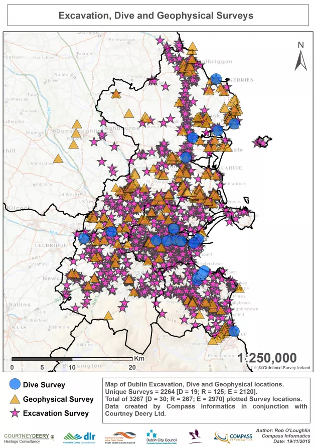
Dublin City and County Archaeology GIS Project
The Dublin City and County Archaeology GIS project was developed by the Heritage and Archaeology sections of Dublin City Council between 2012 and 2016. The project aimed to spatially present and provide free access to all available reports arising from licensed archaeological activities in county Dublin. We have mapped in excess of 1,956 licence numbers and provided links to 2,740 reports in pdf format have been plotted on the GIS system and have been reviewed. We also present complementary datasets including the National Museum of Ireland topographical files and historic maps. This project was a joint-venture of the four Dublin local authority Heritage and Archaeology Offices. It was co-funded by the Heritage Council County Heritage Plan grant scheme and received a grant-in-aid from the National Monuments Service, Department of Arts Heritage and the Gaeltacht.

Dublin City Industrial Heritage Record (DCIHR)
Include following text: The Dublin City Industrial Heritage Record was developed between 2006 and 2009 as an action of the Dublin City Heritage Plan in conjunction with the city archaeologist with grant support from the Heritage Council’s County Heritage Plan grant scheme. The DCHIR investigated and mapped 1219 sites throughout the city and produced a written record of each site and an extensive photographic record of 3866 photographs. Following a review of the DCIHR the survey in 2016 it was converted to GIS and published on heritagemaps.ie.
Dublin City Industrial Heritage Record
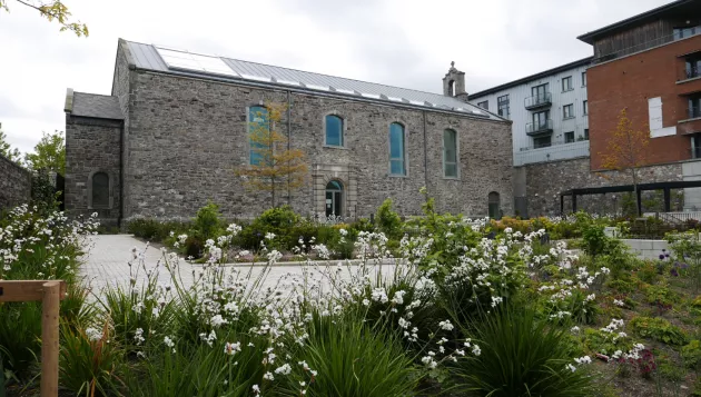
Páirc Lúcáis Naofa/Saint Luke’s Graveyard
On 8th October 1716 the church of St. Luke’s was consecrated at a service by Archbishop, Edward Synge. It closed as place on worship on 19th September 1975 and was left ruinous after a disastrous fire in 1986. Now, on the 300th anniversary of the opening of the church its future will be once again secured. Works will soon begin to conserve the church ruin and adapt it to form offices. In early 2017 work will commence on the recovery of the graveyard and the creation of a new city pocket park.
In 2005 Dublin City Council published the St. Luke’s Conservation Plan under the auspices of the Dublin City Heritage Plan which was part-funded by the Heritage Council. The context for commissioning the conservation plan arose from Dublin City Council’s desire to establish an agreed and appropriate re-use for the derelict church and graveyard, while retaining its significance and enhancing its eroded setting. Following international guidelines (Burra Charter) the conservation plan identified the significance of the church and graveyard and put in place policies and recommendations aimed at safeguarding or enhancing the future of this historic former church and graveyard.
In tandem with the proposals for the conservation and reuse of the church Dublin City Council initiated a graveyard improvement scheme which sought to recover the character of the graveyard and resolve, through a considered design process, the presentation and access of the graveyard addressing St. Luke’s Avenue (the Coombe by-pass). Again the conservation plan guided the proposals for the recovery and enhancement of the graveyards. The scheme creates a new urban pocket park to accessible from St. Luke’s Avenue and a restoration of the graveyard character to the south, with controlled access from Newmarket Square. Part VIII approval for the scheme was granted in 2007 (6148/07) and the park opened to the public in 2018.

Wood Quay Venue
The Wood Quay Venue is a conference and meeting facility the central feature of which is an impressive stretch of the Hiberno Norse city wall dated to c.1100. This facility developed out of the City Walls and Defences Conservation Plan. It was designed by McCullough Mulvin Architects and opened to the public in 2009. The project received grant support from the Heritage Council and Irish Walled Towns Network
Dublin Through The Ages The City Walls
A short and compelling book exploring the history of Dublin city and its defensive town walls from c.790 to the present day. Written by Linzi Simpson, and edited by Charles Duggan and Ruth Johnson.
Contact us at the address below to request a copy.
Dublin City Walls iOS App (iPhone and iPAD)
Dublin City Council’s first smartphone app presents the city walls using animated videos, text and photographs. Updated in 2018. This project was part-funded by the Irish Walled Towns Network
The app can be downloaded for free here
14 Henrietta Street
In 2008, as part of the implementation of the Henrietta Street Conservation Plan, Dublin City Council commenced emergency stabilisation works to No.14 and its neighbour No.3. By this time, both houses were in a precarious condition while No.14 was approaching imminent collapse. This emergency phase of work was followed by the conservation and reinstatement of NO.14’s windows and doors, which rendered the house watertight for the first time in a generation. In 2015, with Centenaries Capital grant-in-aid, Dublin City Council commenced the final phase of work to create the 14 Henrietta Street Museum. This complex project involved many interlinking strands including the conservation and adaptation of the house to a museum of the street’s social and architectural history from its origins in the early 18th century. The project, guided by an advisory group of stakeholders, was informed from the outset by a suite of academic research projects, an oral history project and curatorial strategy. The museum which is managed on behalf of Dublin City Council by the Dublin City Council Culture Company, opened to the public in 2018.
Twentieth Century Architecture in Dublin Research Project
This citywide study of Dublin city’s twentieth-century architecture from 1900 to 1999 was initiated in 2011 and has received County Heritage Plan grant support each year. To date over 90 building case studies have been completed. Each case study comprises a detailed architectural inventory and historical and cultural assessment and an architectural photographic record. The study includes iconic and well known buildings such as Clery’s, the Guinness Storehouse, Liberty Hall or the former Central Bank and less well known structures like the Telephone Exchange in Clontarf or the Oblate's Grotto in Inchicore or the former Rourke’s Bakery on Parnell Street.
More than Concrete Blocks: Dublin City’s twentieth-century buildings is a three-volume series of architectural history books arising from this study. The books are richly illustrated and unpack the history of Dublin’s architecture during the twentieth century. Each book covers a period in chronological sequence: Volume I, 1900–40; Volume II, 1940–72; Volume III, 1973–2000. The series considers the city as a layered and complex place. It makes links between Dublin’s buildings and Dublin’s political, social, cultural and economic histories. Full of new research, photography and previously unseen archive images and drawings, they unpack the history of Dublin’s architecture during the twentieth century by presenting both an overview and more detailed examinations of a rich array of buildings.
More than concrete blocks, Vol.I 1900 - 1940
Authors: Ellen Rowley (editor), Carole Pollard, Shane O’Toole, Merlo Kelly, Natalie De Roiste.
Published by Dublin City Council in 2016, and reprinted 2019.
https://www.fourcourtspress.ie/books/2016/more-than-concrete-blocks/
More than concrete blocks, Vol.II 1940 - 1972
Authors: Ellen Rowley (editor), Carole Pollard, Shane O’Toole, Merlo Kelly, Natalie De Roiste.
Publisher by Dublin City Council in 2019.
https://www.fourcourtspress.ie/books/2019/more-than-concrete-blocks-vol-ii-194072/
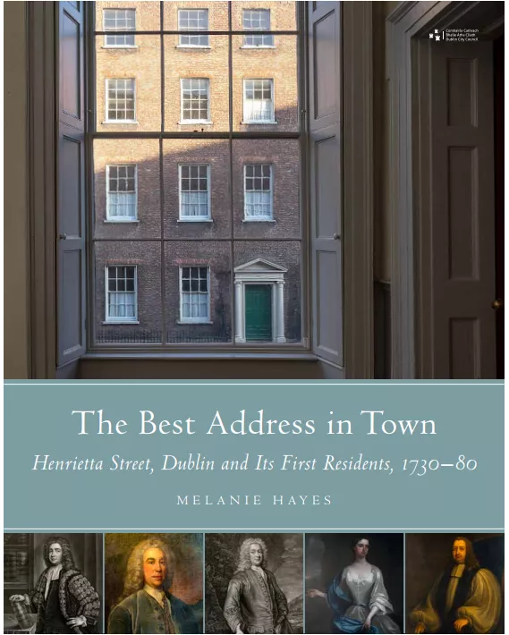
The Best Address in Town, Henrietta Street Dublin and its first residents, 1730 - 1780
A social and architectural history account of the Henrietta Street during the first fifty years of its existence. This publication originated as a research project as part of the development of the 14 Henrietta Street museum. It will be published in 2020. The original research project and this book by Dr Melanie Hayes were commissioned by Dublin City Council and received County Heritage Plan grant funding from the Heritage Council.
https://www.fourcourtspress.ie/books/2020/the-best-address-in-town/

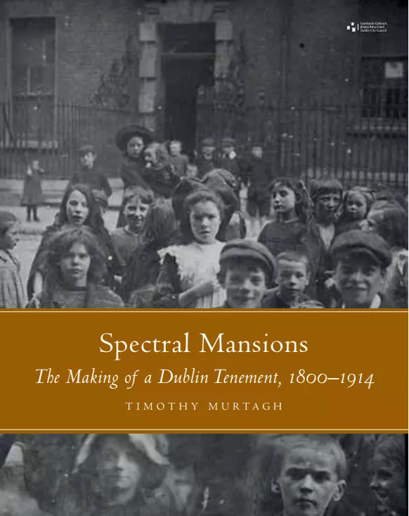
Spectral Mansions, The Making of a Dublin Tenement, 1800 - 1914
Spectral Mansions investigates the transformation of Henrietta Street from an elite residential enclave to a hub of legal learning and activity and ultimately to tenements at the end of the 19th century. The publication is based on a research project commissioned as part of the development of the 14 Henrietta Street museum. Spectral Mansions was published in June 2023 and is available in bookshops and from Four Courts Press.
https://www.fourcourtspress.ie/books/2020/spectral-mansions/

Sources for archaeologists in Dublin city
- Read the Sources for Archaeologists in Dublin City (PDF 2.5Mb)
- Or contact us at the address below to request a copy.
Dublin City Walls Conservation Plan
Dublin city walls are one of the most important, but poorly preserved and presented monuments in the city. This plan addresses concerns about the walls - both above and below ground.
- Dublin City Walls Conservation Plan (PDF 12.3 Mb)
Walks through medieval Dublin
Use these maps to explore medieval Dublin.
- Read the walks through https://www.dublincity.ie/sites/default/files/media/file-uploads/2018-05/walks_through_medieval_dublin.pdfMediaeval Dublin with maps (PDF 985Kb)
Viking Age Dublin
A popular book on the archaeology of Ireland’s first town by Ruth Johnson.
Dublinia: The Story of Medieval Dublin
A popular book on the history of Dublin in the Middle Ages.
Newmarket & Weavers Square Booklet
Archaeological archive
The Archaeology Office maintains an archive of secondary historical material in the Dublin City Archaeological Archive (DCAA). The DCAA includes modern and historic maps, photographs, books, digital files and written records. These can be consulted by researchers upon appointment.
To arrange an appointment, contact the Archaeology Office at the following address:
Archaeology Office
Dublin City Council
Block 3, Floor 3
Civic Offices
Dublin 8