10.5.5 Dublin Bay Dublin
10.5.5 Dublin Bay Dublin
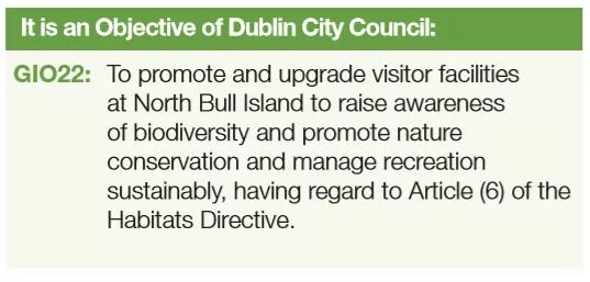
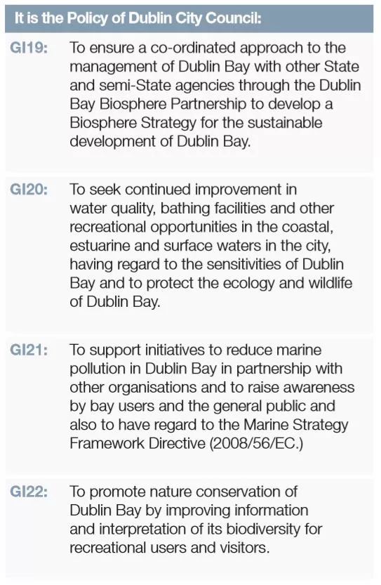
Bay is a major resource for the city, deserving of appropriate management. It contains three internationally recognised bio-diversity designations. Dublin Bay has recently been awarded a UNESCO Biosphere designation. The new Biosphere provides Dublin with an important national special amenity area for recreation and a conservation area of national and international importance.
The Dublin Bay Biosphere covers a total area of circa 30,537 hectares (305km2) across the three local authorities around Dublin Bay: Fingal County Council, Dublin City Council and Dun Laoghaire– Rathdown County Council. The Dublin Bay Biosphere will promote the implementation of the Green Infrastructure Strategic Recommendations (GIR 22, 23 and 24) for coastal zone management of the Regional Planning Guidelines for the Greater Dublin Area 2010 – 2022. The Biosphere will be a formal network of individual sites which recognises the ecosystem of Dublin Bay.
A key objective of the Biosphere will be to strengthen this connectivity of ecological networks by development of spatial planning networks, transcending normal administrative boundaries. This will promote biodiversity management at ecosystem level.
Dublin Bay Biosphere contains three different zones, which are managed in different ways:
- The core zone of Dublin Bay Biosphere comprises 50 km2 of areas of high natural value. Key areas include the Tolka and Baldoyle Estuaries, Booterstown Marsh, Howth Head, North Bull Island, Dalkey Island and Ireland’s Eye.
- The buffer zone comprises 82 km2 of public and private green spaces such as parks, greenbelts and golf courses which surround and adjoin the core zones.
- The transition zone comprises 173 km2 and forms the outer part of the Biosphere. It includes residential areas, harbours, ports and industrial and commercial areas.
(See www.dublinbaybiosphere.ie/about for Dublin Bay UNESCO Biosphere zonation)