River Santry and River Dodder Rainscapes
What is a Rainscape?
A Rainscape is formed when green spaces are adapted to allow rainwater from the road and other hard surfaces to flow into these spaces when it is raining. Rainscapes can also include special hard surfaces that allow rainwater through them.
The green spaces and permeable hard surfaces are designed to hold rainwater for a short period when it rains, which has the potential to deliver a range of benefits, both for the development and the receiving watercourse.
Adapting development which has been conventionally drained using gullypots and pipes to a Rainscape is achieved through the introduction of various Sustainable Drainage features, also commonly referred to as SuDS. Sustainable Drainage Systems (SuDS) are a range of techniques or features which include raingardens, permeable pavement, grassed basins and shallow grassed channels.
Why Rainscapes?
Piped drainage is designed to convey water quickly away from developments and has become the default way to manage rainfall across the developed world. However, this way of managing rainfall comes at a cost to our environment.
Human activity creates pollution which builds up on hard developed surfaces such as roads and pathways. Rainfall washes pollution from developed surfaces into gullypots and pipes where it flows quickly to the watercourse. By changing to the way that collect rainfall and slowing the flow to the watercourse we can remove and naturally breakdown pollutants, thus protecting our rivers.
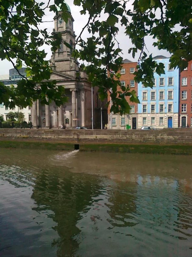
The cocktail of pollutants that wash off our roads and car parks can have devastating impacts on the wildlife that lives in our rivers.
Aims of this project
The project aims to create new green spaces, make enhancements to existing green spaces and change the appearance of some hard surfaces. This will provide benefits to the local community and at the same time protect the Dodder and Santry rivers by cleaning the rainwater that flows off our roads before it gets to the river. Climate change in the impacts it can have on society is a key issue that we have to address. The change in approach to how we manage rainfall can create more climate change resilient urban environments.
The proposed changes will be designed to provide the benefits to the local community and where appropriate opportunities will be taken to:
- Support health and wellbeing
- Provide informal play opportunity
- Attract desirable wildlife
- Reduce flood risk
- Adapt urban development to minimise impact of climate change
Where will the Rainscapes be located?
The following areas are currently being considered.
River Dodder Catchment – Herbert Cottages, Ballsbridge; Simmonscourt Road, Ballsbridge; Eglington Road, Donnybrook, Milltown Road, Dartry
River Santry Catchment: Dunree Park, Donaghmede, Section of Springdale Road, Donaghmede, Brookfield and Westpark, Donaghmede, Sections of the McAuley, Ribh and Lein Estates, Donaghmede, Lein Gardens, Donaghmede.
Will car parking spaces be affected?
The Rainscapes are not intended to remove essential car parking spaces from local residents. There may be some formalisation and demarcation of parking spaces which will make more efficient use of space. Assessment of car parking needs of the local community will form part of the design considerations.
Progress to date
DCC are funding this project as part of our commitment to comply with the Water Framework Directive and to further understand the full benefits of this type of approach so that it can be rolled out into other parts of the city in years to come.
McCloy Consulting (SuDS designers and Engineers) have been appointed by DCC as main consultant in delivery of design services. Robert Bray Associates (SuDS designers and Landscape Architects) are providing supporting design services to McCloy Consulting as part of a multi-disciplinary approach to designing the Rainscapes.
Initial concept designs are being developed and there will be public consultation in early summer 2021.
Rainscapes Update
The initial consultation has now concluded for both the Dodder & the Santry sites. The design team are in the process of reviewing all comments, queries and suggestions. Thank you for your input at this initial stage.
Site surveys are now also being processed to gather further information for use in the design process.
River Dodder Catchment Sites
Herbert Cottages, Ballsbridge
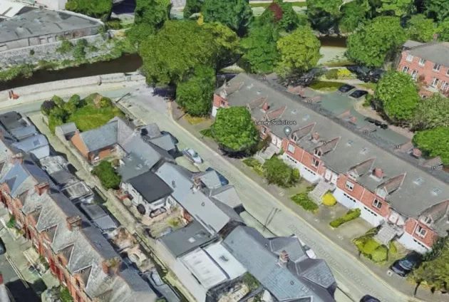
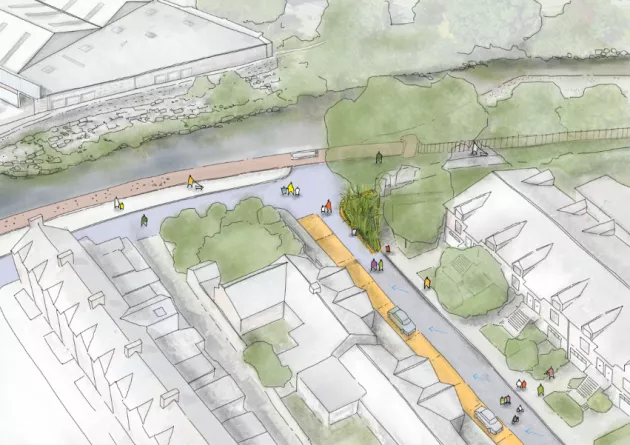
Description: Proposals include the installation of permeable paving in parking areas and the construction of a raingarden. Surface water flow will be collected in the paving and garden and allow for removal of pollutants from the road, prior to discharge to the Dodder River.
Eglinton Road, Donnybrook
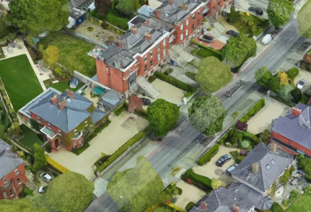
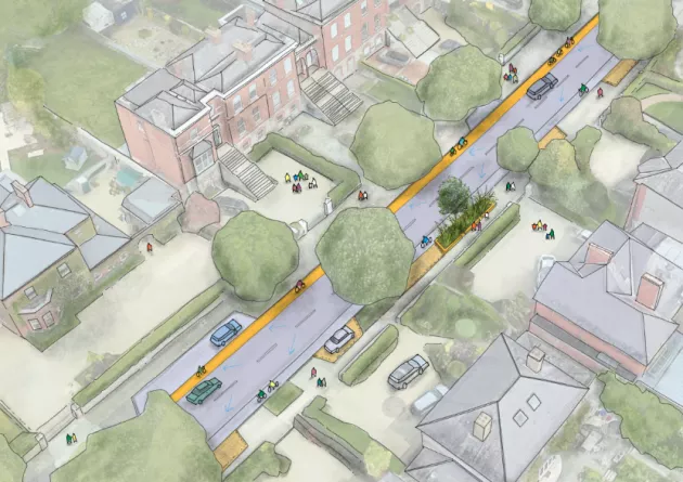
Description: Proposals include the installation of permeable paving in parking areas; permeable surfacing along the cycle lane and provision of new tress were possible. Surface water flow will be collected in the paving, within the cycle way and within the tree pits to allow for removal of pollutants from the road, prior to discharge to the Dodder River.
Milltown Road, Dartry
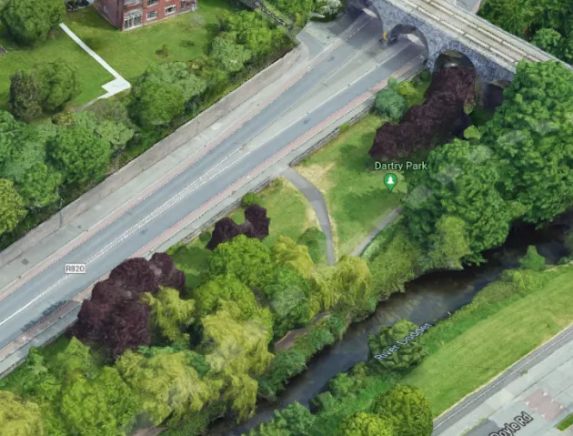
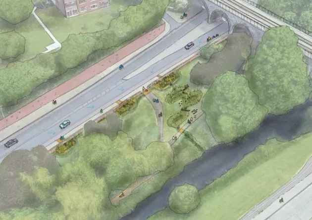
Description: Proposals include the construction of swales behind the wall and a series of basins to form a cascade to the the river. Surface water flow will be diverted from the road in to the swale and allow for removal of pollutants from the road, prior to discharge to the Dodder River.
Santry Catchment Sites
Dunree Park, Donaghmede
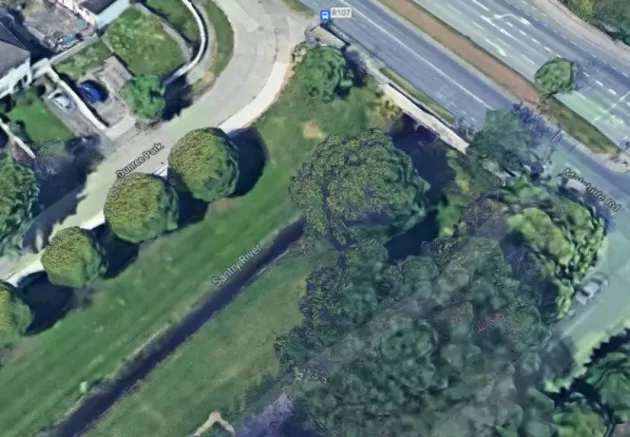
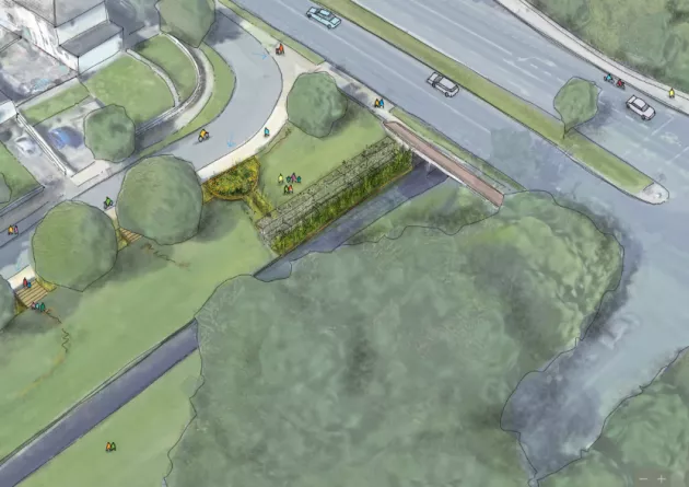
Description 1: Proposals include construction of swales and raingardens within the grassed area. Surface water flow will be collected in the swale from the road, prior to discharge to the Santry River via. the raingarden
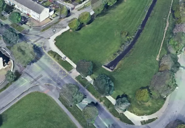
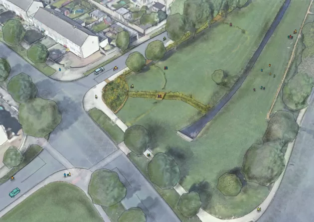
Description 2: Proposals include construction of a raingarden and swales within the grassed area. Surface water flow will be collected in the raingarden, prior to discharge to the Santry River via. the swale.
Section of Springdale Road, Donaghmede
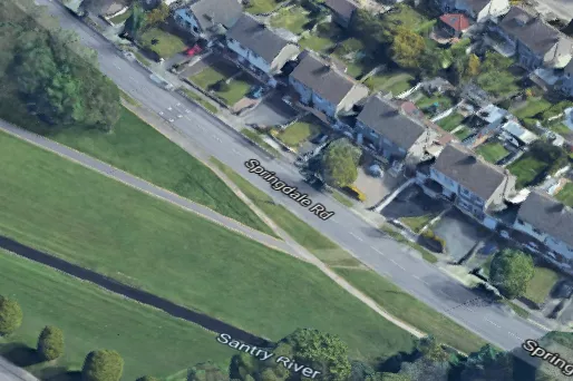
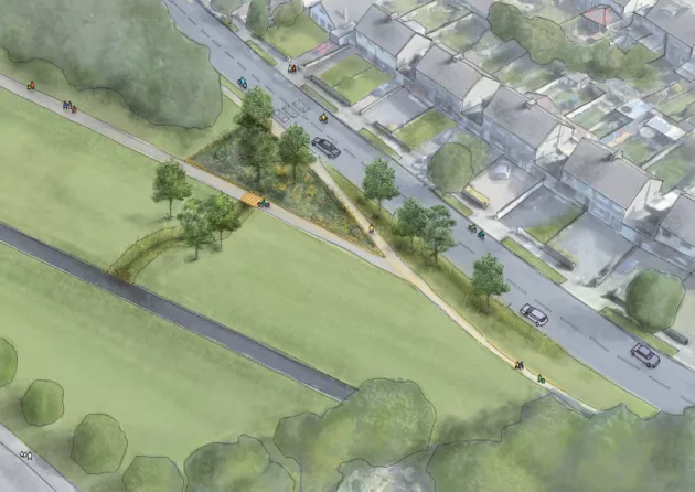
Description: Proposals include a raingarden with trees and a swale to the river. Surface water flow will be collected in the raingarden and allow for removal of pollutants from the road, prior to discharge to the Santry River via, a swale, which will provide further cleansing.
Brookfield & Westpark, Donaghmede
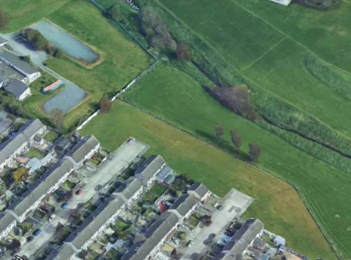
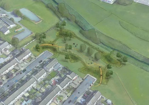
Brookfield Description: Proposals include construction of a raingardens and swales within the grassed area. Surface water flow will be collected in the raingardens, prior to discharge to the Santry River via. the network of swales and raingardens.
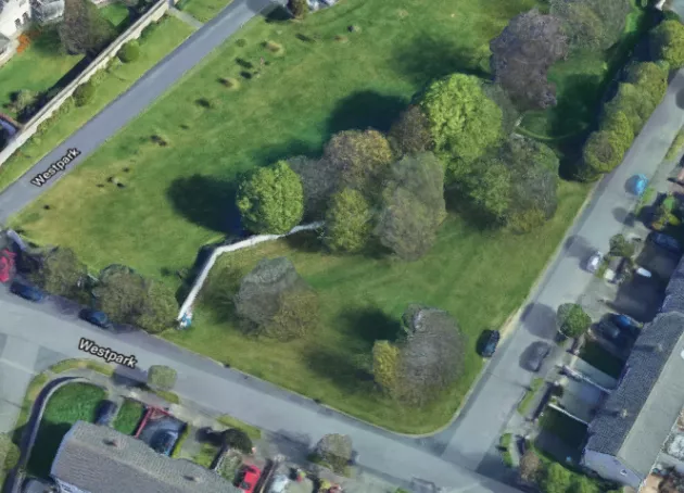
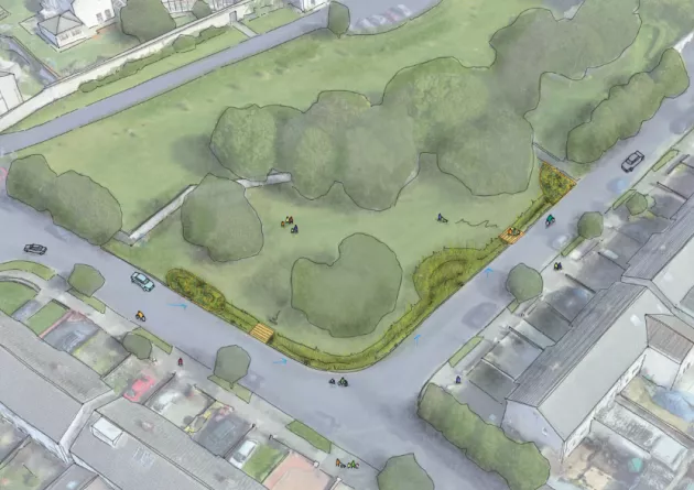
Westpark Description: Proposals include construction of swales and raingardens within the grassed area. Surface water flow will be collected from the road, prior to discharge to the Santry River via. the existing drainage system.
Sections of McAuley, Ribh & Lein Estates, Donaghmede
McAuley Park
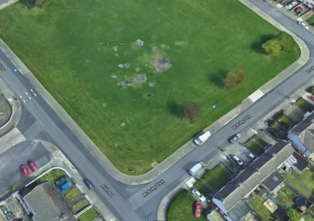
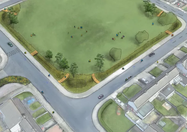
McAuley Park Description: Proposals include construction of a raingardens and swales within the grassed area. Surface water flow will be collected in the raingardens, prior to discharge to the Santry River via. the existing drainage network.
Ribh Road
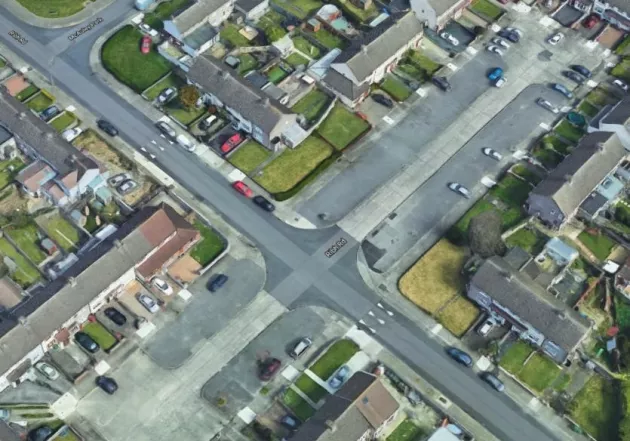
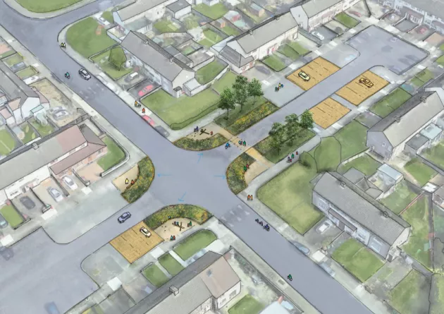
Ribh Road Description: Proposals include permeable paving and construction of raingardens. Surface water flow will be collected from the road, prior to discharge to the Santry River via. the existing drainage system.
Lein Gardens
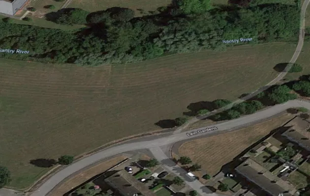
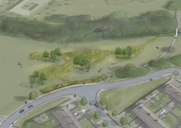
Description: Proposals include construction of a raingardens and swales within the grassed area. Surface water flow will be collected in the raingardens, prior to discharge to the Santry River via. the network of swales and raingardens.
This project website will continue to be updated throughout the project. Alternatively, for more information please contact [email protected] or call 01 222 2222.


