Trinity to Ballsbridge Project
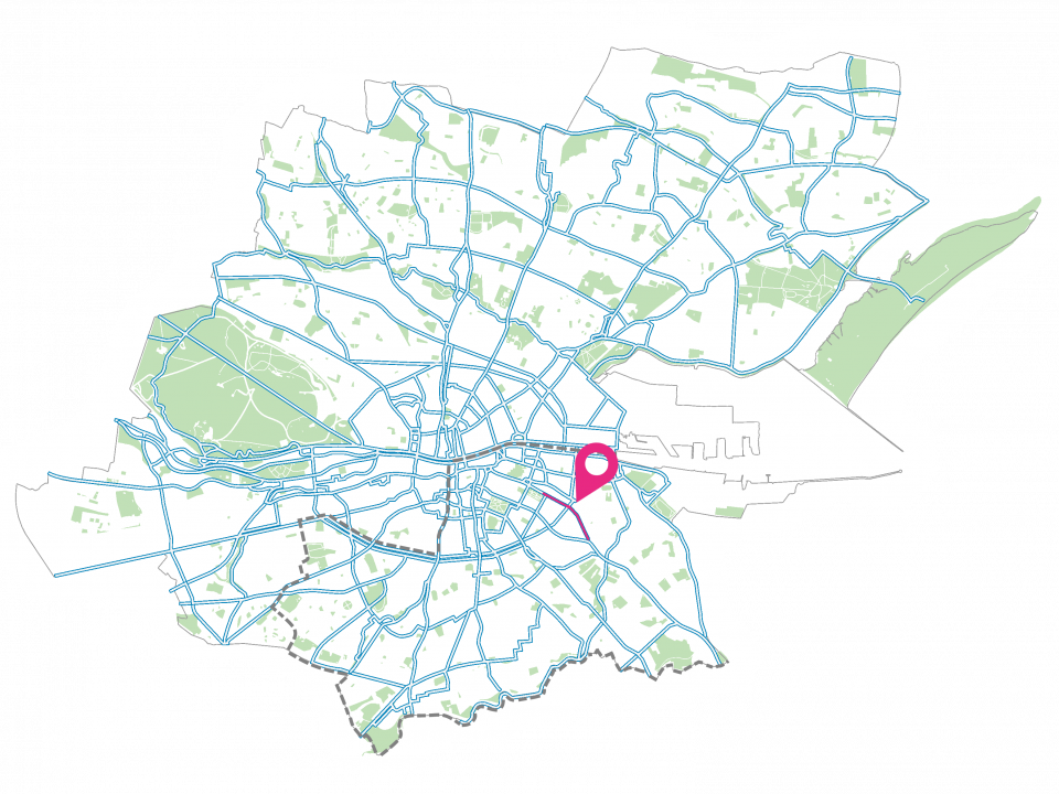
The Trinity to Ballsbridge Walking & Cycling Project is a 2km scheme which proposes to provide protected cycle paths and improved facilities for pedestrians commencing at the Dawson Street junction and finishing at Lansdowne Road. The scheme is to be delivered in two phases as detailed below.
Dublin City Council is developing a safer, inclusive and sustainable walk-wheel cycle network. The objectives and benefits of the scheme can be summarised as follows:
- This scheme will enhance quality of life by improving access, connectivity and sustainable mobility for all, whilst reducing transport-related carbon emissions.
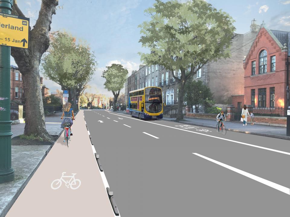
- The scheme will provide a safer environment for walking and cycling. This is especially important to improve walking and cycle access from the Ballsbridge area to Merrion Square.
- The scheme will reduce the risk of pedestrian and cyclist collisions through segregation from traffic and minimising conflicts.
- The scheme will encourage increased levels of physical activity and leisure use along the corridor through provision of a safe, high-quality and attractive route for both cyclists and pedestrians.
- The scheme will facilitate the delivery of the Greater Dublin Area (GDA) Cycle Network Plan by providing continuous, segregated cycling facilities.
- The scheme will improve connectivity to the Fitzwilliam Cycle Route and the Grand Canal Cycle Route.
Phase 1: Holles St to Lansdowne Road (Current Phase)
This phase will provide 1.6km of improved interim walking and cycling facilities from the Holles Street junction to the Lansdowne Road junction, along Mount Street Lower and Northumberland Road. These are temporary measures which will remain until a more permanent scheme is put in place. Please refer to the figure below for the scheme extents.
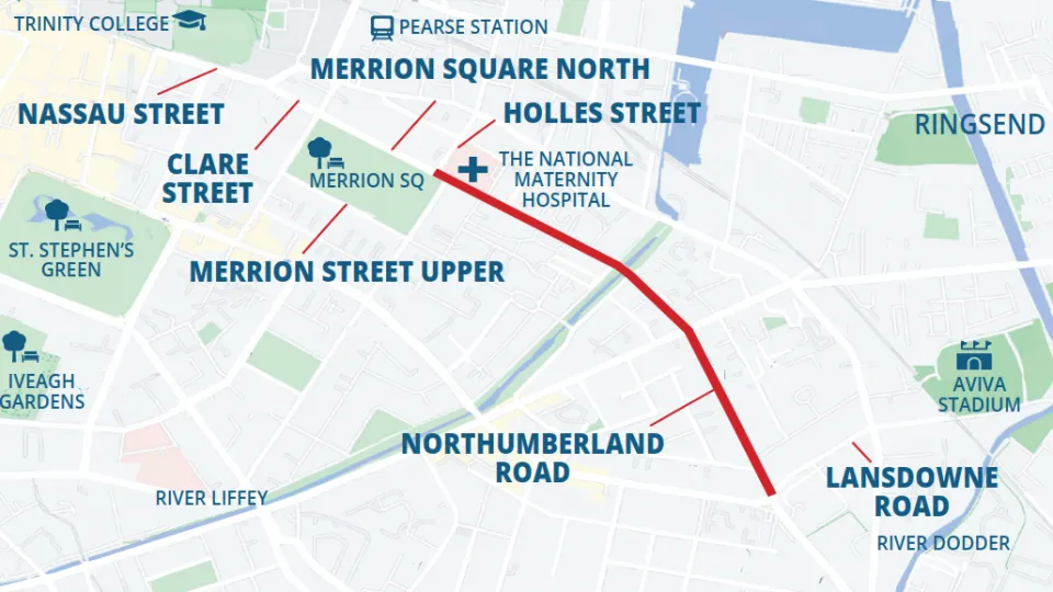
Figure: Phase 1 (Holles Street to Lansdowne Road) Route Map
Public Consultation
Public consultation for Phase 1 (Holles St to Lansdowne Road) commenced on 19th September 2023 and closed on 20th October 2023. A public consultation report and updated public consultation drawings are now available at the following link.


Phase 2: Dawson St to Holles Street
Phase 2 comprises Nassau Street, Clare Street and Merrion Square North and will be delivered once other projects such as the Bus Network Redesign and the City Centre Transport Plan, which are impacting this section of the route, are further developed.