Belmayne and Belcamp Lane Masterplan
This ‘Belmayne and Belcamp Lane Masterplan’ was prepared to guide the delivery / expansion of the Key Urban Village and residential area at the Malahide Road junction in Dublin 13/17.
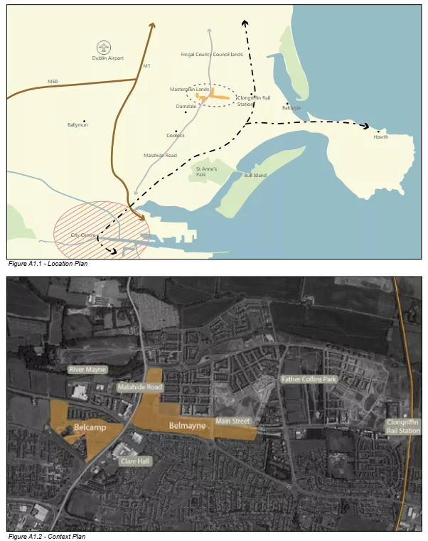
Dublin City Council is looking to facilitate the development of 24 ha of lands at 1. Belmayne and 2. Belcamp Lane, with the delivery of a new Town Centre and residential area focused on the Malahide Road junction (R139 / R107) in Dublin 13/17. This new town centre is to be developed with a strong urban form to reflect its key location based
around high frequency and high quality access to public transport.
The development framework and objectives for these land are set out in the Clongriffin - Belmayne Local Area Plan 2012 (the life of the plan was extended for a further 5 years in 2017). That Local Area Plan seeks the preparation of an integrated Masterplan for the lands.
Development of the Masterplan lands is to supplement and underpin the growth of the new housing areas at Belmayne and Clongriffin in Dublin 13. The development of the wider area, known as Clongriffin – Belmayne (North Fringe), has been on-going since 2000 and the areas’ strategic importance for providing housing for the City is
reflected in Regional and National planning policy.
The development of 24 ha of mostly Council owned lands at Belmayne and Belcamp is an opportunity to create a focus for the Malahide Road junction and a hub for public transport and civic / cultural / community activity in the Belmayne / Belcamp area. It will complement and reinforce the existing District Centre at this junction at Clarehall
Shopping Centre and Northern Cross. New health and other State and community facilities as well as a programme of investment in schools and public transport will underpin this new Town Centre Quarter as well as providing much needed housing.
The development of the lands will provide an opportunity for: placemaking by providing a strong legible urban form; completing key linkages to integrate this area fully into the urban fabric of the City; completion of an attractive Town Centre with a range of key local services; and creating new public parks and spaces.
