Werburgh Masterplan
A Masterplan to regenerate the historic Werburgh Street area is currently being prepared. It will build on Werburgh Street's current status as a Strategic Development Regeneration Area and guide heritage-led development, including the creation of new public spaces and city centre living.
Dublin City Council and the Office of Public Works have appointed a design team, led by Shaffrey Architects, to prepare the Werburgh Masterplan. This plan will guide the development of the city block between Castle Street, Werburgh Street, Ship Street Little and the Castle Steps.
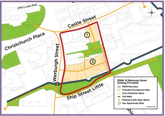
The Dublin City Development Plan 2022-2028 designates this city block as a Strategic Development and Regeneration Area. This designation acknowledges the historical importance of this area and its potential for regeneration and development.
The guiding principles set out in the Development Plan promote:
- The sensitive redevelopment of underutilised sites.
- The delivery of a new key public space.
- A new high walkway along the City Walls, which is a national monument.
The Historic Site
Located within the south-eastern corner of Dublin's Viking settlement, the lands here have been continuously occupied since the 10 century AD. This underutilised part of the city centre has major archaeological and historical significance.
The Masterplan will examine:
- How the block works in the wider city.
- Explore connecting routes, including the creation of a high level walkway along Dublin's City Walls.
- Unlock the potential for sensitive redevelopment that respects and enhances the site’s unique heritage.
Dublin City Council recently acquired sites to the north and south of the City Wall. The Masterplan will propose sensitively designed new buildings fronting onto Werburgh Street. It will also outline how to conserve and present the City Wall in a new public open space at Ship Street Little.
The City Wall
An 83 metre section of the old City Wall runs along Ship Street Little between Werburgh Street and the western gate of Dublin Castle. Dating from the 12 century, this wall stands four metres high at its western end. The eastern part nearest to the Castle has been substantially refaced. Later interventions elsewhere along the wall reflect its use as a garden wall or a bookend to later buildings, taking it to a height of 7 metres.
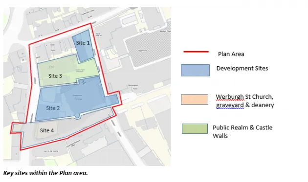
The City Wall originally crossed Werburgh Street. This was once the location of the Pool Gate, which controlled access into medieval Dublin. A stretch of the medieval wall also survives underground on the west side of Werburgh Street. It connects to a medieval tower, Genevel’s Tower, which is buried beneath a site off Ross Road.
Stage One of the Masterplan
The first stage of the masterplan has been completed. It provides a detailed site analysis and policy context, setting out the opportunities and challenges presented within the Masterplan area.
Stage One Archaeology Report
As part of the early analysis, targeted investigative archaeological and engineering trial pits and bore holes were carried out in the first half of 2025. This work was carried out under Archaeological Licence and with Ministerial consent. Read the fill report below.
Associated Documents
Read the other studies and plans that inform the Werburgh Masterplan.
Dublin Castle Strategic Framework Plan 2022
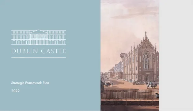
The Strategic Framework Plan for Dublin Castle examines opportunities for the growth and enhancement of the castle's existing facilities. The plan aims to make the castle grounds more pedestrian and visitor friendly. It suggests new routes through the grounds, which would improve access to the castle walls, which are part of the City Walls circuit. The plan identifies space which could be used to create a new public cultural facility.
Dublin City Walls and Defences Conservation Plan 2004
This plan was prepared as an action of the Dublin City Heritage Plan. It provides an understanding of the city walls and defences. This is one of the city's most important, but poorly preserved and presented, historic civic monuments.
The plan addresses the preservation, conservation and presentation of the above ground and below ground remains of the walls.